For late winter hikes, head to the Oregon Badlands
BEND, Ore. — Central Oregon is the rare sort of place where you can be skiing or snowboarding down a mountain one day and hiking through the desert the next.
This time of year, as hikers suffering from cabin fever seek to flee the snow and stretch their legs on area trails, heading east of Bend can be a good option.
And east of Bend lies the Badlands, a 30,000-acre wilderness area named for its harsh terrain. Most of the trails in that area remain snow-free during the winter, offering myriad dry trails to hikers, while elsewhere in Central Oregon many trails remain under snow.
From Bend, I drove about 16 miles east to the Flatiron Rock Trailhead, directly off U.S. Highway 20. This is just one of many trails in the Badlands, but it is one of the most popular because of its accessibility and because of the intriguing rock formations to which it leads.
A group of about eight hikers started ahead of me from the trailhead on the crisp, clear morning. The first thing I noticed about the Badlands is the utter quiet. On a sunny, near windless day, all I could hear was the occasional singsong of resident birds.
Most of the wilderness includes the rugged Badlands volcano, which has features of thickened basaltic lava flows, according to the Bureau of Land Management. Centuries of windblown volcanic ash and eroded lava created the sandy soil that covers the flat areas in those lava fields.
My plan was to hike to Flatiron Rock and back — for a round-trip distance of nearly 6 miles — and take the time to explore the interesting rock shapes.
The mostly flat path meanders through juniper trees, rocks and sand, with no demanding climbs or steep switchbacks. The hiking here can become a bit monotonous, but taking the time to study the trees can add some intrigue to the trek.
Every juniper tree is unique. Some are bushy, green and full of life, others are aged and mangled, their branches rising to the sky like ghoulish claws.
Some of these ancient trees in the Badlands are more than 1,000 years old, according to the Oregon Natural Desert Association. Through the efforts of ONDA, the Oregon Badlands Wilderness Act was signed into law in 2009, permanently protecting the Badlands for future generations.
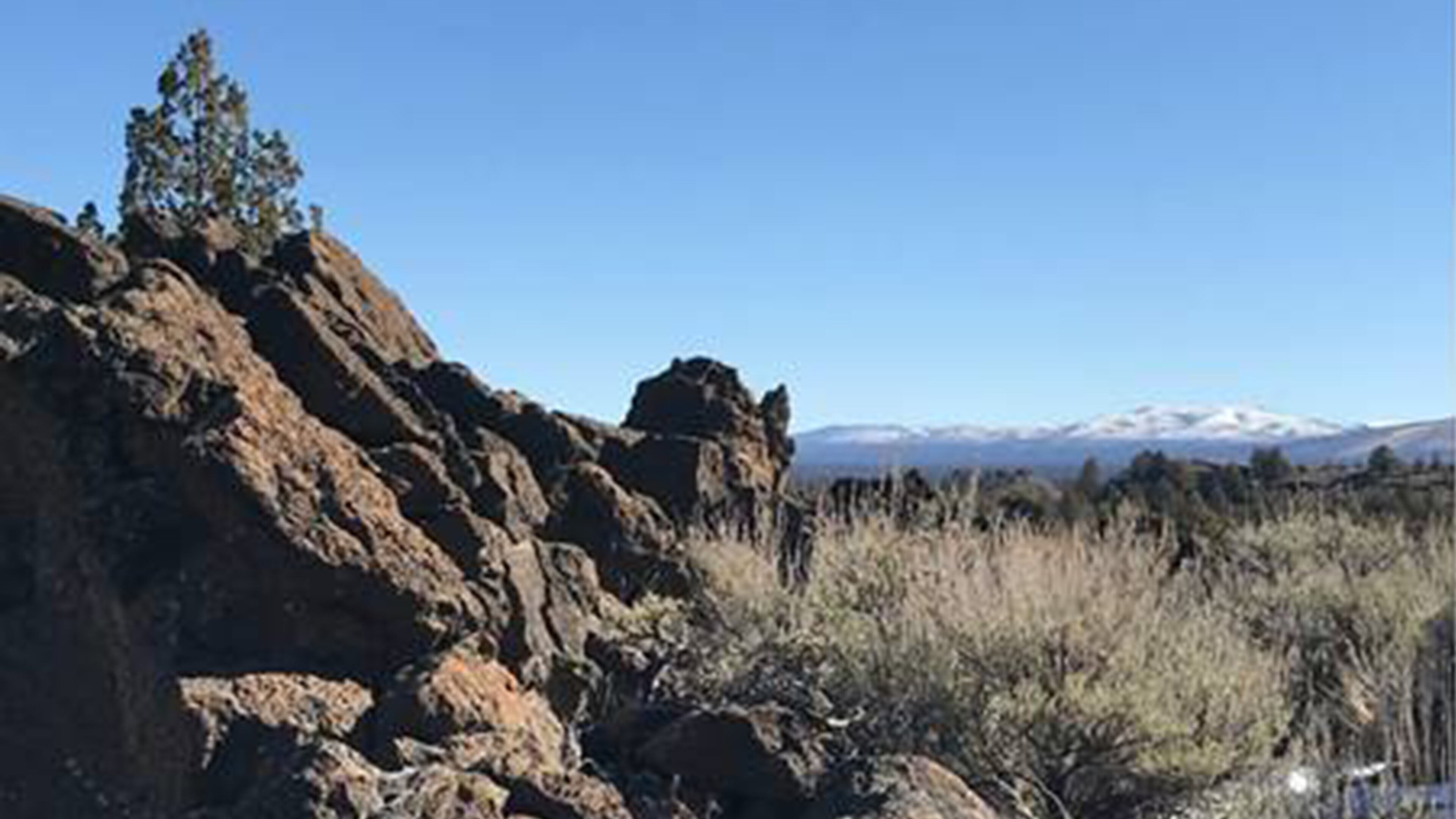
I took a steep path up and to the left when I reached Flatiron Rock, an unusual rock outcrop that is part of the nondescript Badlands shield volcano. Rock walls, some taller than 10 feet, lined the trail. Taking a closer look at the rock, I could see the holes and features shaped by lava flows of long ago. Some jagged rocks even form remarkable arches.
Atop Flatiron Rock, I looked north and east to the rest of the Badlands, and west to faraway, snow-covered Cascade peaks. The day was so clear that Mount Hood was visible, more than 100 miles to the north.
A short loop around the top of Flatiron Rock allows hikers to view all the different rock formations up close. The BLM website describes Flatiron Rock as “an oblong-shaped moat, or crack for a lunar-like hiking experience.” Atop the “moat,” hikers can take in 360-degree views of the Badlands Wilderness.
The small arches are my favorite part of the trail, where sections of rock barely connect to each other above holes in the formations.
Past Flatiron Rock, the trail continues to the north boundary of Oregon Badlands Wilderness.
Another trail option in the Badlands is the Dry River Trail, a different section of the old river’s channel. Starting from the Badlands Rock Trailhead, the Dry River Trail leads to the mouth of the Dry River channel, which features natural cavelike formations and faint red ocher petroglyphs from the natives who fished there thousands of years ago, according to the BLM.
The Dry River once drained ancient Lake Millican, and its course can now be traced through the Oregon Badlands Wilderness north to the Crooked River. The drainage area of Dry River extends eastward to Hampton Butte and southward to the east flank of Newberry Volcano and all of Pine Mountain.
A variety of wildlife makes the Badlands its home, including yellow-bellied marmots, bobcats, mule deer, elk and antelope, according to the BLM. Bird species in the Badlands include prairie falcons and golden eagles.
Outdoors enthusiasts looking for offseason hiking opportunities should consider visiting the Badlands, where they can gain a new appreciation for the twisted trees and eroded rocks of Oregon’s High Desert.
More Stories
The Latest