WEATHER-TRAFFIC UPDATE: Problem areas emerge on metro interstates as temps heat up
ATLANTA FORECAST
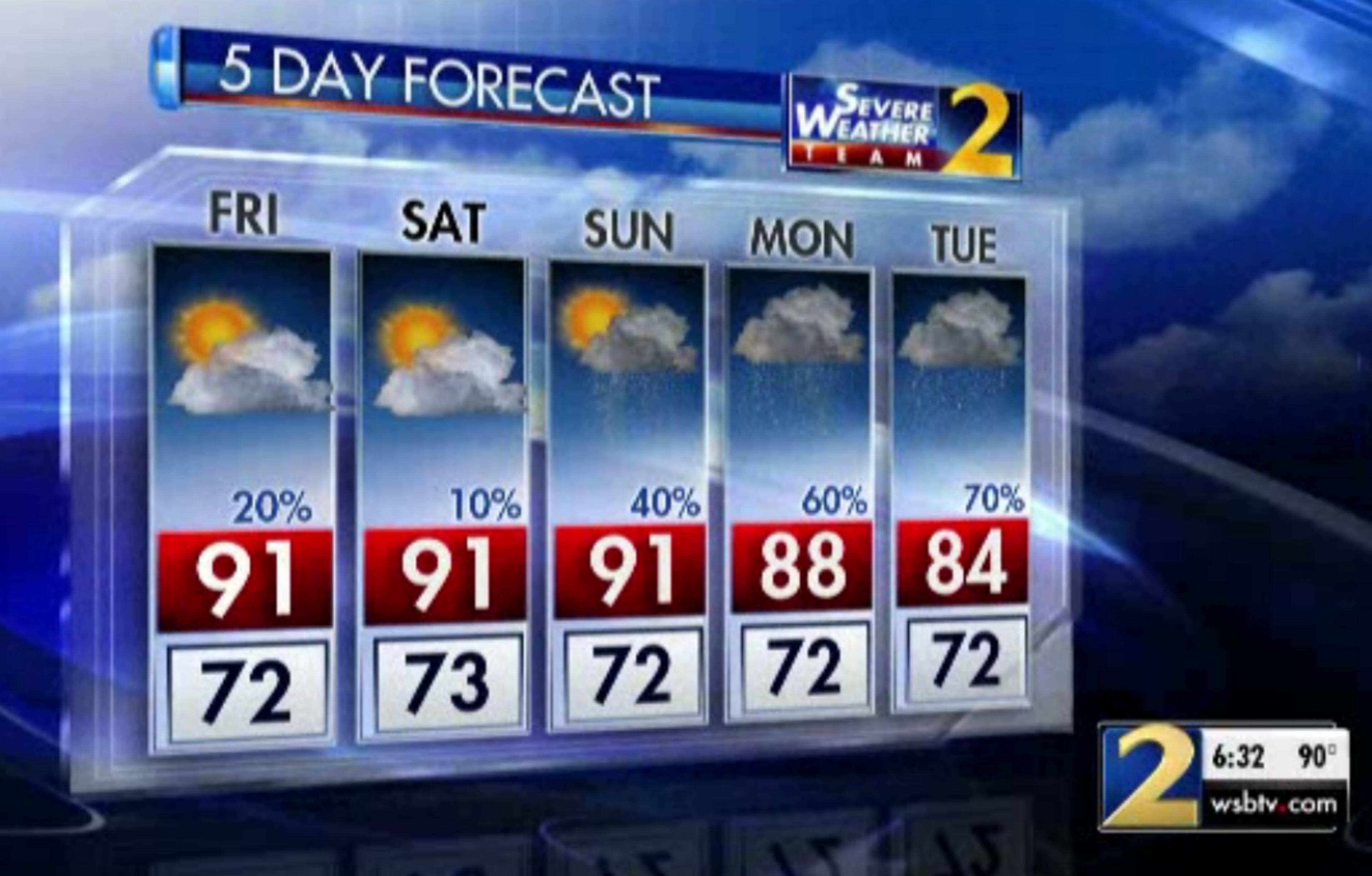
Friday: High: 91
Friday night: Low: 70
Saturday: High: 91
» For a detailed forecast, visit The Atlanta Journal-Constitution weather page.
Volume is building on Atlanta freeways ahead of the evening commute in a few problem areas, namely the Downtown Connector and the DeKalb County side of the Perimeter.
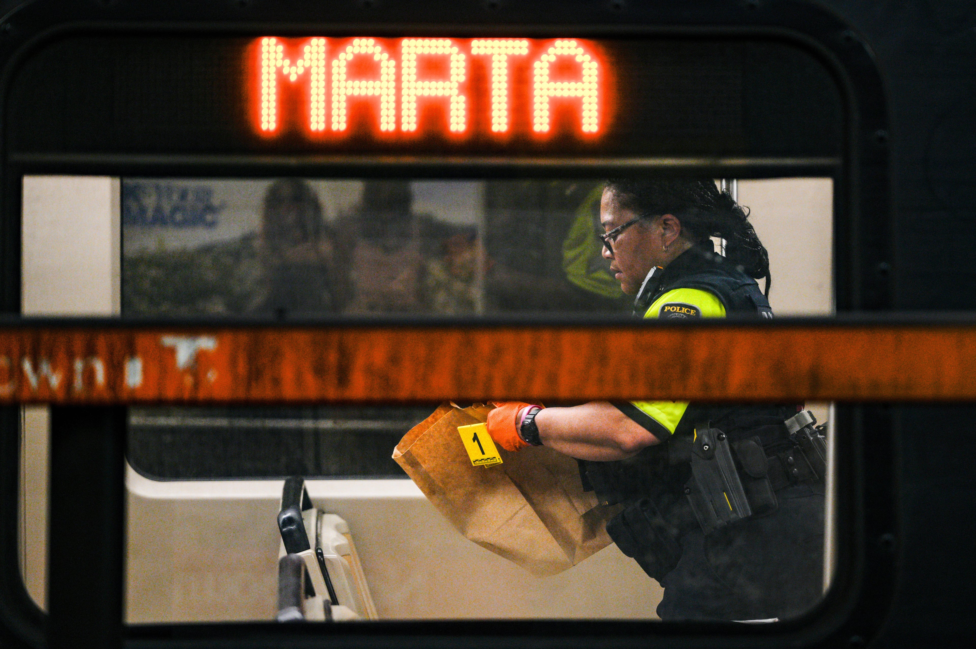
The northbound connector is being affected by a section of Courtland Street between the connector and Linden Avenue being closed due to police presence, according to the WSB 24-hour Traffic Center.
Y’all ain’t gonna believe this. Traffic through downtown Atlanta is already a mess on this Friday afternoon. Who would have thought? Getting in that car make sure you’re tuned to @wsbradio for some @DougTurnbull and @WSBTraffic. pic.twitter.com/3p7nk8CiH7
— Jason Durden (@JasonDurdenWSB) July 27, 2018
Construction has blocked two right lanes on I-285 westbound near Ashford Dunwoody Road, which is causing heavy delays, according to the Traffic Center.
TRAVEL ADVISORY: Construction: I-285/wb (outer loop) at Ashford Dunwoody Rd.; (exit 29); blocks two right lanes; heavy delays; https://t.co/j2xHL1ZFrc; #ATLTraffic pic.twitter.com/lgXfkIKuS2
— AJC WSB Traffic (@ajcwsbtraffic) July 27, 2018
In Bartow County, Ga. 140 is shut down near Cedar Creek Baptist Church due to a serious car accident with multiple entrapments, the Bartow County Fire Department said in a Facebook post. Several emergency units and an air ambulance are on the scene.
Dry air that ushered in comfortable weather Thursday is still in place over North Georgia, which means Friday will experience more of the same low humidity and clear skies.
It will be warm and mainly dry as rain chances remain at a low 20 percent, Channel 2 Action News meteorologist Karen Minton said. That trend continues through most of the weekend.
The expected high Friday is 91 degrees, according to the latest forecast from Channel 2. It’s currently 90 in Atlanta.
Dry air still is in place and is keeping our humidity lower today. It will feel very comfortable today. Moisture is returning for next week. At 6:19am I'll have the timing when showers and storms are likely near you. pic.twitter.com/rCEEpEFIjB
— Karen Minton (@KarenMintonWSB) July 27, 2018
Another cold front is on the way to bring more rain next week. The rain chances will jump to 60 percent or more starting Monday and temperatures will come down to the mid-80s, according to Channel 2.
“It will start to pick up during the day Monday when more widespread showers and storms will be headed this way,” Minton said. “The next weather system will be approaching by then.”
First week of August looks wetter than usual. Expect more clouds, rain and storms to keep temperatures cooler than average too. pic.twitter.com/hTgmAKmCGv
— Karen Minton (@KarenMintonWSB) July 26, 2018
Saturday should be the driest day this weekend, Minton said, while Sunday could see some isolated showers develop east and south of Atlanta in the afternoon.
“Our temperatures will still be on the warm side, but rain amounts are fairly light between now and Monday morning,” she said.
Headed to @SunTrustPark tonight for the @Braves vs. @Dodgers game? Here's the official Severe Weather Team 2 forecast from Meteorologist @KatieWallsWSB - https://t.co/pcNcyIcyXe #ChopOn #GoBraves pic.twitter.com/QrBMSOibZD
— WSB-TV (@wsbtv) July 27, 2018
The low chance of storms and low humidity should make SunTrust Park a comfortable place to watch the Braves take on the Los Angeles Dodges at 7:35 p.m. Friday. It may increase Cobb County’s traffic before and after the game.
» For updated traffic information, listen to News 95.5 and AM 750 WSB and follow @ajcwsbtraffic on Twitter.
» Download The Atlanta Journal-Constitution app for weather alerts on-the-go.
About the Authors

Zachary Hansen, a Georgia native, covers economic development and commercial real estate for the AJC. He's been with the newspaper since 2018 and enjoys diving into complex stories that affect people's lives.