Learning from Dorian: Will hurricanes be more frequent and stronger?

On Sept. 2, as Hurricane Dorian battered the Bahamas, Georgia meteorologist Marshall Shepherd tweeted his reaction: “Simply unbelievable…The Bahamas are enduring something I just can’t fathom…,” he wrote. Shepherd, director of the Atmospheric Sciences Program at the University of Georgia, circled a line of text in the advisory from the National Weather Service National Hurricane Center: “Present movement: Stationary.”
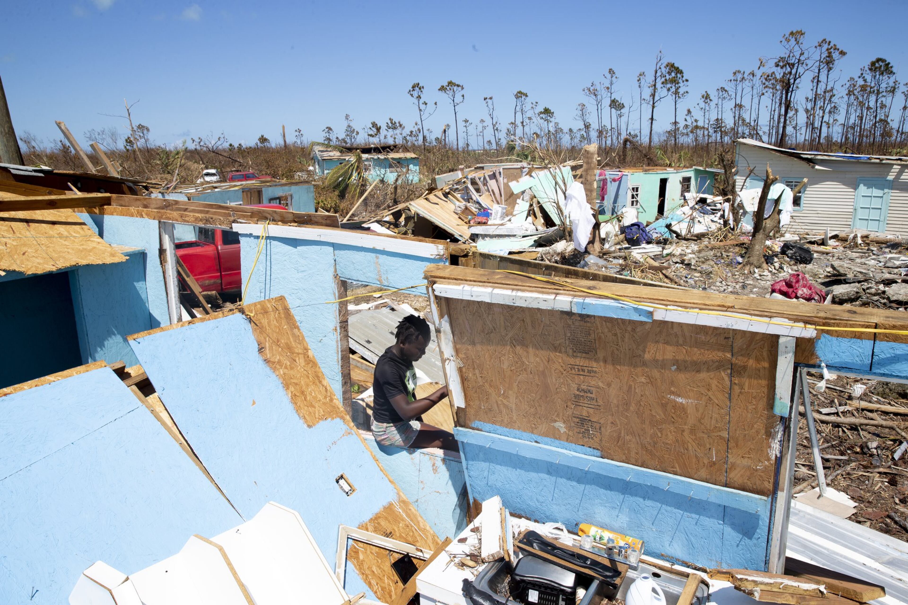
The Category 5 hurricane was traveling at 1.3 mph, the slowest speed ever recorded for a major hurricane. At times, it stopped moving entirely, unleashing its fury on the islands of Great Abaco and Grand Bahama for 48 hours.
>> RELATED: Some of Georgia's worst hurricanes
While we are moving into a period where fewer hurricanes are approaching the coast, those that do are in the range of Category 3 to Category 5, according to a 2017 study by James Kossin, an atmospheric researcher at the National Oceanic and Atmospheric Administration's Center for Weather and Climate. Between 1924 and 2019, there have been 35 Category 5 hurricanes in the North Atlantic, five of which have occurred in the past four hurricane seasons — a rate scientists consider well beyond average.
“The scientific studies and literature don’t say we are going to see more frequent or more hurricanes, but when we do get them, they are likely to be more intense given the increase in warmth of the ocean near and just beneath the surface,” said Shepherd.
Starting with Matthew in 2016, this is the fourth hurricane season — the period from June to November — that a Category 5 storm has ripped through the Atlantic basin. With maximum sustained winds of 185 mph, Dorian was the strongest of them all.

Scientists are still trying to understand if human activities — particularly greenhouse gas emissions that cause global warming — have a detectable impact on hurricane activity. Some caution against overstating the link.
In a Sept. 10 op-ed in the National Review, Judith Curry, president of Climate Forecast Applications Network and a professor emerita of earth and atmospheric sciences at Georgia Tech, writes that links between changes in hurricane activity and human-caused global warming cannot be made with much confidence. "There is a small overall trend of increasing hurricane intensity, but we only have global data back to 1970 and you can't tell from that if it is natural variability or man-made global warming," said Curry by phone.
But research from leading climatologists has linked some characteristics seen in Dorian — slow movement, storm intensity and higher storm surges — to impacts of global warming rather than natural causes.
Last year, Kossin found that hurricanes moving over land in the North Atlantic have slowed by as much as 20%. He attributes that slower motion in part to the effects of climate change amplified by human activity. Hurricanes are propelled from place to place by steering winds, but as the Earth's atmosphere warms, those winds can weaken, slowing down or totally stalling the storms.
The impact of global warming on changes in the patterns of the jet stream, the big current of air that brings a lot of our weather, is still a developing area of research, but scientists said the pattern of hurricanes parking themselves in place, like Dorian in the Bahamas, Florence in the Carolinas (2018) and Harvey in Texas (2017), is growing.
>> RELATED: Nearly a year after Hurricane Michael, relief money is finally coming to Georgia
Hurricanes are also getting wetter, said scientists. The Earth’s warmer atmosphere holds more water vapor, allowing hurricanes to have more water in them than they used to, said Kristina Dahl, senior climate scientist for the Union of Concerned Scientists. More water in hurricanes combined with stalled movement can lead to the kind of record-breaking rainfall and massive flooding that devastates entire cities.
All of that warm, moist air and warm water in the ocean acts as fuel for hurricanes, making them stronger.
Dorian had plenty of energy to tap into. When it passed off the coast of Florida, the temperature of the ocean’s surface was about 1/2 to 1 degree above normal, Dahl said. A 1-degree Fahrenheit rise in ocean temperature can increase the wind speed of a hurricane by 15-20 mph, she said.
At one point, Dorian’s winds jumped from an already intense 150 mph up to its maximum speed of 185 mph.
When hurricanes make landfall, storm surge — the water pushed onto shore by hurricane winds — can overwhelm coastal areas. Dorian's storm surge in the Bahamas reached almost 24 feet, leaving the airport in Freeport engulfed in water. Residents on the Georgia coast were spared, but they know too well the perils of rising sea levels. Add a hurricane to already rising waters, and the potential for devastation is even greater.
>> READ MORE: A rising tide of concern
Sea levels have risen as big ice sheets in Greenland and the Western Arctic have melted from the effects of global warming and sent freshwater into the ocean, Shepherd said. As ocean water has become warmer from climate change, the increase in temperature has caused the water to expand and rise even more. Add to that parts of the coastline that are disappearing due to natural sinking of the land, and conditions are set for flooding long before a hurricane comes near.
>> READ MORE: Antarctica's ice sheet is melting 3 times faster than before
“You have these issues, then you add a hurricane with storm surge and it’s exacerbating the situation,” Shepherd said.
Shepherd said scientists have struggled to convey to the public concerns about the impacts of climate change on our weather system. He allows that the climate has changed naturally, but because of human-induced climate change, those natural occurrences are being amplified, he said.
A developing field of climate science known as climate attribution is helping scientists to better identify and quantify the role of human-caused climate change in different types of extreme weather.
“Skeptics will say ‘We aren’t getting too many hurricanes this year’ but did you see the typhoons that pummeled the Philippines? Those are the same types of storms as hurricanes,” Shepherd said. “The key message going forward is they are just going to accelerate. It is not going to be an incremental change.”
CATEGORY 5 STORMS
There have been 35 Category 5 Atlantic hurricanes since the first one was recorded in 1924. Only four, including Michael in 2018, have made recorded landfall in the continental United States. The most Category 5 hurricanes in one season occurred in 2005 when four hurricanes (Emily, Katrina, Rita and Wilma) reached that level of intensity. The decade from 2000 to 2009 had eight Category 5 storms.
Below are the most recent storms that have reached Category 5 intensity:
2016 Matthew*
2017 Irma
2017 Maria
2018 Michael
2019 Dorian
* The most recent Category 5 storms before this were Hurricanes Felix and Dean in 2007.
BALANCED COVERAGE
The debate over dealing with our changing climate is divisive. We always try to present multiple points of view so that readers can reach their own conclusions. Today’s story includes perspectives from four climate and weather experts including a researcher with the National Oceanic and Atmospheric Administration’s Center for Weather and Climate studying the effects of climate change on hurricane activity along with an examination of hurricanes over the past decade.


