WEATHER UPDATE: Late evening storms threaten south metro area

[9:20 p.m.] Strong storms have reentered the south metro Atlanta area, with Severe Thunderstorm Warnings issued for Coweta, Fayette, Meriwether, Pike and Spalding counties. Channel 2 Action News meteorologist Brad Nitz is reporting large hail falling from this new wave of strong weather.
[5:55 p.m.] Rain is still falling and thunder rumbling across the metro Atlanta area. But the severe storms should be done, according to Channel 2 Action News Chief Meteorologist Glenn Burns.
“The rain-cooled air we had today, really stabilized the atmosphere and we’re going to see more rain tonight, but nothing in the way of severe storms,” Burns said.
[3:05 p.m.]: A severe thunderstorm warning is in effect for Paulding, Cherokee, Haralson, Cobb, Carroll, Douglas, Fulton, Polk and Barrow counties until 3:45 p.m. Trees were reported down in some areas and heavy rain was making driving dangerous in parts of the metro area. The National Weather Service has also issued a flash flood warning the metro area until 8 p.m.
[12:35 p.m.]: A line of fast-moving thunderstorms is moving into the northwest Atlanta suburbs.
“Near-continuous lightning strikes” have been reported in the storms crossing into Cherokee and Paulding counties shortly after 12:30 p.m., according to Channel 2 Action News chief meteorologist Glenn Burns. Within the past 15 minutes, nearly 300 lightning strikes were recorded within the storm system, he said.
Severe thunderstorm warnings have been issued for Bartow and Cherokee counties.
The thunderstorms are moving at a pace of 40 to 50 mph, which Burns said is a much faster clip than the 30 mph storms which produced tornadoes in metro Atlanta on Monday. Additional storms are teeing up in Alabama, where a tornado watch is in effect Tuesday.
“It’s going to be a long afternoon, Burns said.
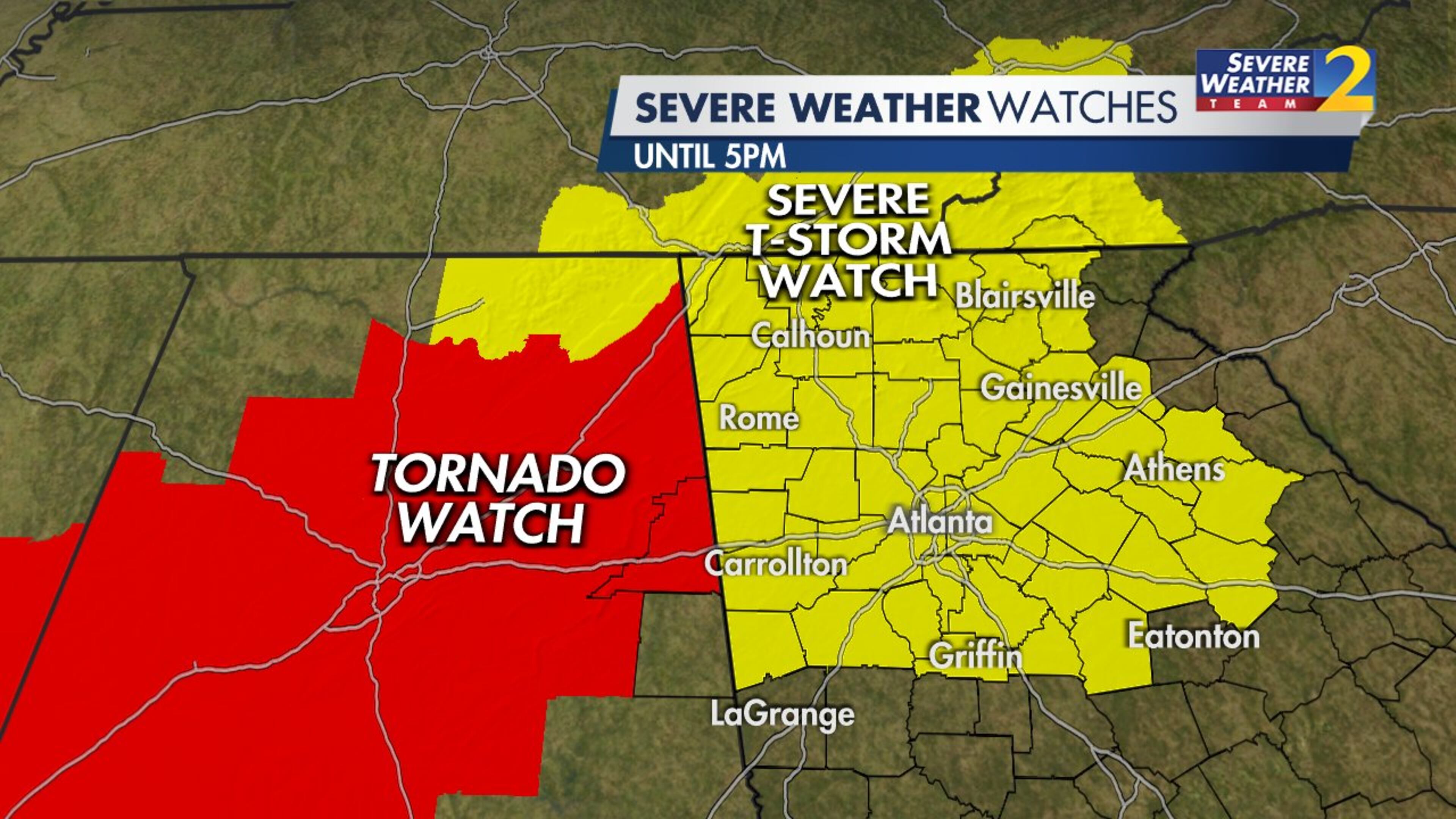
UPDATE [11 a.m.]: The National Weather Service has issued a severe thunderstorm watch for much of North Georgia as the first system of storms enters the region Tuesday morning.
The watch includes all of metro Atlanta and is scheduled to expire at 5 p.m. The main impacts will be storms that produce heavy rain and damaging wind gusts, but hail and brief tornadoes are also possibilities, according to Channel 2 Action News meteorologist Brian Monahan.
A tornado watch is also in effect for counties west of the border in Alabama, but there are no active tornado watches or warnings in Georgia. Severe thunderstorms were crossing into the northwest corner of the state at 11 a.m.
ORIGINAL STORY: After a break overnight, North Georgia is getting back into the thick of things Tuesday with waves of storms and another possibility of severe weather.
Strong storms on Monday produced at least one tornado and killed a man inside his vehicle in Douglas County. Surveyors with the National Weather Service are still investigating storm damage in southwest Atlanta, where another possible twister touched down.
The region is waterlogged and weather-weary, but it won’t get much of a break, according to Channel 2 Action News meteorologist Brian Monahan.
“For now, everything is just fine,” he said. “It’s quiet and dry across North Georgia, but as we go through the morning and into the mid- to late morning hours, storms develop in Alabama and they move toward metro Atlanta.”
Monahan expects the storms to reach the city by 9 a.m. and continue through early afternoon. The region will get a reprieve after about 3 p.m., but another wave of storms in the forecast is timed for the Tuesday evening commute, according to Channel 2.
The risk for severe weather is greatest in west Georgia, where the Weather Service has issued an enhanced Level 3 warning for severe thunderstorms. The rest of North Georgia is under a Level 2 risk, with five being the greatest threat level.
The primary concern will be flooding, Monahan said. Monday’s storms dumped nearly 2 inches of rain in Atlanta, and some of the western suburbs saw up to 4 inches of accumulation. With an additional 2 inches in the forecast Tuesday, all of North Georgia is under a flash flood watch until 2 a.m. Wednesday, according to the Weather Service.
“It’s not going to take much to cause additional flooding today across North Georgia,” Monahan said. “A moderate risk of storms that will produce damaging wind gusts, and we do have that tornado risk again later today.”
Considering the soggy soil, Monahan expects more trees to fall Tuesday when the wind picks up. There is a high possibility of power outages and road closures, he said.
In between waves of widespread rain and storms, Atlanta is expected to reach a high of 80 degrees.
“We’ll get a break for a while and then by drivetime tonight, another round of some strong storms will move in,” Monahan said. “Those will be with us through sunset, and then beyond things will quiet down overnight. I do not think we’ll have to worry about any storms in the overnight hours.”

The rain hasn’t started back up in metro Atlanta, but there are already problems for drivers in Newton County on Tuesday morning, according to the WSB 24-hour Traffic Center.
A crash on I-20 had blocked all eastbound lanes at Almon Road for more than an hour before authorities began clearing the scene, the Traffic Center reported. A right lane remained blocked at 6:30 a.m.
There are still several miles of delays behind the wreck, traffic reporter Mark Arum said. Commuters can take Ga. 162 to Ga. 81 to get around the backups and rejoin I-20.
“It’s a long alternate, but its better than sitting in the traffic,” Arum said. “This is heading away from town. Your ride westbound heading in from Covington and Conyers is delay-free.”
» For a detailed forecast, visit The Atlanta Journal-Constitution weather page.
» For updated traffic information, listen to News 95.5 and AM 750 WSB and follow @ajcwsbtraffic on Twitter.
» Download The Atlanta Journal-Constitution app for weather alerts on-the-go.


