Could historic flooding happen in metro Atlanta? It did, in 2009


This article was originally published in 2019. The story was re-published in light of record breaking flooding due to Hurricane Helene in September 2024.
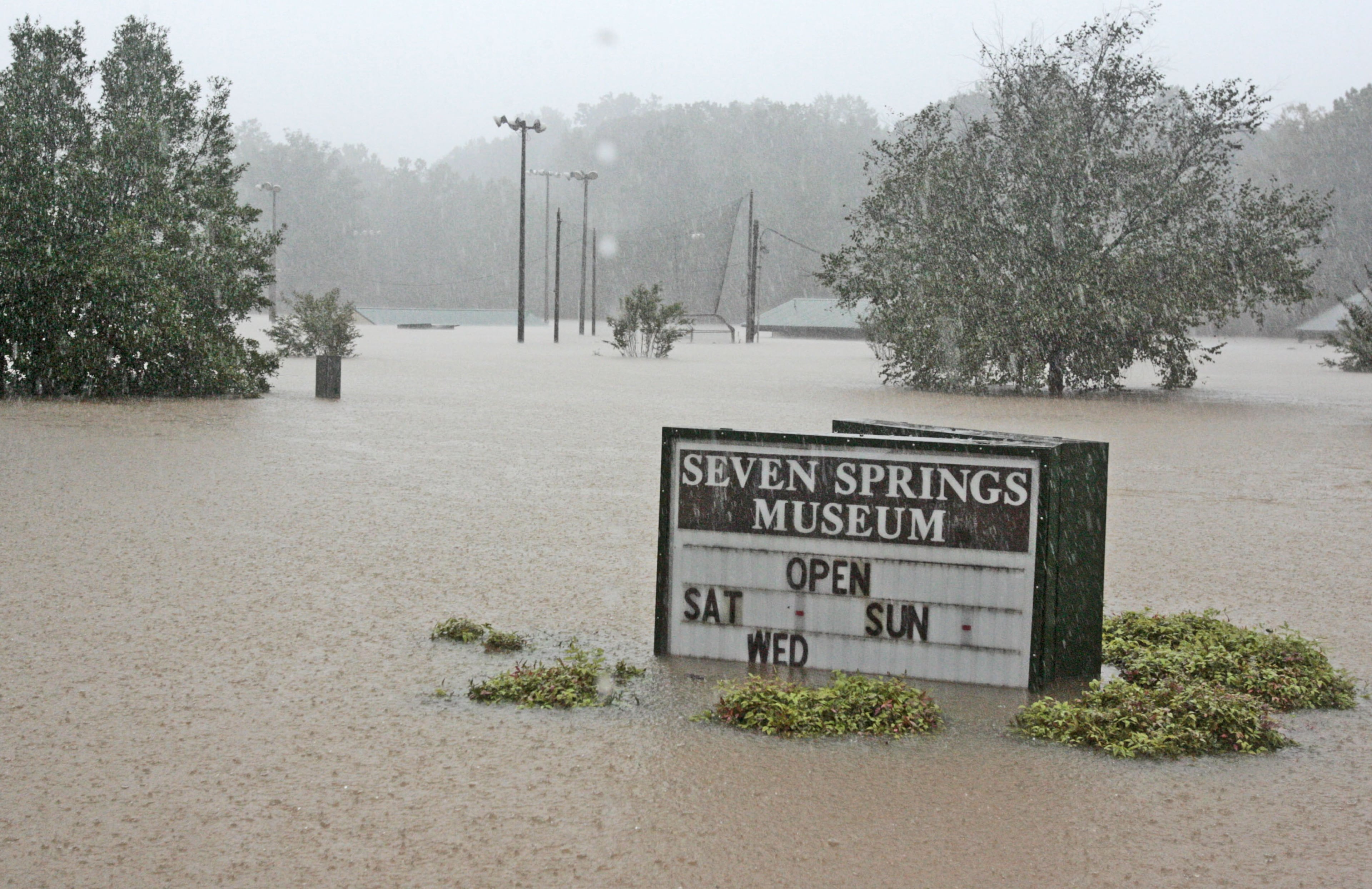
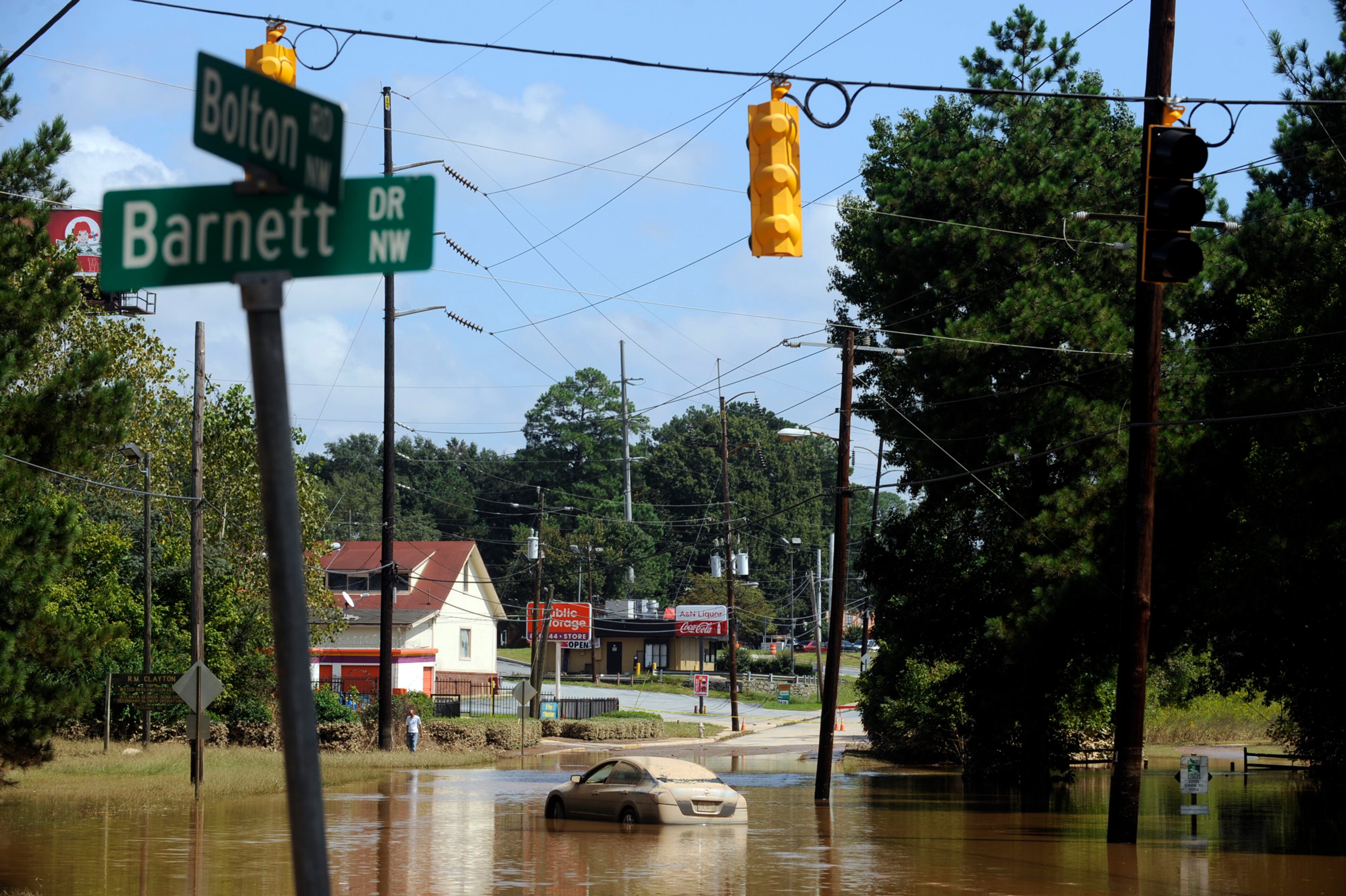
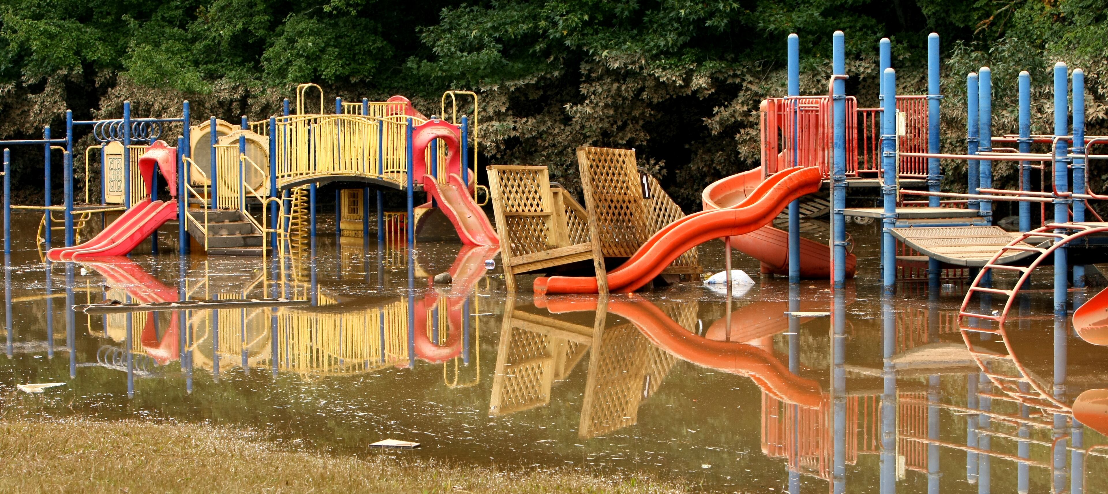
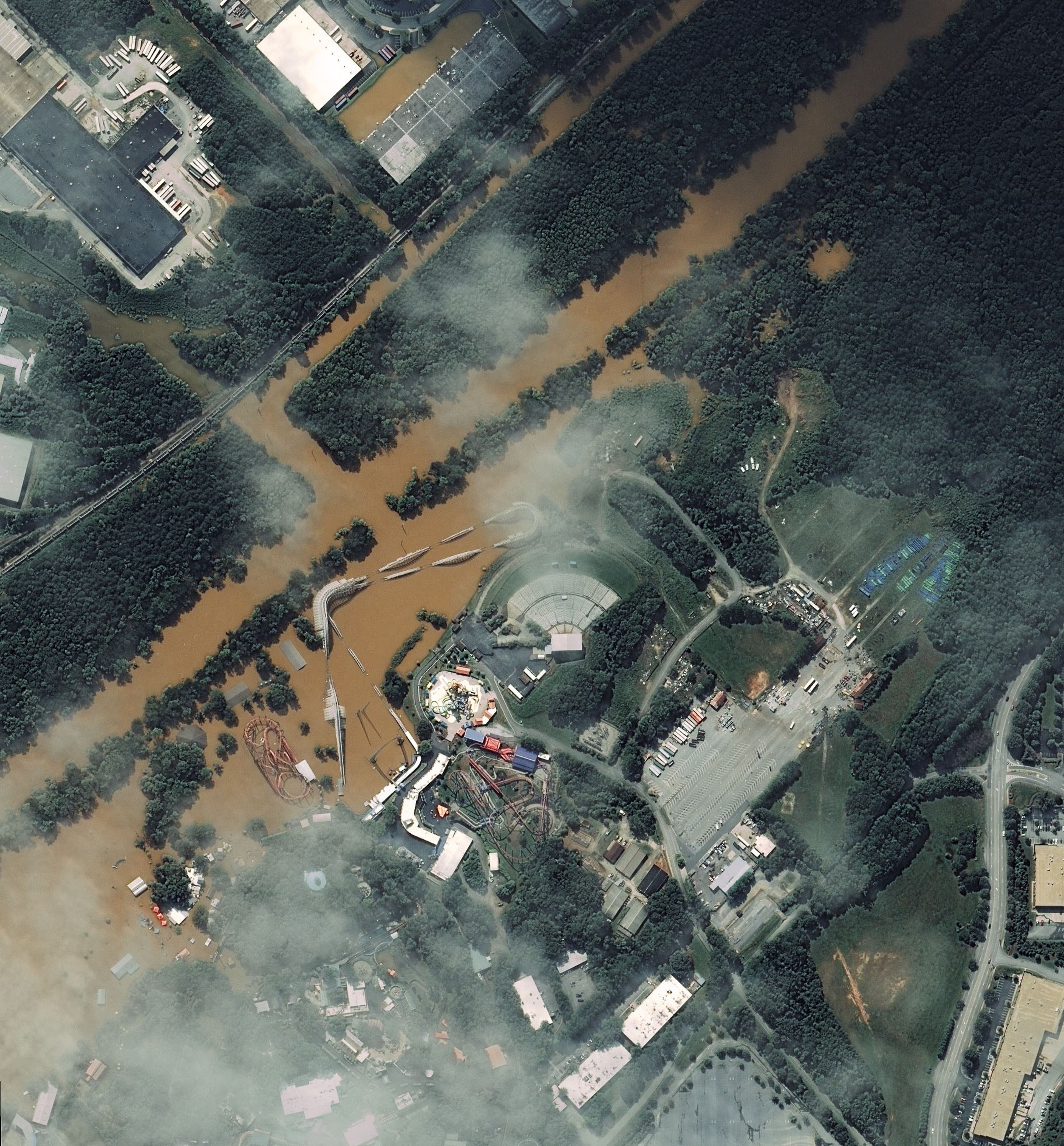
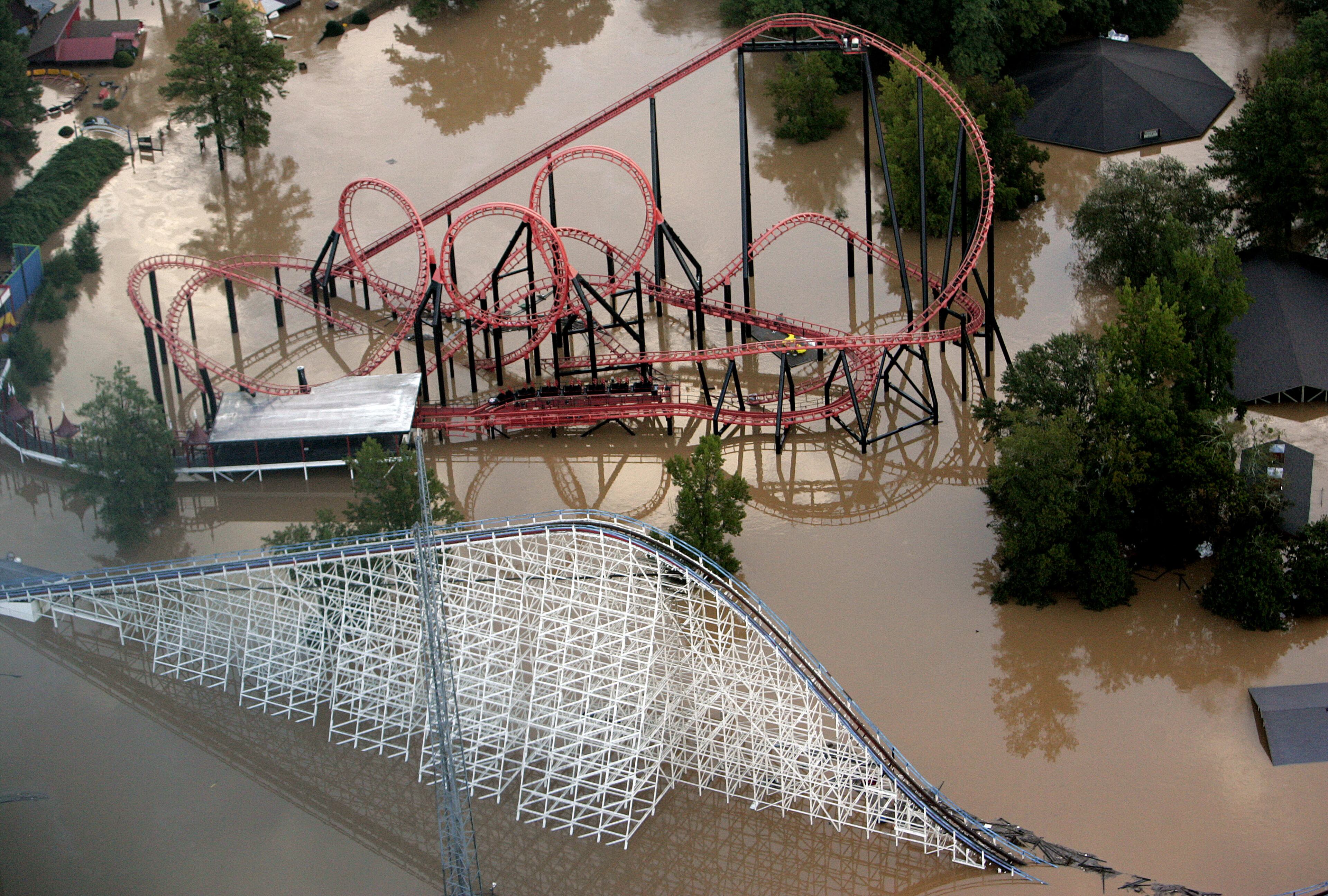
Ten years ago, large swaths of metro Atlanta were flooded when unrelenting rain fell from Sept. 15-22, 2009 on already-saturated ground. Roads were impassable, bridges were underwater, homes were inundated and even roller coasters at Six Flags were submerged.
The floods were record-breaking, catastrophic, and left a lasting impact for the metro area.
The flooding
There already were record levels of moisture when storms developed in the area on Sept. 15, said Laura Belanger, a senior service hydrologist at the National Weather Service in Peachtree City. Then the storms continued with near-constant rainfall for more than a week.
“We had pretty wet conditions late that summer,” said Belanger, who was an intern at the NWS in 2009.
The flooding peaked overnight Sept. 20 and into Sept. 21.
Fulton, DeKalb, Gwinnett, Bartow and Cherokee counties all got at least five to seven inches of rain in a 24-hour period that began on the evening of Sept. 20. It was worse in Cobb and Douglas counties. One Douglas location was swamped with more than 21 inches of rain in 24 hours, Belanger said.
Cobb County hit hard
Sweetwater Creek’s levels rose to 20 feet above flood stage — soaring past the creek’s previous high-water mark of nine feet above flood level. The Austell area, in particular, sustained quite a bit of damage. The Great American Scream Machine, a roller coaster at Six Flags, was mostly under water.
“It was not something that we’d really seen before,” Belanger said.
Jim and Margaret Hobbs live in Vinings, on the Chattahoochee River. They’d raised their home seven feet in the 1980s, when wet weather had caused water to fill their yard. After the 2009 flood, they raised it again.
“This was a real flood,” Jim Hobbs said. “It was scary.”
There was almost two feet of water on the first floor of the Hobbs’ home, he said. When it receded, they had mold, and the mud stuck like concrete.
“It was a mess,” Margaret Hobbs said. “It was nasty.”
2011 VIDEO: Flood damaged homes demolished
It took more than a year to set everything back to normal. Margaret Hobbs said the flooding has had a lasting impact on her — she's always nervous when there are heavy rains. But she said the disaster brought neighbors together.
“We say we live on the river, and sometimes in the river,” she said.
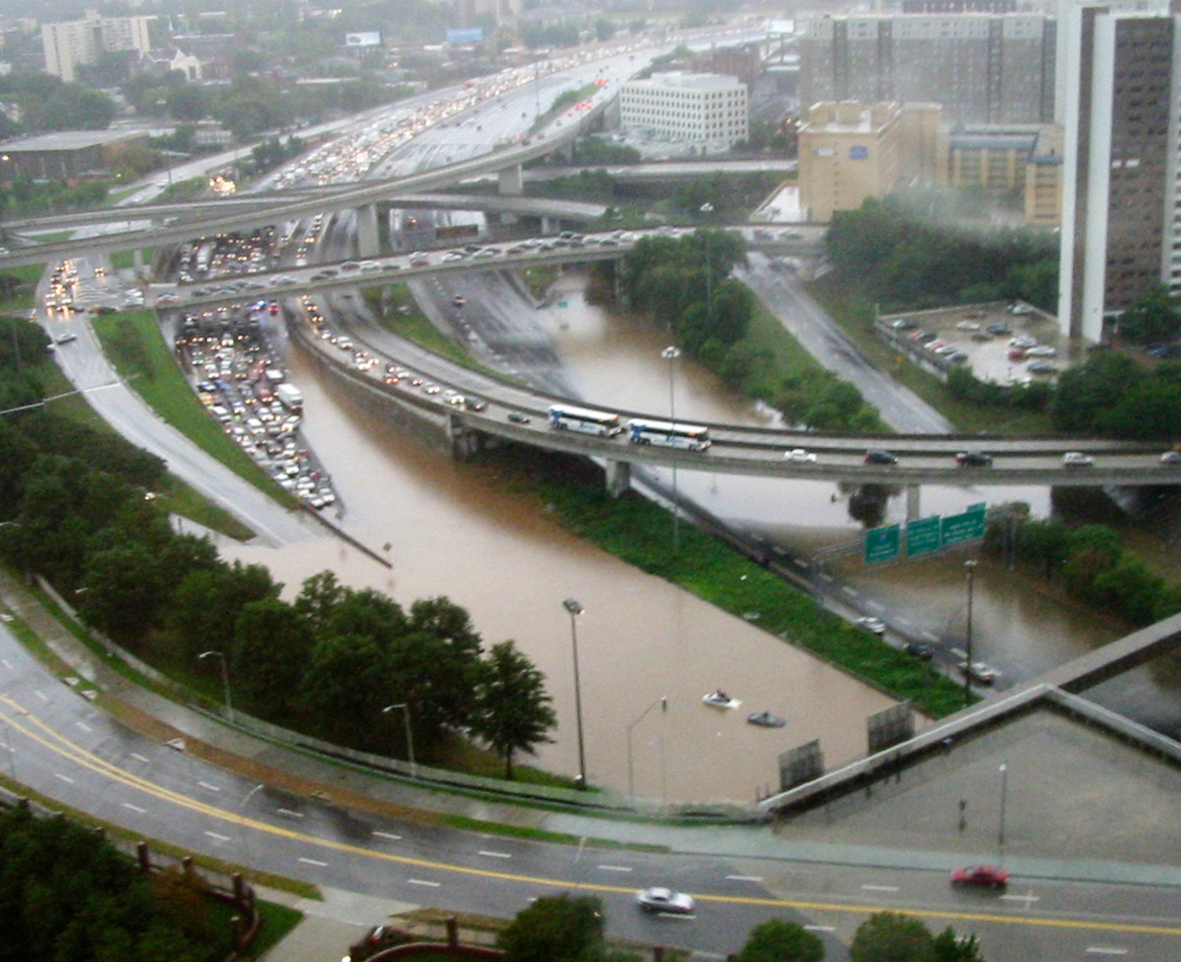
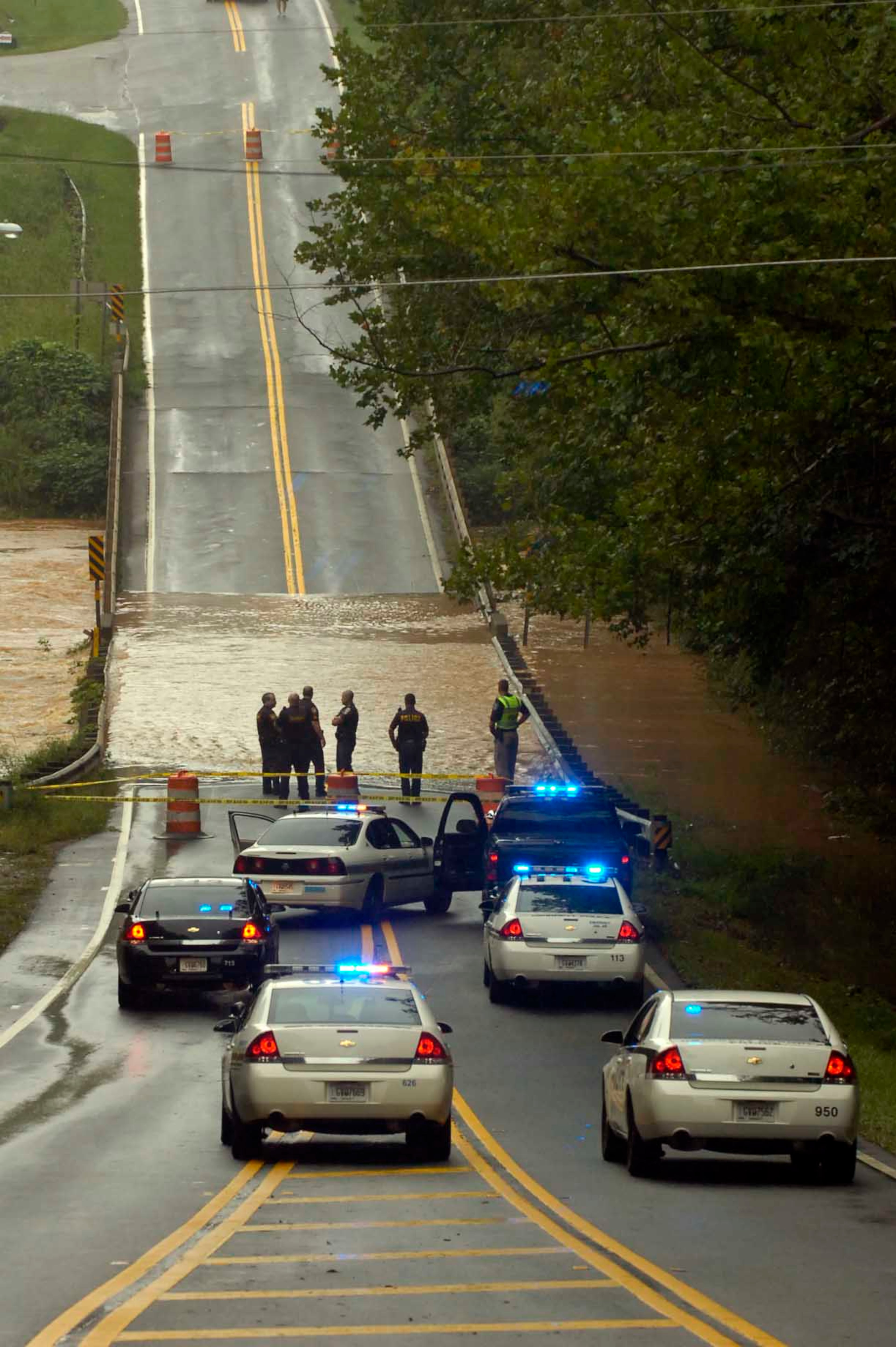
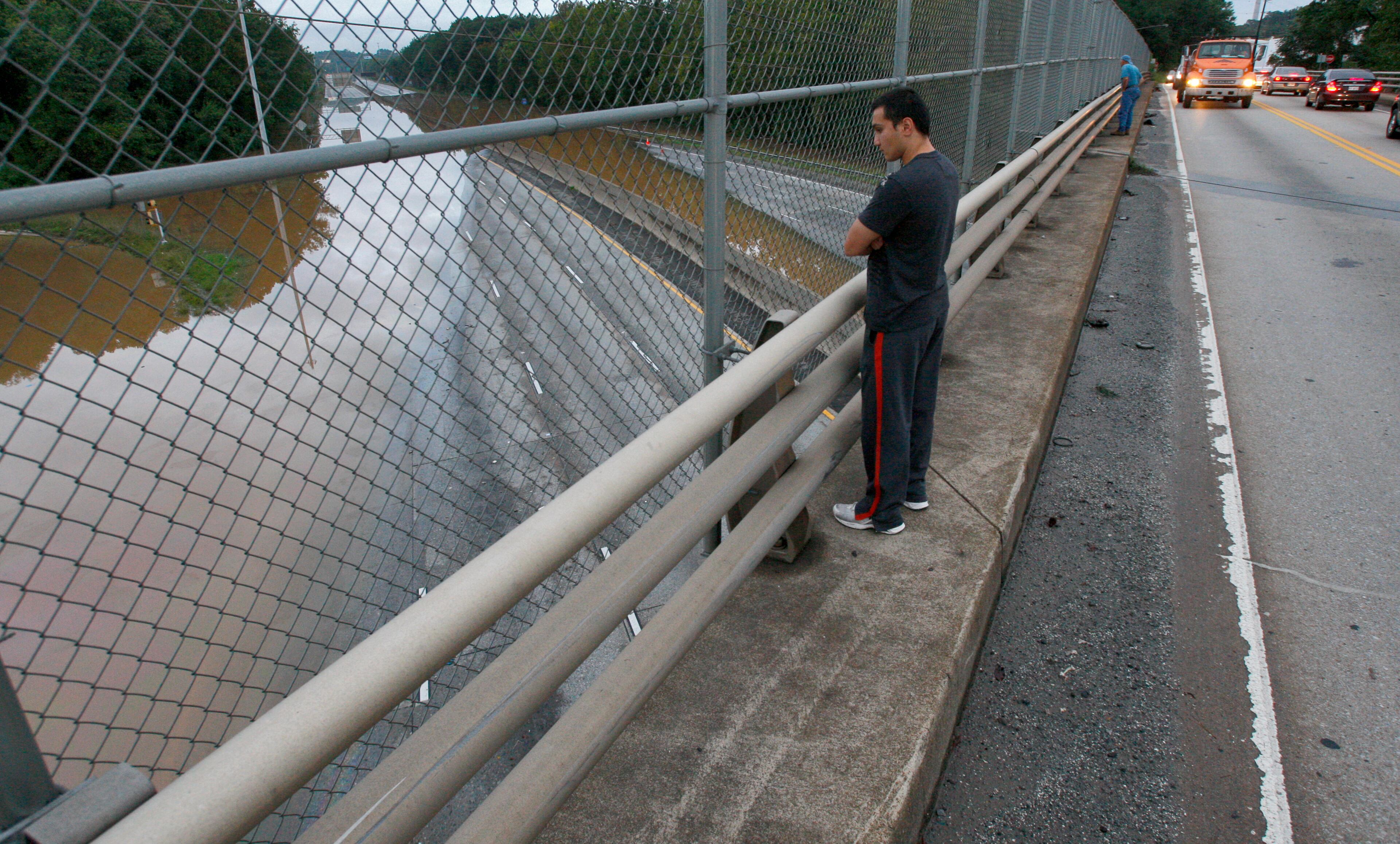
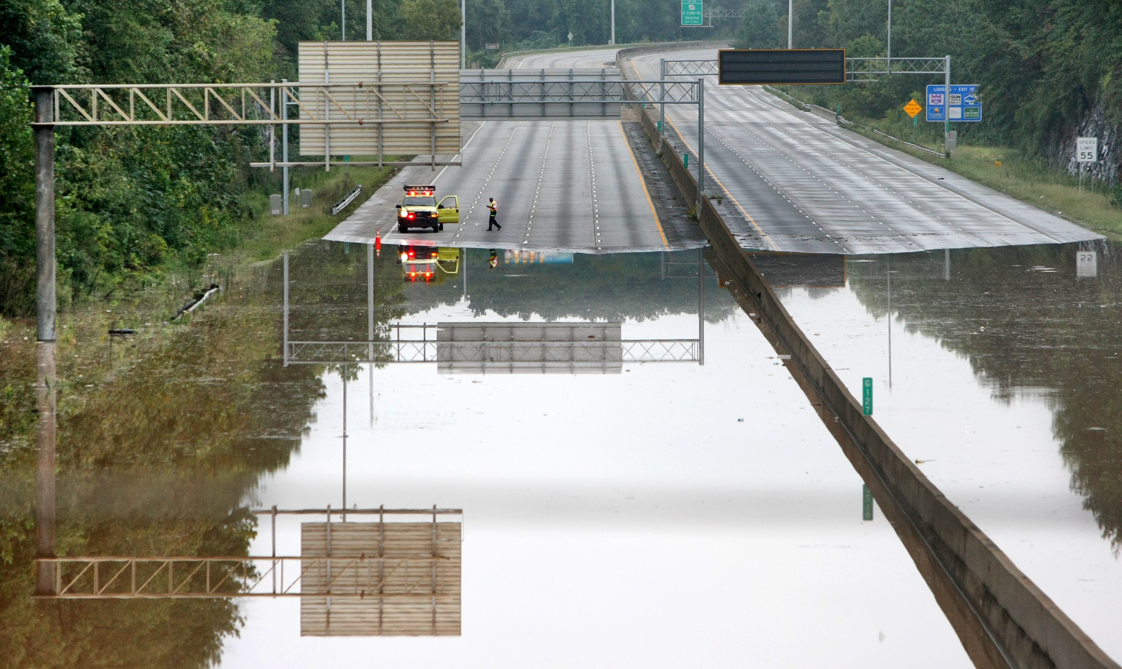
The roads
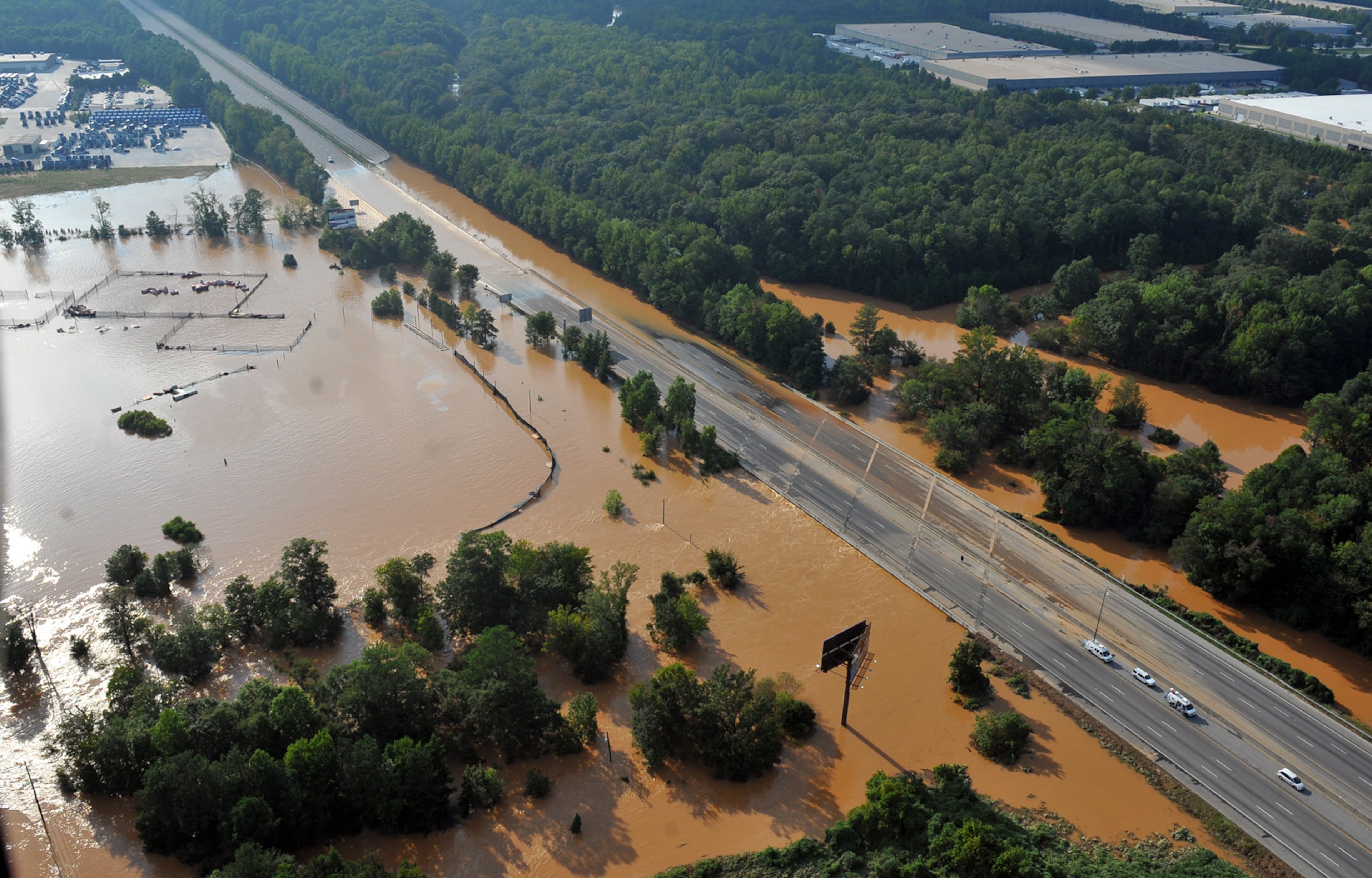
Natalie Dale, a spokesperson for the Georgia Department of Transportation, said flooding on highways was exacerbated by blocked drains. Leaf debris and other trash clogged the system, and made it harder for the water to drain off roadways.
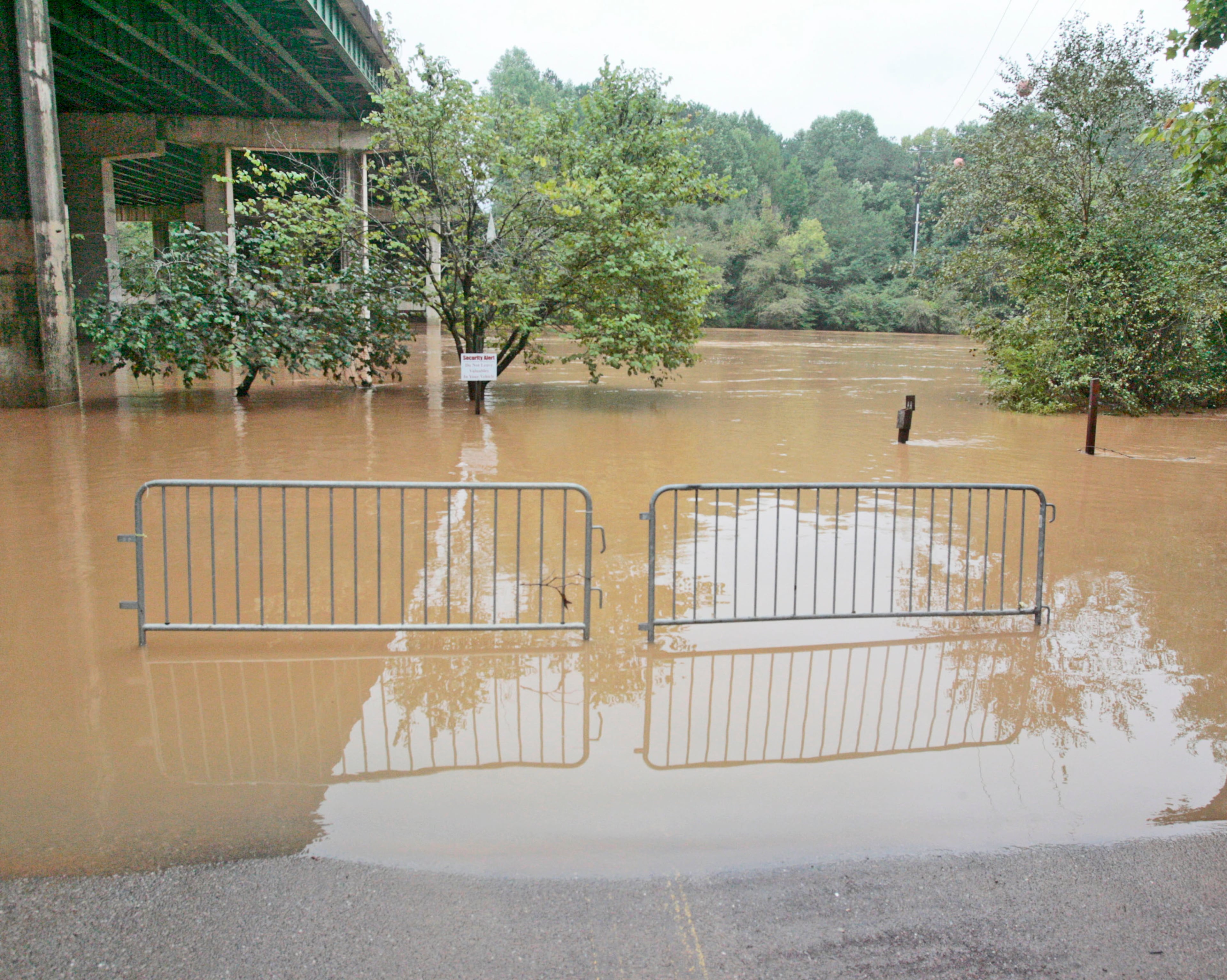
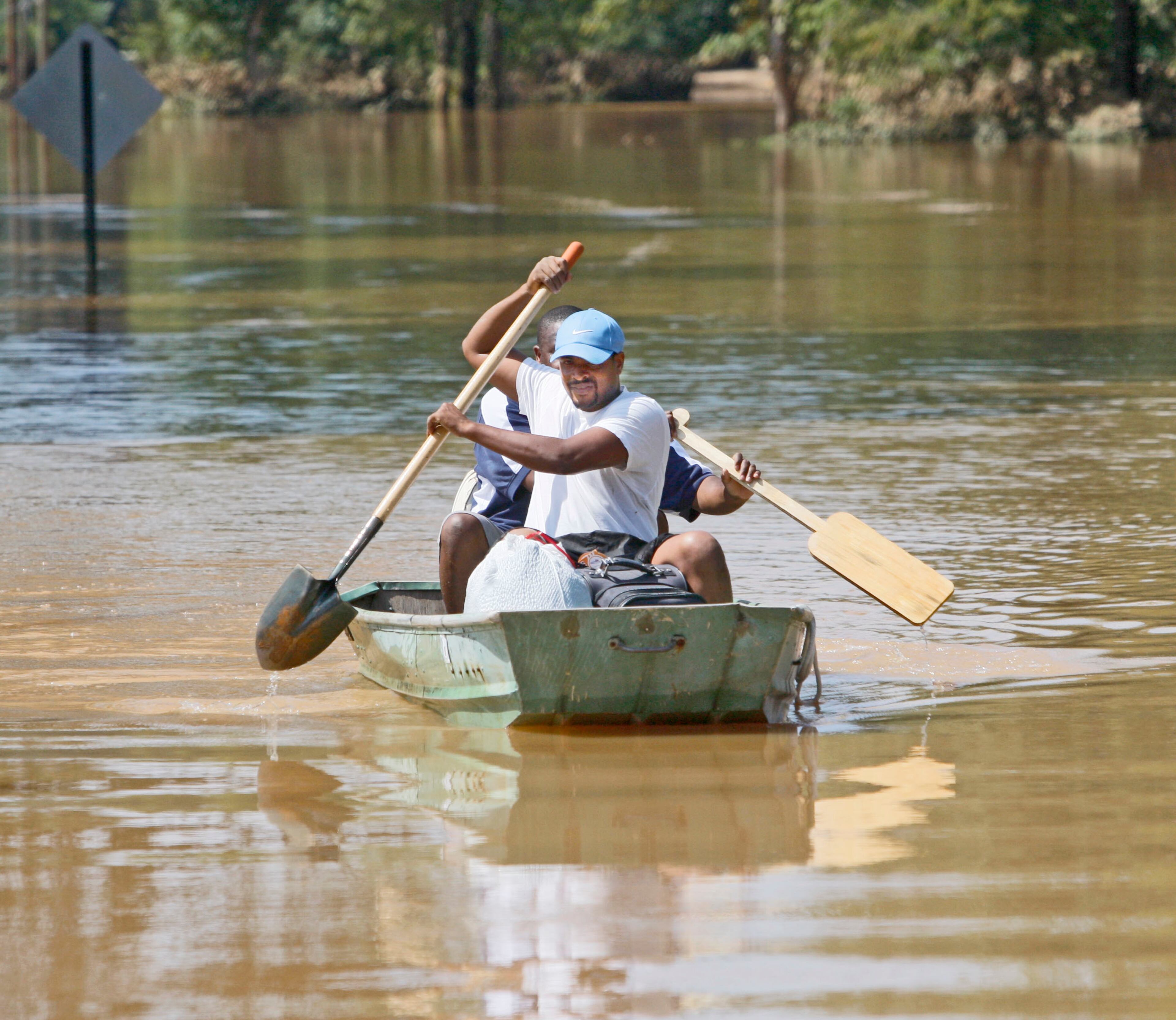
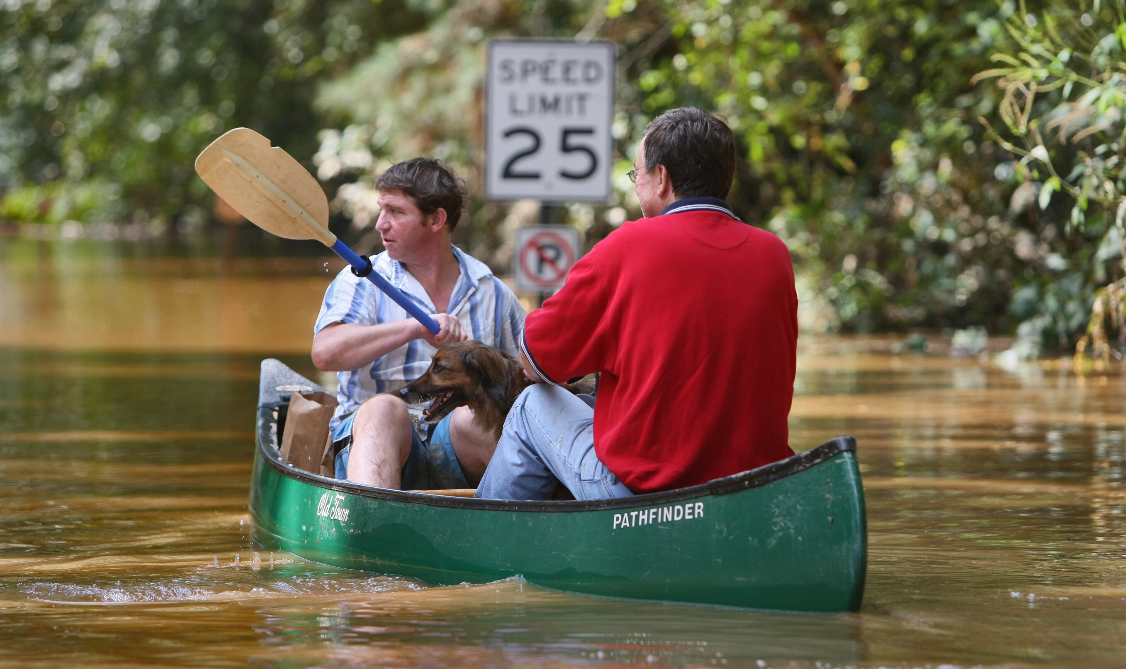
There was significant flooding on the downtown connector, I-20 and I-575, as well as Stone Mountain freeway. All were closed. Rivers often overwhelmed bridges and roads, leading to closures across the metro area. Many residents took to boats to check on neighbors or move belongings.
Belanger said the speed with which the water overtook roads was one of the factors that led to phone alerts warning about flash flooding. There were more than 100 rescues across the metro area.
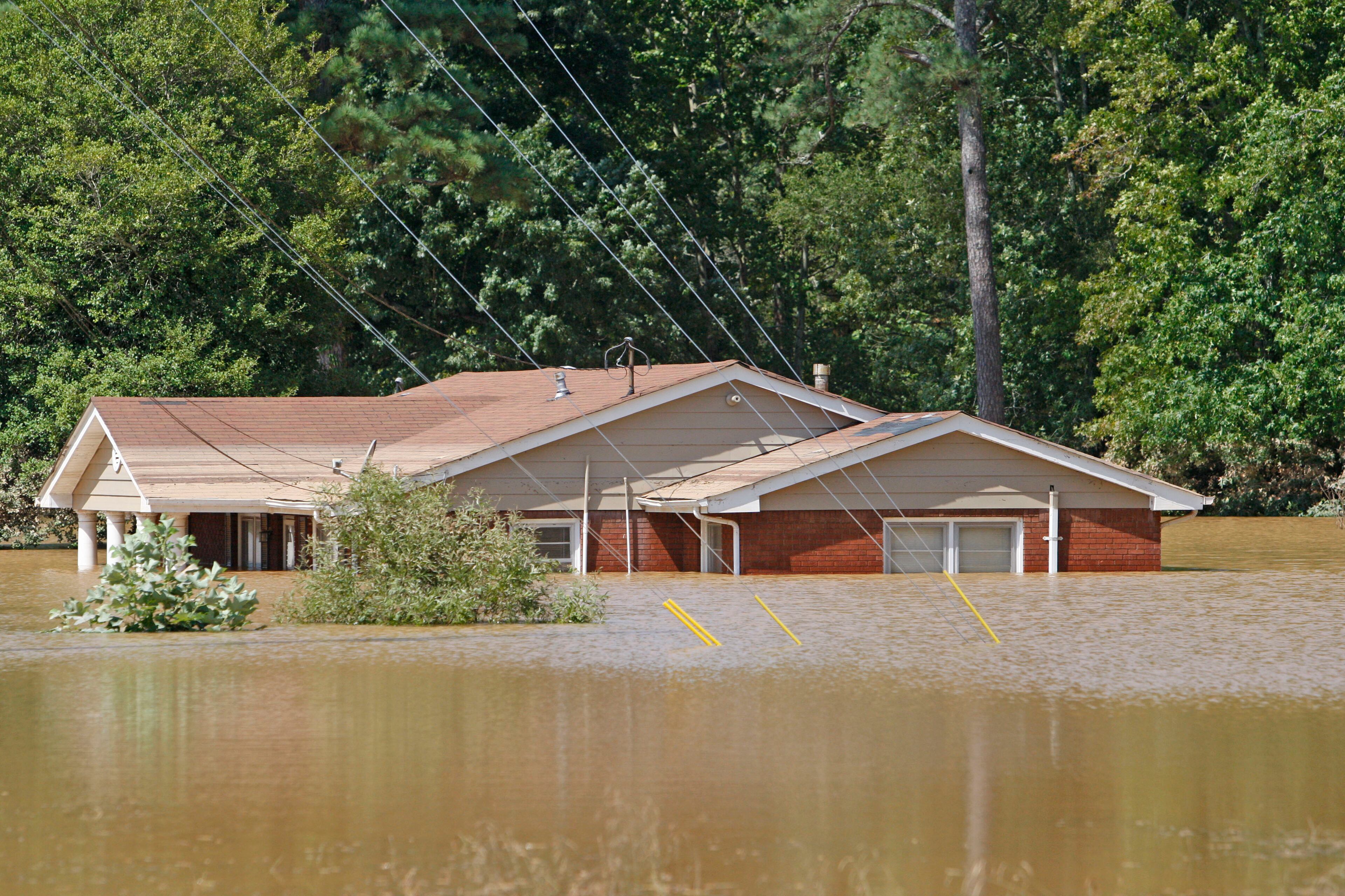
The damage
Eleven people died in the storms, including 10 in Georgia. Of those, eight died in their cars as they tried to traverse floodwaters.
The flooding also did a lot of damage. Belanger said the official estimate of $500 million is likely an undercount, since the figures don’t include the cost of debris removal.
More than 20,000 homes and businesses were damaged. Cobb County purchased more than 75 homes in flood hazard areas and more than 125 acres of vacant floodplain. In Sandy Springs, three homes destroyed by the 2009 flood were torn down and replaced with Windsor Meadows passive park.
The damage included the replacement of several bridges that were washed out. Seventeen counties received federal disaster declarations.
VIDEO from 2014: New damage estimates released from 2009 flooding
About the Author

Arielle Kass covers Gwinnett County for The Atlanta Journal-Constitution. She started at the paper in 2010, and has covered business and local government beats around metro Atlanta. Arielle is a graduate of Emory University.