Kayaking in Georgia: 5 spots to launch your weekend
It’s summertime and the living is easy, just not as easy as it used to be.
In years past you could head to a beach or a park for a fun and relaxing outing. This year you have to worry about the coronavirus pandemic.
» Kayak through an abandoned mine tunnel via the Etowah River
One way to have fun, cool off and maintain a safe distance from others is kayaking. With its rivers and lakes, Georgia has plenty of places to launch your kayak. Here are five:
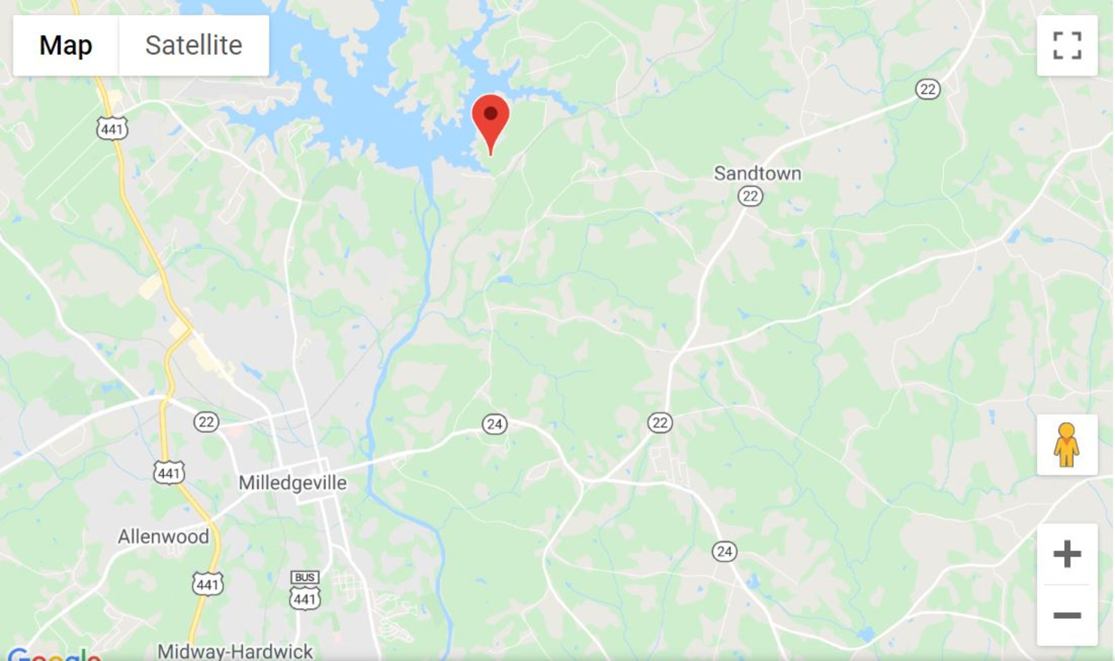
Oconee River
The Oconee River's headwaters are in Hall County. The Middle Oconee and North Oconee flow 55-65 miles before joining below Athens to form the Oconee River. The Oconee River then flows freely for about 20 miles until it joins the northern end of Lake Oconee, which is formed by Wallace Dam. It then joins the Ocmulgee to form the Altamaha River.
The upper section has Class II rapids, which are best handled by intermediates who can maneuver canoes and read water.
However, 365 Atlanta Traveler says "young kids or beginners will love the lower section, with plenty of sandbars for you to stop, relax, and explore. Starting at the Oconee River Greenway and taking you down to the State Boat ramp, there are no rapids here."
» 5 family friendly canoe trips to take right outside of Atlanta
Lake Sinclair
Georgia Power's Lake Sinclair is about halfway between Atlanta and Augusta off Interstate 20. The Eatonton lake is calm, so it's good for beginners. It has public boat ramps, a picnic area and other amenities.
When you're done kayaking, head over to Rocky Creek Park on the southeast side of the lake in Baldwin County and enjoy a pavilion with restrooms and vending machines, picnic tables, grills, fishing pier, swimming beach, playground, and a boat ramp. This park is open to the public 10 a.m. to 7 p.m. Wednesday through Sunday until Labor Day.
» Tips to keep you safer during July 4th weekend amid coronavirus
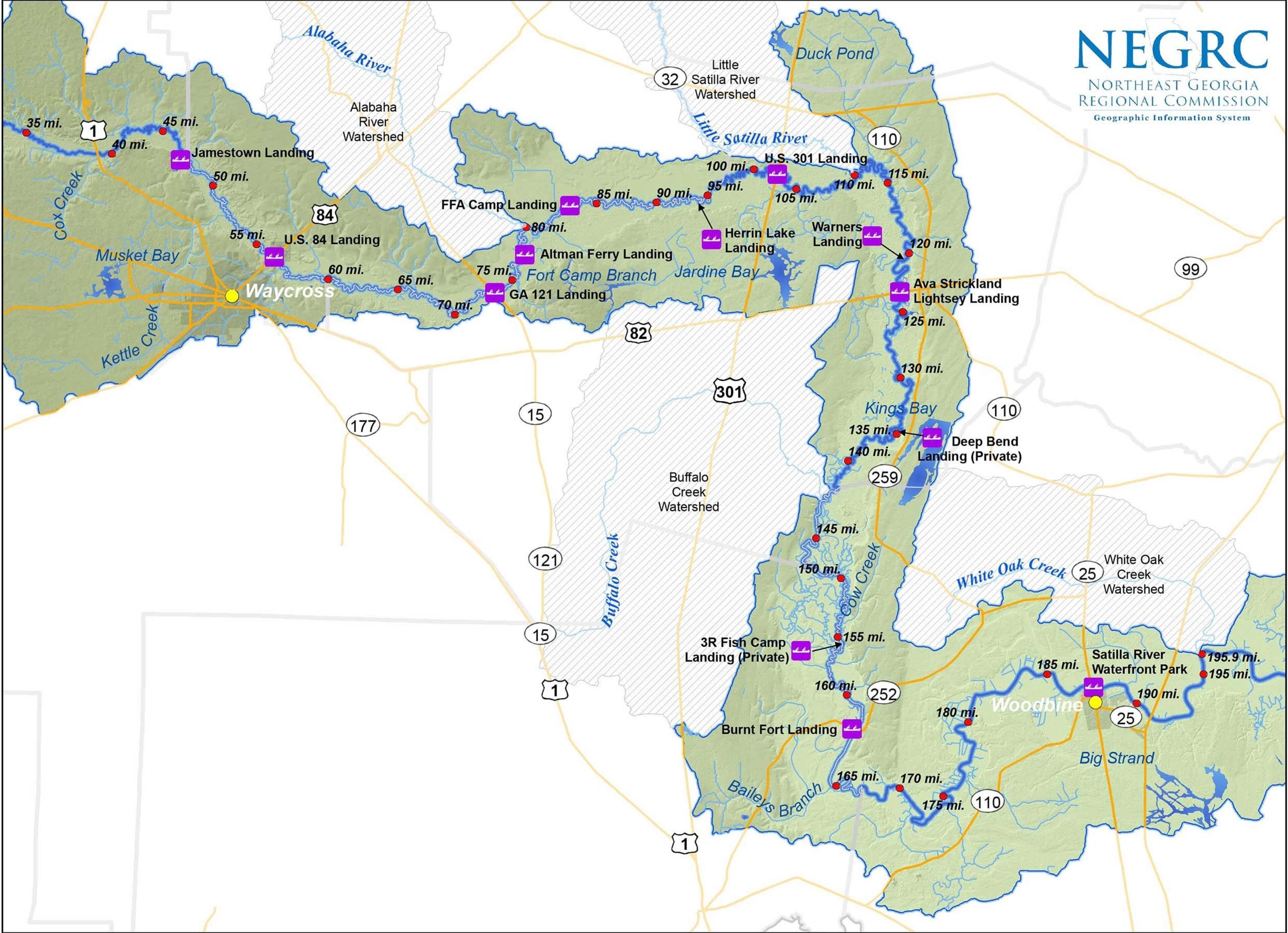
Satilla River
The Satilla River Water Trail in southeast Georgia is 150-200 miles long, beginning in Jamestown, and continuing downstream to the city of Woodbine.
"This unpolluted river has abundant wildlife and the 'tannic' stained water gives it a mirror quality that is beautiful. Numerous wide white sand bars on the inside of bends in the river provide ample room for 14 paddlers," paddlers with KayakGuide.com wrote.
» Why a 'punk stick' might make your 4th of July fireworks safer
Augusta Canal
You can’t play golf at Augusta National (unless you’re a member), but you can paddle the Augusta Canal.
The first level is a 7.5-mile corridor that follows the best-preserved industrial canal of its kind remaining in the South, according to Georgia River Network.
The first level is an easy, beginner paddle on moving flatwater with some current that ends near downtown Augusta. The second and third levels pass through a series of gates and bulkheads that are dangerous for paddlers and should be avoided.
» Don't let your pet become another 4th of July runaway
Georgia Coast Saltwater Paddling Trail
The Southeast Coast Saltwater Paddling Trail connects the Chesapeake Bay and the Georgia-Florida border. For more than 800 miles, the SECT hugs the coastal waters of Virginia, North Carolina, South Carolina and Georgia, providing an unbroken trail through four states in the tidal marshes and rivers of the Southeast.
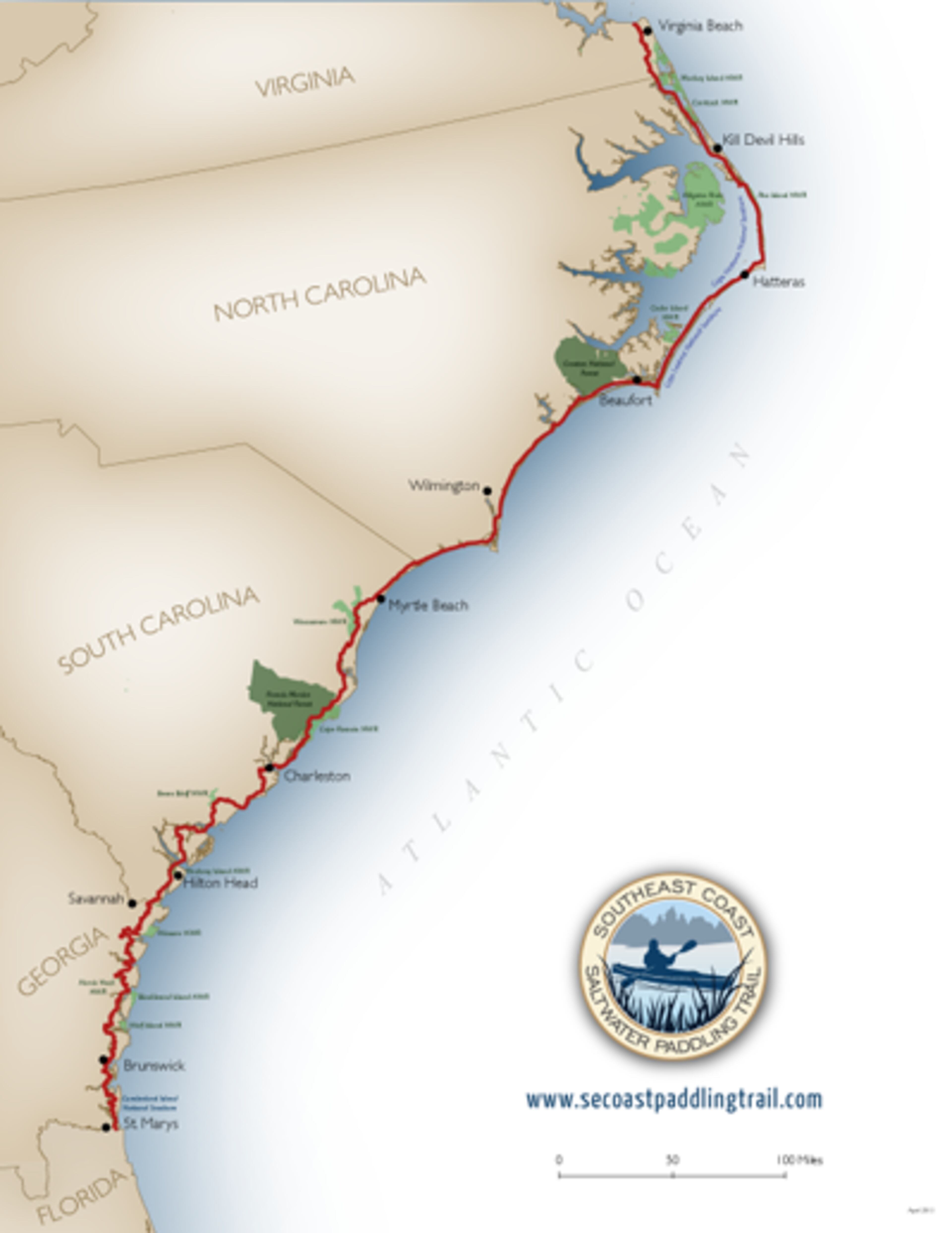
The Georgia section is nearly 200 miles of tidal marshes, rivers and coastline suitable for all levels of experience.
There are 35 places to access the trail. Check out the interactive map here.