WEATHER-TRAFFIC: Atlanta is blistering hot; Ga. 400 problems continue
It’s a steamy afternoon in North Georgia, where Atlanta has hit its projected high for the day, according to Channel 2 Action News.
The air isn’t the only thing hot though, since traffic hasn’t cooled off all day.
Ga. 400 has been the biggest problem area, with two left northbound lanes being blocked by a crash just before Holcomb Bridge Road, the WSB 24-hour Traffic Center reported. This comes after all northbound lanes of the freeway were blocked in Alpharetta, but that crash has been cleared.
Clayton County is also recovering after a rollover crash on I-285 West blocked all but one right lane near Riverdale Road, the Traffic Center reported. The crash has been cleared, but heavy delays remain.
There’s been no relief so far from the heat Tuesday, and a dry spell means there won’t be much coming, Channel 2 reported.
Most of the region hit the mid-90s this afternoon, but Channel 2 meteorologist Brian Monahan said with the humidity it felt more like 100 degrees outside. To the south of the city in lake country, actual temperatures are forecast to near triple digits.
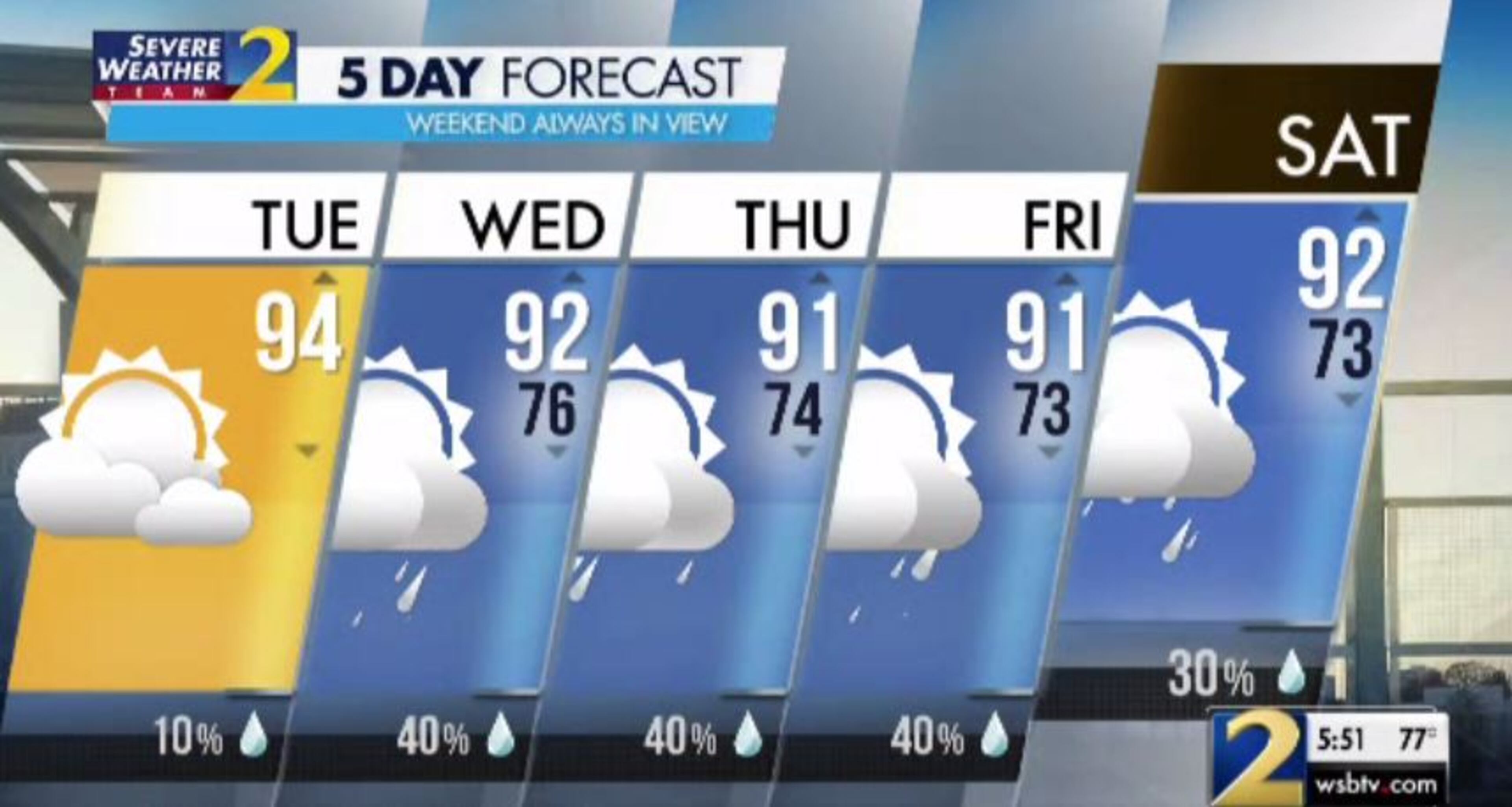
Atlanta has already hit 94 degrees, which is the predicted high Tuesday.
“That’s about five degrees above average for this time of year,” Monahan said. “It’s been a hot July, and we will see that hot stretch roll on.”
Like Monday, rain chances are low Tuesday. Isolated showers and storms are only 10% likely later in the day, according to Channel 2.
A break in the heat, however slight, is coming. Monahan said North Georgia will see the highest temps Tuesday before numbers drop back for the rest of the week. It’s only a few degrees, he said, but it’s something.
“The reason for that is going to be a little more rain moving into the forecast,” he said. “We're going to bake into the mid-90s this afternoon, then a little upper level disturbance — this will come through Wednesday and Thursday — increases our chance of rain and drops temperatures just a little bit.”
North Georgia is still forecast to hit the 90s for the rest of the week, but after Tuesday, afternoon highs are not projected to get above 92 degrees, according to Channel 2.
Metro Atlanta will finally see the effects of Hurricane Barry, which diminished to a tropical depression Sunday and continues to lose strength as it drifts across Missouri, by late Wednesday.
“This disturbance — it’s not much, a mini cold front I would call it — is going to try to slide through North Georgia,” Monahan said. “Some of the moisture that’s left from Hurricane Barry is going to get wrapped into this system. That’s why our rain chances go up tomorrow.”
Wednesday has a 40% chance of scattered storms in the afternoon and evening, but Monahan said the morning drive should be dry. The storms are forecast to develop in the northeast Georgia mountains around 3 p.m. before moving into metro Atlanta for the evening commute.
“The last couple of days have been pretty dry,” Monahan said. “Tomorrow will not be a dry day across North Georgia as the storm chance picks back up.”
By the end of the week, he said more Southside communities will see some accumulation. But the best chance for rain remains in the mountains and through the Northside. A wetter pattern continues over the next week or so, Monahan said.
Rain chances come down slightly to 30% for the weekend, when Monahan said afternoon storms are possible after some morning sunshine.

» For a detailed forecast, visit The Atlanta Journal-Constitution weather page.
» For updated traffic information, listen to News 95.5 and AM 750 WSB and follow @ajcwsbtraffic on Twitter.
» Download The Atlanta Journal-Constitution app for weather alerts on-the-go.


