Road tripping through Alabama

As the COVID-19 pandemic continues to dampen travel plans to far-flung destinations, road trips remain the go-to solution for travelers looking for a getaway close to home. With that in mind, here are three National Scenic Byways in Alabama that showcase reasons to visit the state’s coast, mountains and plains.

Alabama’s Coastal Connection
The longest of the state’s National Scenic Byways is Alabama’s Coastal Connection at 130 miles. True to its name, it connects multiple communities and cities bordering Mobile Bay and the Gulf of Mexico. It also connects travelers to nature and history at nearby preserves, parks and historic sites.
One of the few scenic byways in the nation that includes a ferry ride, the route features a ride on the Mobile Bay Ferry ($16 and up, 110 AL 180, Gulf Shores, 251-861-3000, mobilebayferry.com) connecting Dauphin Island to the Fort Morgan Peninsula. The 40-minute ride across the mouth of Mobile Bay spans two historic forts where the Battle of Mobile Bay took place during the Civil War. Here Union Adm. David G. Farragut bellowed his now immortal command, “Damn the torpedoes, full speed ahead!”
From Dauphin Island to Orange Beach, Alabama’s 60 miles of Gulf Coast includes plenty of white-sand beaches comparable to those in the Florida Panhandle. For a socially distant experience, explore the 7,100-acre Bon Secour National Wildlife Refuge (12295 AL 180, Gulf Shores. 251-540-7720, www.fws.gov/refuge/Bon_Secour) on the Fort Morgan Peninsula. In addition to beach access points to uncrowded sands, there are hiking trails through a maritime forest and coastal dune habitats with views of saltwater lagoons, freshwater lakes, the beach, the bay and the chance to see lots of wildlife.
A number of waterfront towns line the coast. The artsy Eastern Shore enclave of Fairhope has a pier jutting a quarter-mile into the bay with an adjacent beach park and shady areas for a quiet picnic. At Point Clear, visit the circa-1847 Grand Hotel Golf Resort & Spa (17855 U.S. 98, Fairhope, Alabama, 251-928-9201, www.marriott.com) to witness the longstanding tradition of the daily ceremonial cannon firing over the bay.
(Alabama’s Coastal Connection is 348 miles southwest of Atlanta. It begins at Grand Bay Wilmer Road off exit 4 from I-10.)

Deemed an All-American Road by the National Scenic Byways Program, this historic route has more than scenery to offer. The three voting rights marches that took place here in March 1965 changed the course of U.S. history by leading to the signing of the Voting Rights Act into law five months later.
The first two marches were halted by local and state law enforcement at the Edmund Pettus Bridge (www.selma-al.gov/edmund-pettus-bridge) in Selma on what became known as “Bloody Sunday” and “Turnaround Tuesday.” The last march made it all the way to Montgomery over a five-day period after a federal judge ruled in favor of the protestors’ right to march.
The 54-mile route follows the marchers’ trek on U.S. 80 from downtown Selma to downtown Montgomery and up Dexter Avenue to the steps of the state capitol building. Along the way it passes through a rolling landscape of farmlands and small communities. Historic markers, memorials and wayside exhibits dot the roadway, showcasing notable spots such as the farmers’ fields where marchers camped in the cold, rainy weather.
Start your journey at the Selma Interpretive Center (2 Broad St., 334-872-0509, www.nps.gov/semo) at the foot of the Edmund Pettus Bridge. Exhibits are currently closed due to the pandemic, but the bookstore is open and serving as a welcome center staffed with National Park Service personnel who can answer questions and provide maps and informative brochures. The bridge ― now a National Historic Landmark ― crosses the Alabama River and looks the same as it did in 1965.
(The Selma to Montgomery National Historic Trail is 210 miles southwest of Atlanta. It begins at the intersection of J.L. Chestnut Jr. Boulevard and Martin Luther King Street in Selma.)
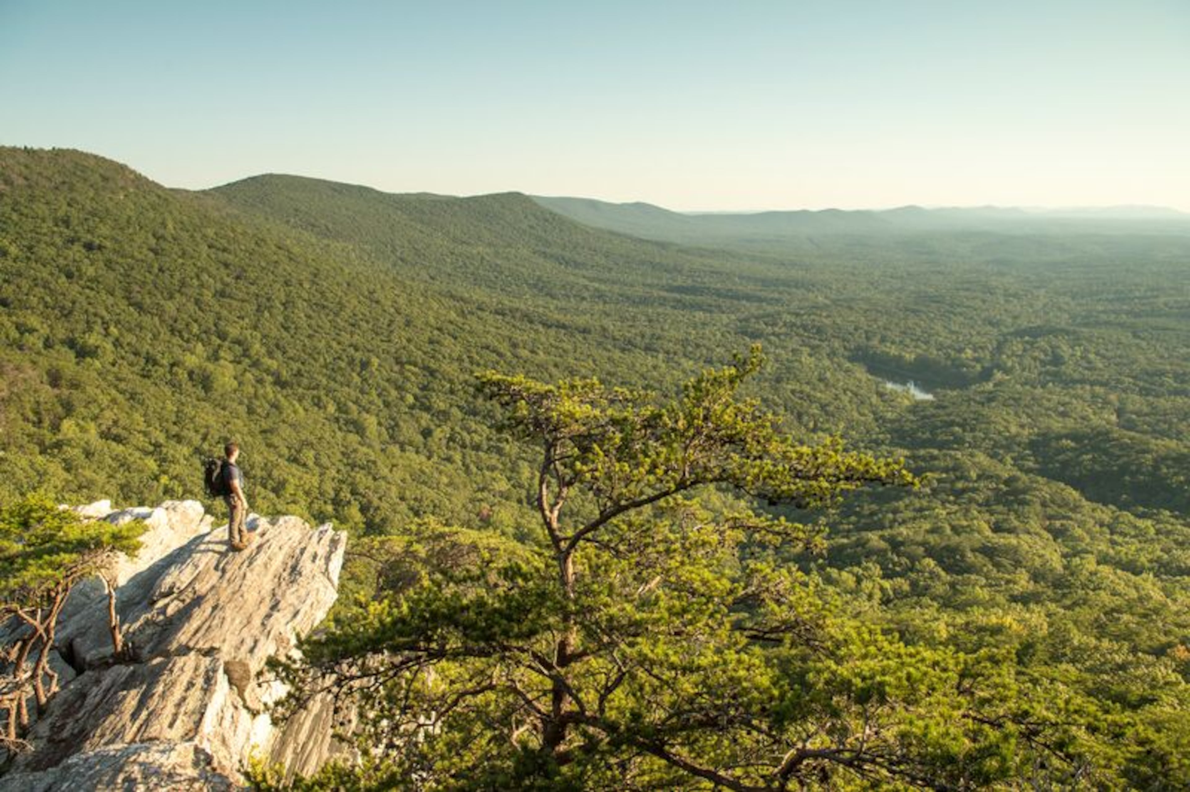
The closest Alabama national byway to Atlanta is the Talladega Scenic Drive just off I-20 halfway to Birmingham. Despite sharing a name with the famous Talladega Superspeedway 28 miles to the west, this stretch of blacktop has nothing to do with racing. In fact, the speed limit on the two-lane road is a relaxing 35 miles per hour.
The 26-mile route traverses the crest of the state’s highest mountain chain in the 400,000-acre Talladega National Forest (9905 AL 5, Brent, Alabama, www.fs.usda.gov), so there’s no commercial or residential development and traffic is light. You could drive the route one-way in about an hour including stops to take in the pastoral vistas at the scenic overlooks, but it’s worth spending a day or two here to find seclusion and beauty in the southernmost reaches of the Appalachian Mountains.
The drive roughly parallels the southern section of the Pinhoti National Recreation Trail (www.fs.usda.gov), a 337-mile footpath connecting the central Alabama Piedmont region to the North Georgia mountains. The Pinhoti has three access points for excursions into the mountain and valley wilderness areas of the forest. Other roadside trails lead to waterfalls and small pristine mountain lakes.
The byway’s major attraction is Cheaha State Park ($5, 19644 AL 281, Delta. 256-488-5111, www.alapark.com/parks/cheaha-state-park) that encompasses Cheaha Mountain. Most day visitors head straight to the circa-1935 CCC-built observation tower at the summit to take in the panoramic view. The best views, though, are seen by hikers on the out-and-back trails leading to rock outcroppings at the edge of the mountain. The quarter-mile boardwalk trail leading to the Bald Rock overlook is wheelchair and stroller accessible with its own viewing platform. Seven-acre Cheaha Lake has a swimming beach, picnic area, playground and paddleboat rentals in summer. Overnight accommodations include a campground, cabins and a hotel, and there’s a country store and restaurant on site.
(Talladega Scenic Drive is 76 miles west of Atlanta. It begins at the intersection of U.S. 78 and AL 281 near the town of Heflin.)