WEDNESDAY’S WEATHER-TRAFFIC: Fog could make hectic a.m. drive even worse

A dense fog advisory is in effect for most of North Georgia as low clouds blanket the region Wednesday morning.
The advisory, which includes all of metro Atlanta, is scheduled to expire at 11 a.m. Channel 2 Action News meteorologist Brian Monahan said conditions look pretty clear inside the Perimeter, but that could change quickly.
“This time of year it usually takes a little while to see fog burn off,” he said. “There could be spots on your drive into work this morning that could see visibility that drops really fast.”
Visibility has dropped to less than a half-mile on the Southside, according to Channel 2. Once the sun breaks through the clouds, Atlanta is really expected to warm up.
“Another day that feels like springtime in February,” Monahan said. “It’s kind of a treat later on this afternoon — about 66, the high.”
That’s not a record-breaking temperature, but it is about 10 degrees above average for this time of year. Monahan said the city will enjoy a mix of sun and clouds and mostly dry conditions Wednesday, with just a stray shower possible.
“Tonight, though, clouds continue to fill in,” he said. “And by this time tomorrow, we’re going to have some light showers around, especially in the north Georgia mountains and northwest Georgia.”
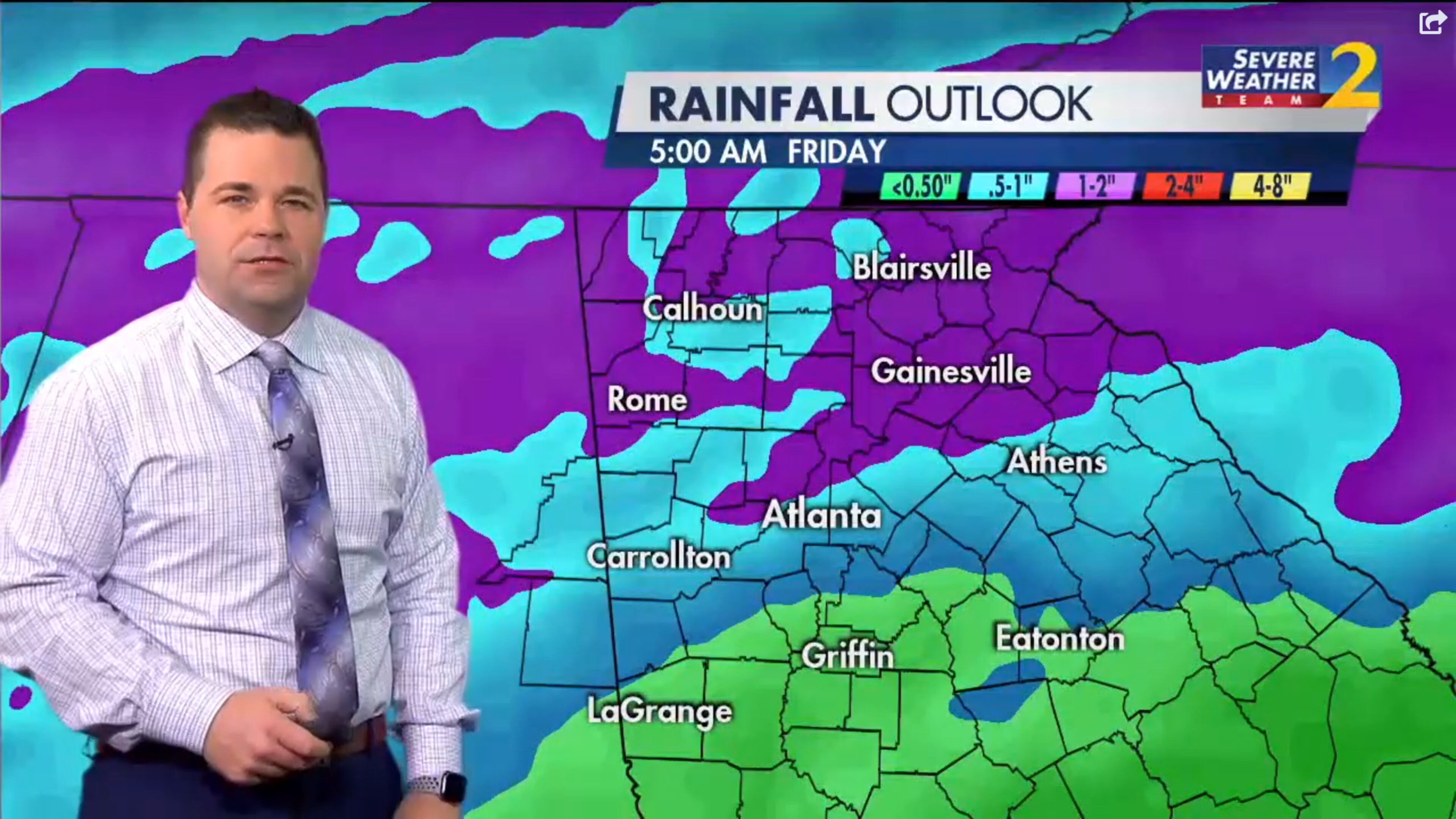
He expects the rain to be on the light side Thursday morning, but showers will pick up through the day. Showers and thunderstorms are 80% likely Thursday, and another 70% chance of showers is in the forecast Friday.

“Just a stray shower possible for today but it doesn’t stay that way this week,” Monahan said. “As we go through Thursday as we go through Friday, the rain is going to start to add up.”
Some areas could collect up to an inch of rainfall by the end of the week, he said. More rain in the forecast this weekend could push those totals even higher.

The dry and warm conditions in the weather forecast Wednesday will have to make up for the abysmal conditions on I-85 South.
The interstate has been shut down north of Brookwood and the entrance to I-75 since a deadly shooting was reported about 5:15 a.m. Those stuck behind the closure have not moved since then, creating “parking lot” conditions back to the Ga. 400 merge, WSB traffic reporter Mark Arum said.
“Massive delays on I-85 now out of DeKalb and Ga. 400 south into Buckhead,” he said.
Authorities do not expect the interstate to reopen before 8:30 a.m. The WSB 24-hour Traffic Center suggests commuters take the Buford-Spring Connector, Peachtree Street or Piedmont Avenue to get around the backups inside I-285.
Outside the Perimeter, use I-285 West, I-75 South or Roswell Road to get into Buckhead and Midtown, the Traffic Center reported.
» For a detailed forecast, visit The Atlanta Journal-Constitution weather page.
» For updated traffic information, listen to News 95.5 and AM 750 WSB and follow @ajcwsbtraffic on Twitter.
» Download The Atlanta Journal-Constitution app for weather alerts on-the-go.


