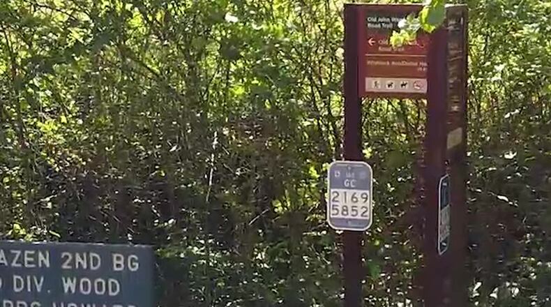
When people get lost or hurt along the 21 miles of trails at the Kennesaw Mountain National Battlefield Park, now they can be found easily due to Cobb’s new Emergency Locator Markers (ELM) installed along those trails.
The arrangement between the county and the National Park Service is one of the first of its kind in the nation and should lead to faster response times by Cobb first responders, according to a county statement.
Until the ELMs, the park’s Chief Ranger Anthony Winegar said the park service had to take maps, graph them and show them to the fire department when people were hurt or lost.
“Now everyone has the same numbers and the same map and the same grid system. We’ll be able to find them faster. We hope this will become a model for other national parks to use,” Winegar said.
Sgt. David Ablashi, park ranger with the Cobb County Police Department, said the ELMs “help us find them much, much faster. We have informational signs at our trailheads to make it easier to understand how it works. Now they look for the blue number before they call 911.”
Also, ELMs are all across Cobb on most of the trails
Check out the markers in this video at youtu.be/T3oqekzQnac.
Information: nps.gov/kemo
About the Author
Keep Reading
The Latest
Featured


