Climate change may have just gotten a little less theoretical in Georgia.
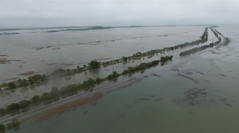
Jill Gambill of the University of Georgia Marine Extension Service sent along the above photo of U.S. Highway 80, the only road access to Tybee Island off the Georgia coast, which was closed this morning due to flooding.
Savannah’s tide gauge, she reports, measured the third-highest tide since record-keeping began in 1935. The photo comes courtesy of the Tybee Island Police Department.
The Washington Post has a multi-state take that includes this:
Tuesday morning's high tide peaked at 8.69 feet in Charleston, over a foot and a half higher than the predicted level. The highest crest on record in Charleston was 12.56 feet on Sept. 21, 1989 — the day that Hurricane Hugo made landfall in South Carolina.
The water level near Savannah, Ga., reached 10.43 feet, which was the third highest on record for the station. The top two records are 10.47 feet on Aug. 11, 1940, when a Category 2 hurricane made landfall on the Georgia and South Carolina coast, and 10.87 on Oct. 15, 1947, when Hurricane Nine made landfall in the same location.
This isn't unforeseen. A recent look at climate change and rising sea levels by the AJC's Dan Chapman and (Insider) Greg Bluestein begins thusly:
Here, though, on Georgia's 100-mile-long coast, most everybody takes seriously rising seas and dying marshes caused by drastic changes in the Earth's climate. They live already with the proof: greater tidal surges; flooded roads; and ages-old trees killed by salt water creeping further inland. If the dire predictions of state, federal and university scientists prove true, then billions of dollars of property in Brunswick, Darien, St. Marys and Savannah and on the islands of St. Simons, Sea and Tybee will be under water within a century.
Much of the coast's ecologically critical salt marsh will die off. Upland streams will turn brackish. Sparrows and shrimp will disappear if, as predicted, the Atlantic Ocean rises an additional 3 feet by 2110.
About the Author
The Latest
Featured


