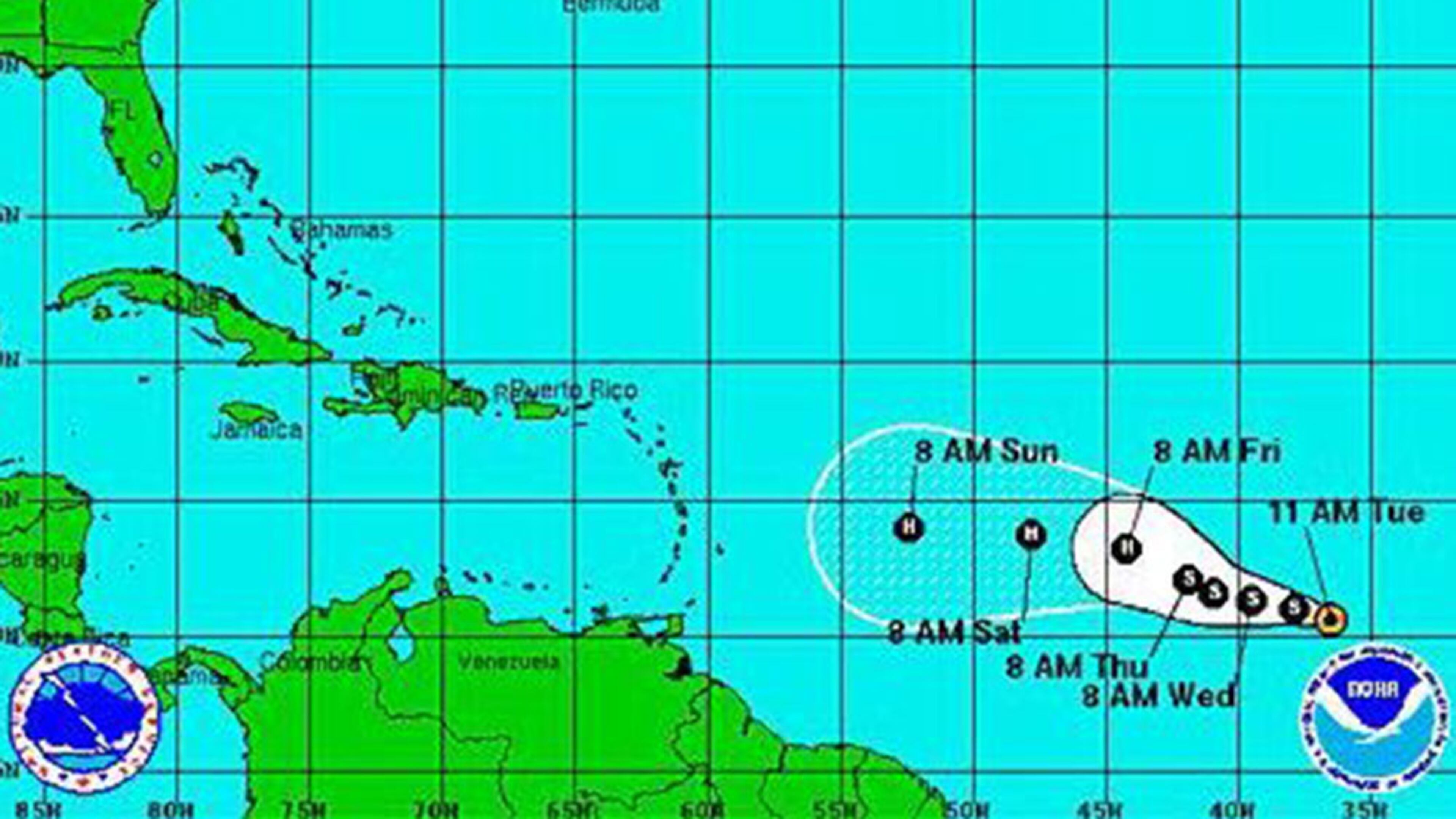
Tropical depression forms in the Atlantic

- Dangerous trend: Teens are making DIY braces that can ruin their teeth
- Morgan Freeman's granddaughter stabbed to death in New York
- Homeowner group threatens family with jail time over purple playground
- Caught on video: Man can be heard praying as he frees niece from wreckage
- Mayor declares local Walmart a public nuisance after multiple incidents
The National Hurricane Center reports that the tropical system in the Atlantic has strengthened into a depression with sustained maximum winds of 35 mph.
The system, which would be named Danny if it becomes a tropical storm, is moving west at 13 mph.
A tropical depression forms when an area of low pressure is accompanied by thunderstorms that produce a circular wind flow with maximum sustained winds below 39 mph. It becomes a tropical storm when circulation becomes more organized and maximum sustained winds are between 39 mph and 73 mph.
The storm is moving west, northwest at 10 mph to 15 mph and is still several hundred miles west of the Cape Verde Islands.
AccuWeather forecasters weren’t giving the storm much of a chance of reaching South Florida on Monday. While it’s in an area conducive to development now, it’s going to encounter a stronger wind shear and cooler waters in the Caribbean.
"Anyone with interests in the eastern Atlantic and Caribbean should continue to monitor the progress of this low for updates to any future impacts," wrote Kristina Pydynowski, AccuWeather senior meteorologist in her blog this morning. "While the prospect of damaging winds and flooding would like to be avoided, the Caribbean Islands are in need of soaking rain from tropical systems to combat the ongoing drought."
Earlier this morning WeatherUnderground forecasters said that while so-called “invest 96-L” has a “reasonable shot” at becoming a tropical storm, it has an uphill battle in front of it.
As the system grows, it’s more likely to suck in dry, dusty air, which is a hurricane killer, especially when accompanied by vertical wind shear – a characteristic El Nino has been bringing us since March.
From WeatherUnderground:
It's been a very quiet August so far in the tropical Atlantic. Chris Dolce at weather.com points out that if we go another two weeks without a named storm, this will be the first such August since 1997—which happens to be the last year that featured an El Niño ramping up as strongly as the current one. Prior to 1997, the last August without any named storms was 1961 (which wasn't an El Niño year).

