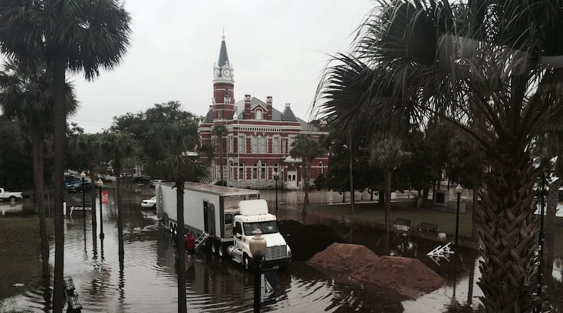
Driven by a "super" moon and rising sea levels, coastal flooding shut down Tybee Island on Tuesday as flood waters closed U.S. Highway 80 -- the only road access to Tybee Island, off the Georgia coast.
From his perch in Athens this morning, Marshall Shepherd, director of the University of Georgia's atmospheric sciences program, posted a link to a 2014 federal study of rising sea levels and increased flooding that opens thusly:
As SLRrel increases mean sea level (MSL), there is naturally an increase in tidal datum elevations, which are typically used to delineate inundation thresholds. Direct consequences of rising sea level against fixed elevations such as today's built infrastructure also include increased inundation during extreme events both spatially and temporally.
Not only are extreme flooding events reaching higher grounds and covering larger areas due to SLRrel, the frequency and duration of these extreme flood events are increasing.
In this particular instance, though, pictures may be worth more than the research. The tidal deluge, which residents say is a little better today, still has some neighborhoods underwater. Above and below are some photos of the situation that readers have sent us.
About the Author
The Latest
Featured


