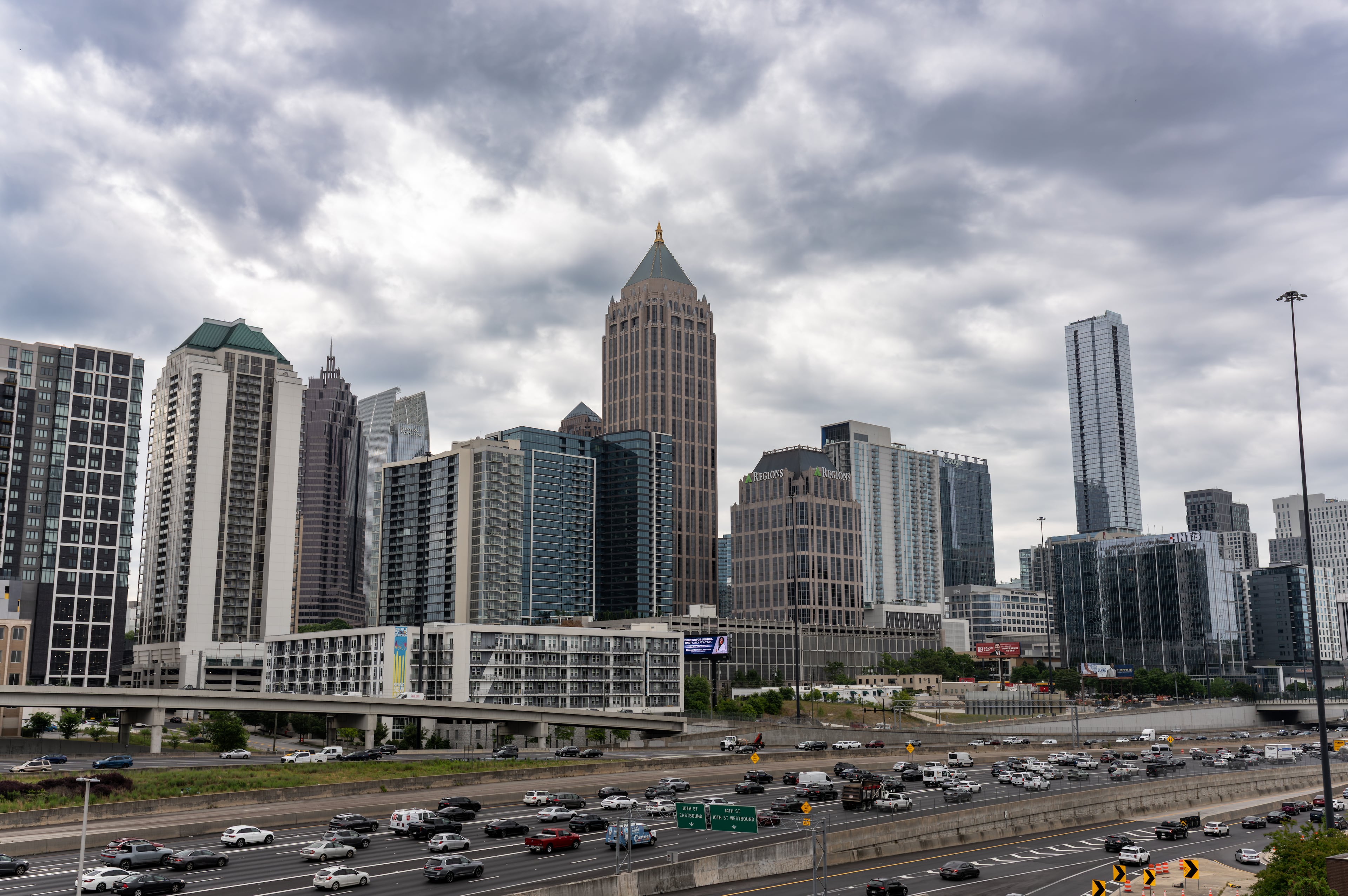
WEATHER UPDATE: Tornado watches remain for storm fronts north, south of Atlanta
Tornado watches are in effect for counties in both northwest Georgia and south of I-20 as storm fronts bring severe weather to the state for the second day in a row.
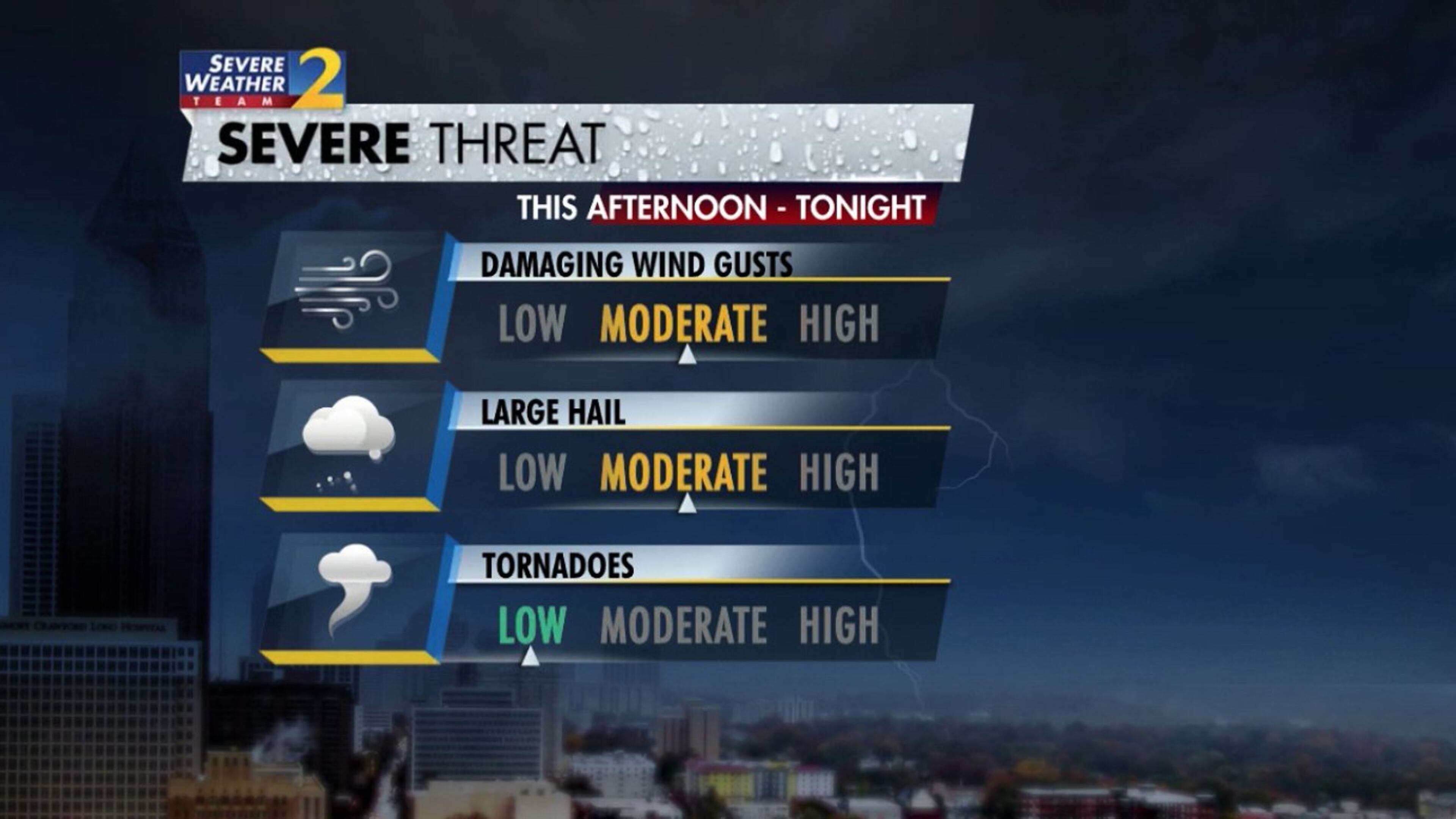
Early Wednesday afternoon, the National Weather Service issued a tornado watch for metro Atlanta counties south of I-20. A severe thunderstorm warning was issued hours later for parts of the region as they continued to weather the first wave of storms, Channel 2 Action News chief meteorologist Glenn Burns said. Clayton, Henry, Fayette and Spalding counties were included in the initial tornado watch, which remains in effect until 10 p.m.
In northwest Georgia, a separate tornado watch was issued around 5 p.m. as a cold front moved into the state. That watch will remain in effect until 10 p.m. as well and includes Chattooga, Fannin, Gilmer and Gordon counties.
Golf ball-sized hail and serious lightning were reported in southern Jasper and Putnam counties Wednesday evening, Burns said.
Unlike Tuesday’s wet weather, the region is not seeing widespread heavy rain, Channel 2 reported. But Wednesday’s storms have created conditions that could cause more damaging weather events.
There is a possibility for day two of flooding. More than 2 inches of rain fell in the city Tuesday, prompting flash flooding, closing roads and stranding motorists. Strong winds and lightning strikes brought down trees from Buckhead in the north to Henry County in the south.
Flood warnings remain in effect for Big Creek near Alpharetta and Suwanee Creek in Gwinnett County.
Tuesday’s pollen count, which reflected dry and warm conditions Monday, was sky high at 4,557 pollen particles per cubic meter of air. The count Wednesday was much lower at just 334, according to Atlanta Allergy and Asthma, the organization that tracks the daily pollen count.
Pollen levels should remain low through Thursday, when metro Atlanta will get a chance to dry out. Expect clear but cool conditions at Truist Park on Thursday night for the Braves’ home opener against the Cincinnati Reds.
Temperatures in the upper 50s are forecast for first pitch at 8 p.m. and could drop back into the low 50s by the late innings. According to the latest forecast, cooler weather sticks around this weekend with highs in the 50s both Friday and Saturday.

» For a detailed forecast, visit The Atlanta Journal-Constitution weather page.
» For updated traffic information, listen to News 95.5 and AM 750 WSB and follow @ajcwsbtraffic on Twitter.
» Download The Atlanta Journal-Constitution app for weather alerts on-the-go.
About the Authors


Henri Hollis is a restaurant critic and food reporter for The Atlanta Journal-Constitution, where he covers Atlanta’s restaurants, chefs and dining culture. As part of the AJC’s Food & Dining team, he reviews new restaurants, reports on industry trends and explores metro Atlanta’s culinary scene through the neighborhoods and people that shape it.