WEATHER-TRAFFIC UPDATE: Heavier waves of rain forming in metro Atlanta; flooding possible
ATLANTA FORECAST
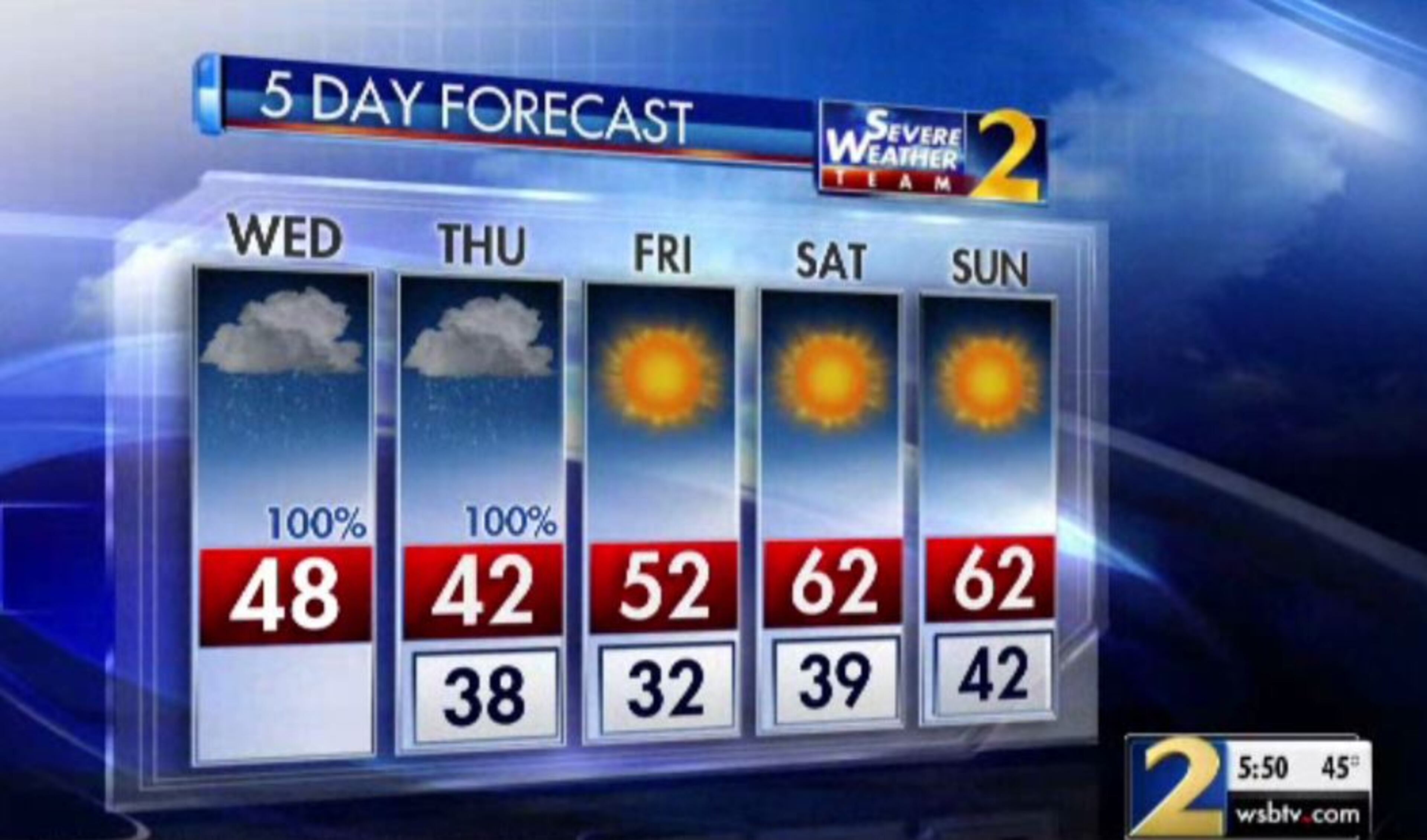
Wednesday: High: 48
Wednesday night: Low: 38
Thursday: High: 42
» For a detailed forecast, visit The Atlanta Journal-Constitution weather page.
As light rain continues, heavier waves of rain are forming on the edges of metro Atlanta, Channel 2 Action News reported.
The showers made the evening commute a mess, and the heavy rain should only make slick roads wetter and put many areas at risk of flooding.
Flash Flood Watch in effect through Thursday morning for most of North and Central Georgia. 1-3" with isolated 4" of additional rainfall is expected. Creeks & rivers could rise out of their banks, closing roads and impacting homes, businesses and farms. #gawx pic.twitter.com/G9zjdw1xwV
— NWS Atlanta (@NWSAtlanta) November 14, 2018
“Heavy rain will start to pick up ... through this evening and into the overnight hours,” Channel 2 meteorologist Karen Minton said. “We could pick up an additional 2 to 3 inches of rain, and when you combine that with saturated soil and the amounts we've already had, flooding is a possibility in many areas. You have got to be weather aware.”
Heavy rain will move back in later today increasing our flood threat. I'll break down the timing and threats with @bmonahanwsb at noon on @wsbtv. pic.twitter.com/JHUlgWrJxI
— Brad Nitz (@BradNitzWSB) November 14, 2018
The most rain will fall from the I-85 corridor eastward, Channel 2 meteorologist Brian Monahan said. Over west Georgia, rainfall amounts are expected to be an inch or less.
All of North Georgia and much of central Georgia is under a flash flood watch until 7 a.m. Thursday, meaning the conditions could develop to produce flash flooding.
MORE: Read more about the flash flood watch
“Due to the heavy rainfall the past several days, many creeks and streams are already near or above bankfull,” the National Weather Service said in an advisory. “Creeks and rivers could rise out of their banks, closing roads and impacting homes, businesses and farms. High water may not recede until well after the rain has ended.”
FLASH FLOOD WATCH: This watch is now through 7am Thursday. Habersham and Rabun counties are in an Areal Flood Watch. 2"-3" of additional rain could fall between now and Thursday morning leading to flash flooding. pic.twitter.com/AHkqgxTIos
— Karen Minton (@KarenMintonWSB) November 14, 2018
A flood warning continues for Big Creek near Alpharetta, and Suwanee Creek near Suwanee. Since Monday afternoon, those areas have seen minor flooding onto green spaces, sidewalks and roadways as the creeks have risen past flood stage and overrun.
The latest projections show the heaviest rain falling until 11 p.m. By 10 p.m., strong rain showers will still be over the Athens and Eatonton areas, then Minton said it will start to move out.
“With clouds and rain in the forecast, temperatures will continue to run well below average — mainly in the 40s across North Georgia today and tomorrow,” Monahan said.
It is going to be a cold, wet day. Most areas won't get out of the 40s. Rain will increase through the morning into the afternoon. It will be heavy at times especially from Athens to Eatonton to Thomaston. Heaviest rain afternoon thru evening. pic.twitter.com/PWW9wmh6Nq
— Karen Minton (@KarenMintonWSB) November 14, 2018
North Georgia should see more showers early Thursday morning before it all dries out in the afternoon, according to the latest forecast from Channel 2.
In the North Georgia mountains, a few snow flurries or light snow showers are possible Thursday as the last of the moisture squeezes out of the state and colder air moves in, according to Channel 2.
“It’s going to be chilly on Friday morning, but sunny and dry through the weekend,” Minton said.

» For updated traffic information, listen to News 95.5 and AM 750 WSB and follow @ajcwsbtraffic on Twitter.
» Download The Atlanta Journal-Constitution app for weather alerts on-the-go.


