WEDNESDAY’S WEATHER-TRAFFIC: Rumbles of thunder possible with spring showers
The official start of spring is a little more than a week away, and North Georgia weather is responding in kind.
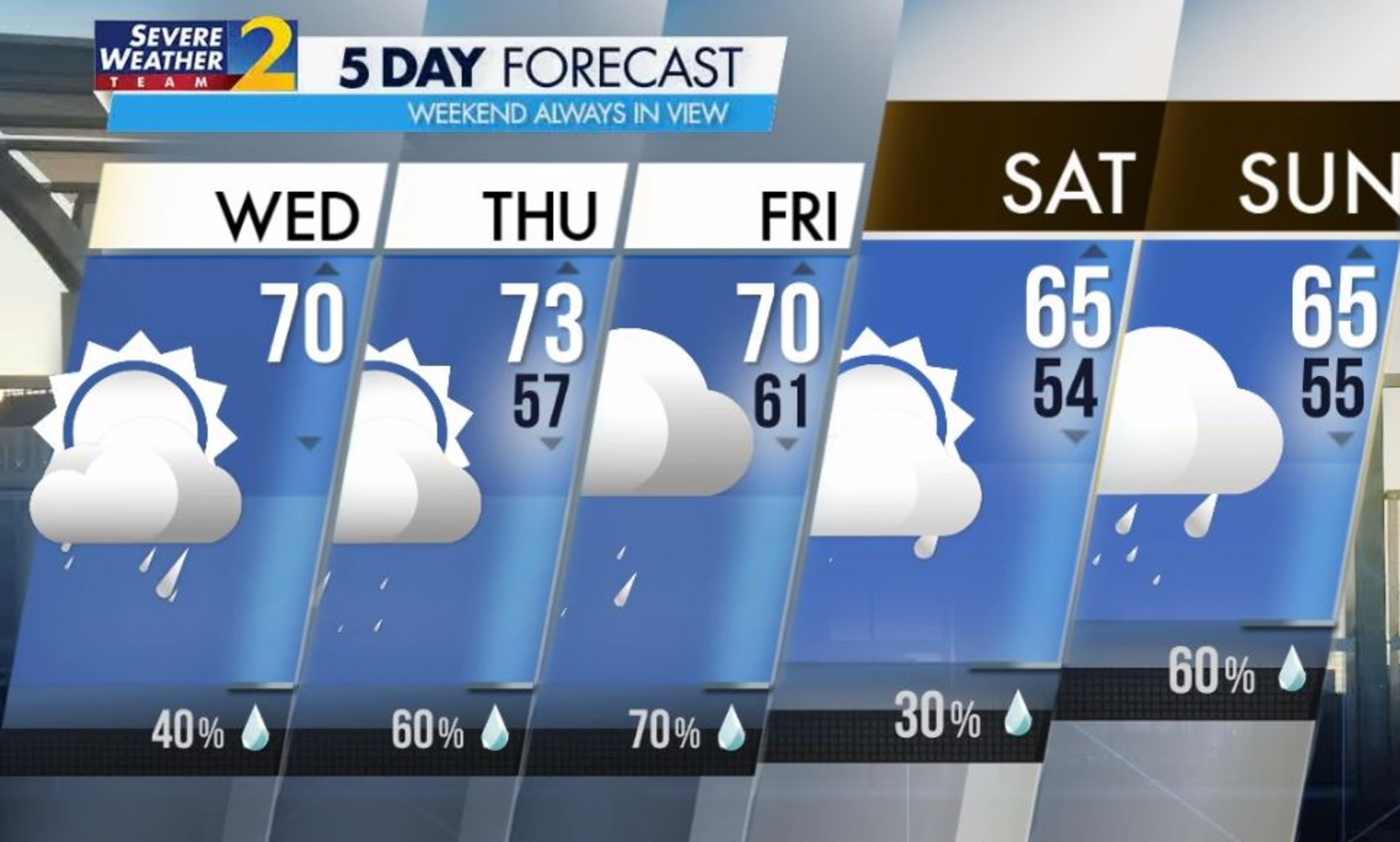
It will feel more like April than mid-March on Wednesday with afternoon highs in the low 70s, according to Channel 2 Action News. Spring showers are also in the forecast.
“First thing this morning, there could be a couple of showers up in northwest Georgia,” Channel 2 meteorologist Brian Monahan said. “By the afternoon, headed home from school later today, there will be some spring showers developing and the chance for a rumble of thunder or two.”
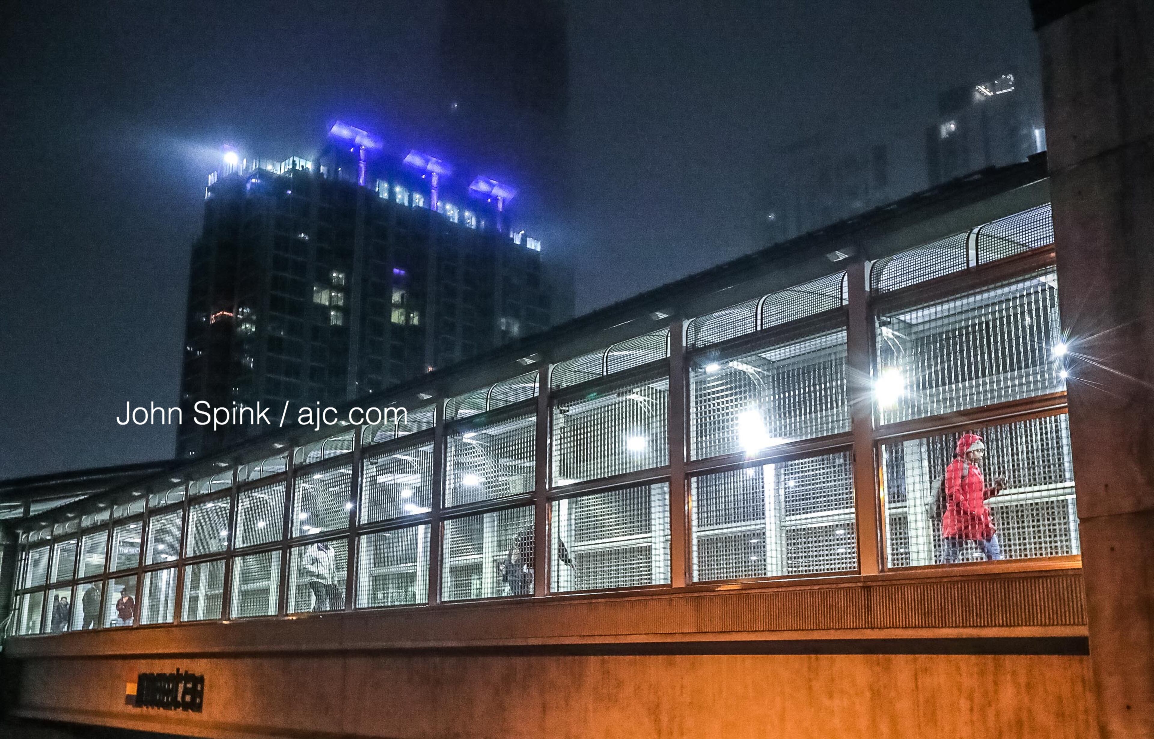
Those not seeing the showers Wednesday morning are dealing with fog and areas of low visibility. Cloud cover is reaching the ground in some neighborhoods, contributing to visibility of about a mile from Atlanta to the west, Monahan said.
“Use the low beams, you could run into some thicker fog as you head into work and school this morning,” he said.

Monahan said the warm, muggy weather will create the right conditions for a few thunderstorms to develop alongside scattered showers early in the afternoon. The rain chance is 40% Wednesday, according to Channel 2.
The showers should fade a bit after sunset, but the opportunity for rain continues into the overnight hours, Monahan said.
“And by tomorrow morning, I think we'll see a few more showers across North Georgia,” he said.
Rain remains in the forecast each day through the end of the week.
Winter officially ends March 19 with the spring equinox. The average high for this time of year is 63 degrees, and Atlanta is headed for a projected high of 70, according to Channel 2.
Monahan said Thursday will be even warmer with a high of 73, but rain chances are increasing. By Friday, once the next weather system sweeps through the state, rain and storms are 70% likely, according to the latest forecast.
“A little bit more rain coming by Friday with some heavier downpours around on the other side of that system,” Monahan said. “It gets a little bit cooler for the weekend with highs in the mid-60s Saturday and Sunday.

Traffic is still slow on the Eastside Perimeter headed to Hartsfield-Jackson International Airport after a tractor-trailer crash shut down the interstate Wednesday morning , according to the WSB 24-hour Traffic Center.
All lanes of I-285 South were blocked for more than an hour at the I-20 interchange before they reopened about 6:40 a.m. Big jams remain through DeKalb County, the Traffic Center reported.
Traffic reporter Mark Arum said inner loop traffic is slowly recovering.
"This is thankfully in the non-rush hour direction of I-285, and it is not impacting I-20 or I-285 northbound,” he said. “That is the good news.”
Until the backups clear, commuters should continue to avoid I-285 and take the Downtown Connector instead, according to the Traffic Center.
» For a detailed forecast, visit The Atlanta Journal-Constitution weather page.
» For updated traffic information, listen to News 95.5 and AM 750 WSB and follow @ajcwsbtraffic on Twitter.
» Download The Atlanta Journal-Constitution app for weather alerts on-the-go.


