WEATHER-TRAFFIC UPDATE: Thunderstorm warnings issued for metro counties
ATLANTA FORECAST
Friday: High: 90
Friday night: Low: 72
Saturday: High: 89
» For a detailed forecast, visit The Atlanta Journal-Constitution weather page.
The National Weather Service has issued severe thunderstorm warnings for Coweta, Fayette and Spalding counties until 6:45 p.m. Warnings for DeKalb, Newton and Rockdale counties expired at 6 p.m.
Severe Thunderstorm Warning including Peachtree City GA, Newnan GA, Fayetteville GA until 6:45 PM EDT pic.twitter.com/zoKuYHZ1RT
— NWS Atlanta (@NWSAtlanta) June 8, 2018
Traffic has gotten considerably worse since scattered downpours developed across the metro Atlanta area.
Trees are down in Cobb County, and traffic lights lost power along Haynes Bridge Road in Alpharetta, Channel 2 Action News reported.
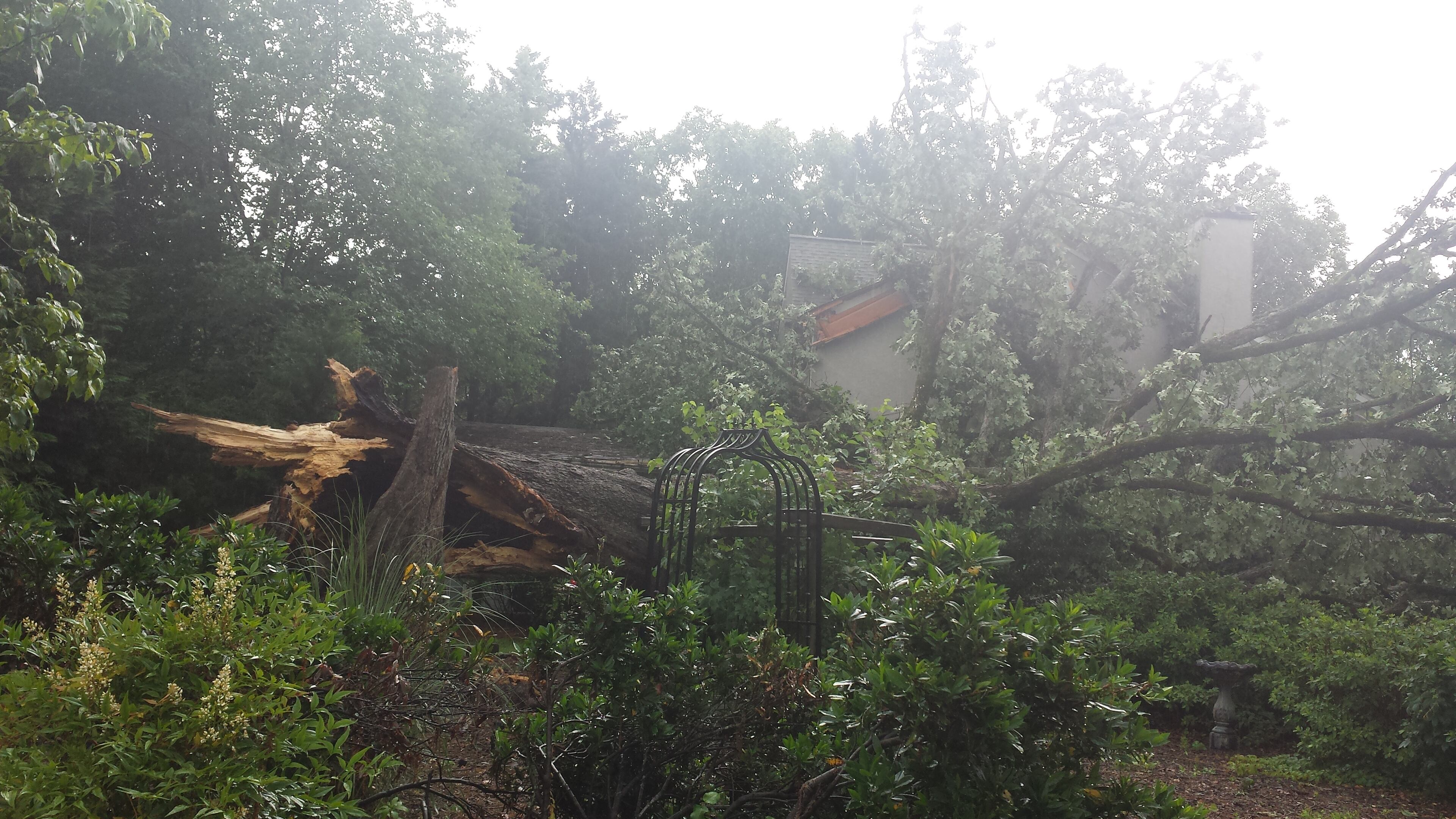
And it isn’t smooth riding for MARTA passengers on the Gold line due to a fallen tree between the Brookhaven and Lenox stations, MARTA said in a tweet. All train service north of Lenox station has been shut down, and there’s no estimated time for when it’ll reopen.
There is no train service on the Gold Line north of Lenox Station due to rail power cut due to large fallen tree. Bus Bridge in effect between Lenox and Doraville serving all stations in between. No ETA on when tree can be removed and power restored.
— MARTA (@MARTASERVICE) June 8, 2018
Multiple wrecks across the metro area are also causing problems, according to the WSB 24-hour Traffic Center.
There were heavy delays due to a crash on Ga. 400 South at Sidney Marcus Boulevard, the Traffic Center reported. In Sandy Springs, a downpour jammed both directions on Ga. 400 near Abernathy Road.
#TRAVELADVISORY Sandy Springs: The rain is falling and the ride is jammed here on GA-400 in both directions at Abernathy Rd (Exit 5). Rain falling all over the metro making the PM ride a big mess. Be patient & tune to Triple Team Traffic on 95.5/AM750 WSB. #ATLtraffic pic.twitter.com/5OCx7UQb3c
— AJC WSB Traffic (@ajcwsbtraffic) June 8, 2018
But at least there are fewer cows on the interstate now.
After six hours, crews cleared an overturned cattle hauler on the I-285 South ramp to I-20 East in DeKalb County. The three dozen cows trapped inside the truck were transported and the rig was towed away. Three cows were killed in the crash, officials said.
MORE: Tractor-trailer crash that killed 3 cows in DeKalb County cleared
RELATED: 10 cows killed in crash that closed I-75 for hours
Dekalb Co.: Overturned Tractor Trailer Crash Cleared: I-285/sb (inner loop) ramp to I-20; ramp is now back open; delays on I-20 and I-285 remain; https://t.co/kTgeaYu0Zi; #ATLTraffic pic.twitter.com/mqdwz7Vxjw
— Triple Team Traffic (@WSBTraffic) June 8, 2018
One Cobb County roadway is closed for railroad replacement and won't reopen today. Piedmont Road between Canton and Morgan roads in Marietta is scheduled to reopen Saturday, the Cobb County Department of Transportation said.
TRAFFIC ADVISORY: A reminder Piedmont Road east of Canton Road will be CLOSED today. Work is UNDERWAY to replace a rather rough railroad crossing. pic.twitter.com/x9Nw5rZfco
— Ross Cavitt (@RossCavitt) June 8, 2018
Temperatures climbed into the 80s, which is only fueling these slow-moving scattered showers, Channel 2 Action News meteorologist Katie Walls said. It’s currently 82 degrees in Atlanta.
Atlanta will feel that moisture moving in as dew points continue to rise today.
“You can expect hot temperatures, and it’s going to be feeling even hotter because of that increased humidity, so there will be a bit of a heat index to consider this afternoon and into this weekend as well,” Walls said.
Torrential downpours continue around metro #ATL -- start of a wetter (at times) weekend. @GlennBurnsWSB is tracking the very slow-moving storms and updating the weekend outlook -- in 2 minutes on @wsbtv!
— Brian Monahan, WSB (@BMonahanWSB) June 8, 2018
Downpours Friday should be contained to the afternoon and evening before the sun goes down.
“The rain chance is fairly minimal for today,” Walls said. “It could be one of those situations where you drive through a downpour and then within 10 minutes, it’s done.”
Plan for HOT temps, increasing humidity and an increasing chance for storms today into the weekend. Today's rain chance is 20%, very hit and miss. Tomorrow's chance increases to 30%, mainly in the afternoon. pic.twitter.com/awzBuRlxg2
— Katie Walls (@KatieWallsWSB) June 8, 2018
The chances of rain only go up from there, with Saturday at 30 percent and Sunday at 40 percent. However, Walls said these should be very isolated showers, so there’s no need to cancel outdoor plans. Like on Friday, the afternoon has the best chance of showers developing throughout the weekend.
Hot & humid into the weekend with scattered shower & storm chances each day... that continues into early next week.
— Brian Monahan, WSB (@BMonahanWSB) June 8, 2018
The rain will bring temperatures back down to the 80s, according to the latest forecast.
“That’s not a washout by any means, but one of those weekends to be weather aware,” Walls said.
Storms that develop over the weekend will likely be pretty slow-moving... heavy rain will be the biggest impact from them.
— Brian Monahan, WSB (@BMonahanWSB) June 8, 2018
The same can’t be said for Monday and Tuesday. Both have a 60 percent chance of rain and thunderstorms, which will be more widespread both days, according to Channel 2.
» For a closer look at the weekend outlook and things to do in your area:
Cobb | DeKalb | Gwinnett | North Fulton
» For updated traffic information, listen to News 95.5 and AM 750 WSB and follow @ajcwsbtraffic on Twitter.
» Download The Atlanta Journal-Constitution app for weather alerts on-the-go.
About the Authors

Zachary Hansen, a Georgia native, covers economic development and commercial real estate for the AJC. He's been with the newspaper since 2018 and enjoys diving into complex stories that affect people's lives.