Coastal Georgia can breathe. Tropical Storm Imelda predicted to miss state.
Georgia can breathe a sigh of relief, as Tropical Storm Imelda is forecast to miss the East Coast, though some rain and wind are still expected.
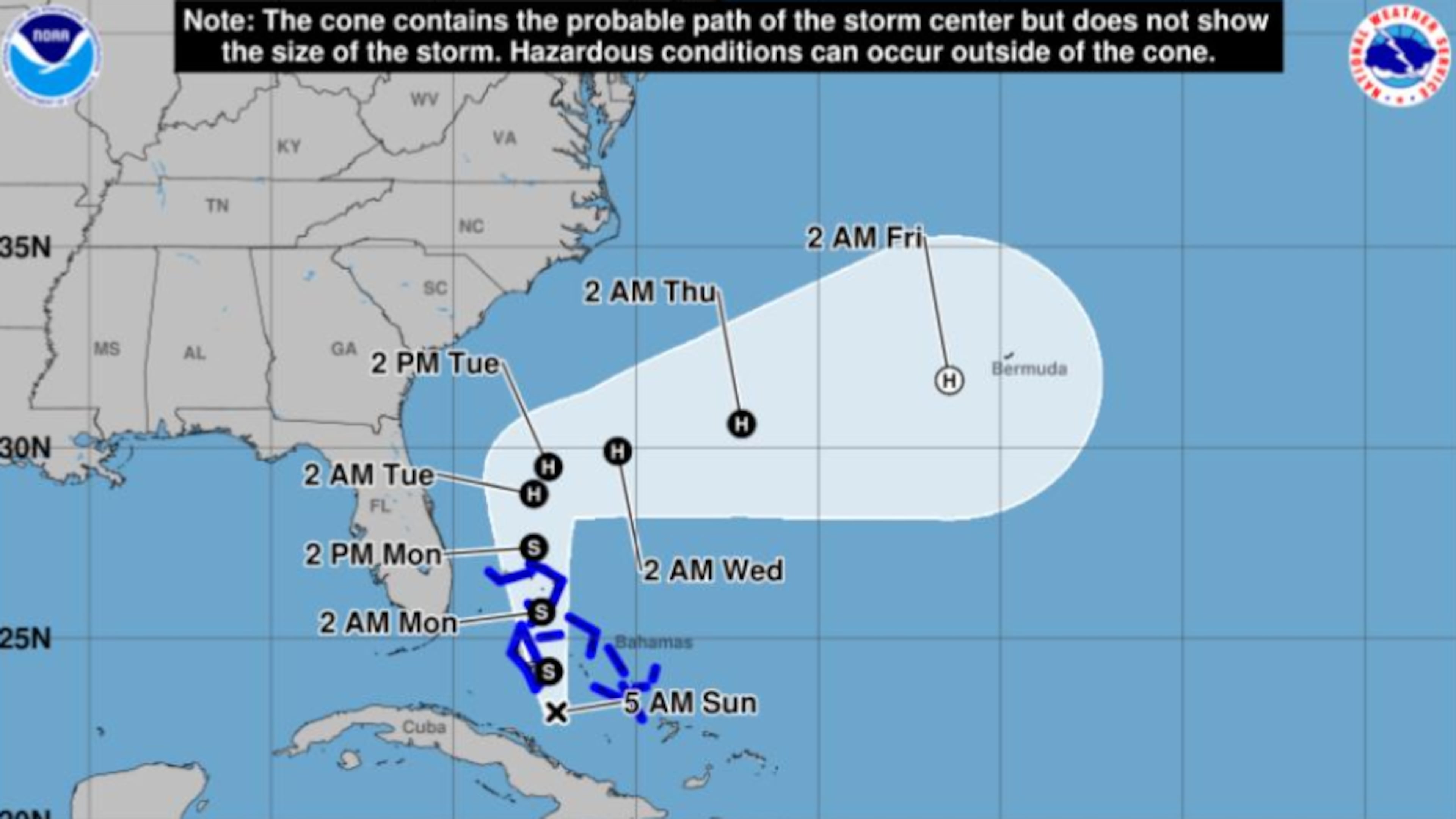
The system, which intensified into a tropical storm Sunday, remains in the Atlantic Ocean just under 300 miles southeast of Cape Canaveral, Florida. It is still projected to become a hurricane by Tuesday afternoon, according to the National Hurricane Center. Another storm, Hurricane Humberto, is lurking to the east of Imelda and is affecting the weaker storm’s course.
“What is going to happen over the next couple of days is the bigger storm, the Category 4 Hurricane Humberto, with wind at 130 miles per hour, that’s going to start to pull Imelda away from the coast,” Channel 2 Action News meteorologist Brian Monahan said.
“That is good news, so I don’t expect any direct impact to the Carolinas or Georgia as Imelda curves out to sea,” he added.
Still, “while Imelda will not have any direct impacts on our area, it will influence the weather conditions through mid-week,” the National Weather Service reported.
Along the coast, dangerous marine conditions and rip currents are expected, according to the Hurricane Center. Cloudy skies and breezy conditions with winds of 10-15 mph and gusts up to 25 mph are also expected across the state at least through Tuesday, forecasters say. Scattered showers and storms are also possible in the afternoon and evening hours.
The Georgia Emergency Management and Homeland Security Agency predicted 2-3 inches of rain in eastern and coastal Georgia counties from Monday through Wednesday. The storm will likely have “minimal impacts” on North and central Georgia as it moves east, according to the NHC.
Still, GEMA said it was prepared and would have resources, such as water, tarps, sandbags and ready-to-eat meals, at warehouses across the state for quick deployment. Gov. Brian Kemp told reporters in Savannah on Friday during the Georgia Tourism Conference that authorities were watching the weather.
The Bahamas, where a tropical storm warning was issued, was cautioned about possible flash flooding and mudslides as the center moved across Monday, according to the NHC.
Last September, Hurricane Helene claimed nearly 150 lives after making landfall in Florida as a Category 4 hurricane, according to the National Oceanic and Atmospheric Administration. The historic storm caused $79 billion in damage across the Southeast, with parts of Georgia still facing a long recovery.
About the Authors

Rosana Hughes is an award-winning bilingual (fluent in Spanish) journalist with a passion for explanatory public service journalism. She has been a reporter on the breaking news team since January 2022.