WEATHER-TRAFFIC UPDATE: Congestion builds on roads during hot, steamy afternoon
ATLANTA FORECAST
Friday: High: 90
Friday night: Low: 73
Saturday: High: 88
» For a detailed forecast, visit The Atlanta Journal-Constitution weather page.
Temperatures and traffic have begun ramping up in tandem this afternoon.
In Atlanta, the temperature has reached 92 degrees, which is 2 degrees hotter than the predicted high. The heat index is higher, reading a sweltering 96 degrees.
We just hit 92° in Atlanta, our average high is 85° this time of year. pic.twitter.com/uH3vj8tAbh
— Brad Nitz (@BradNitzWSB) September 7, 2018
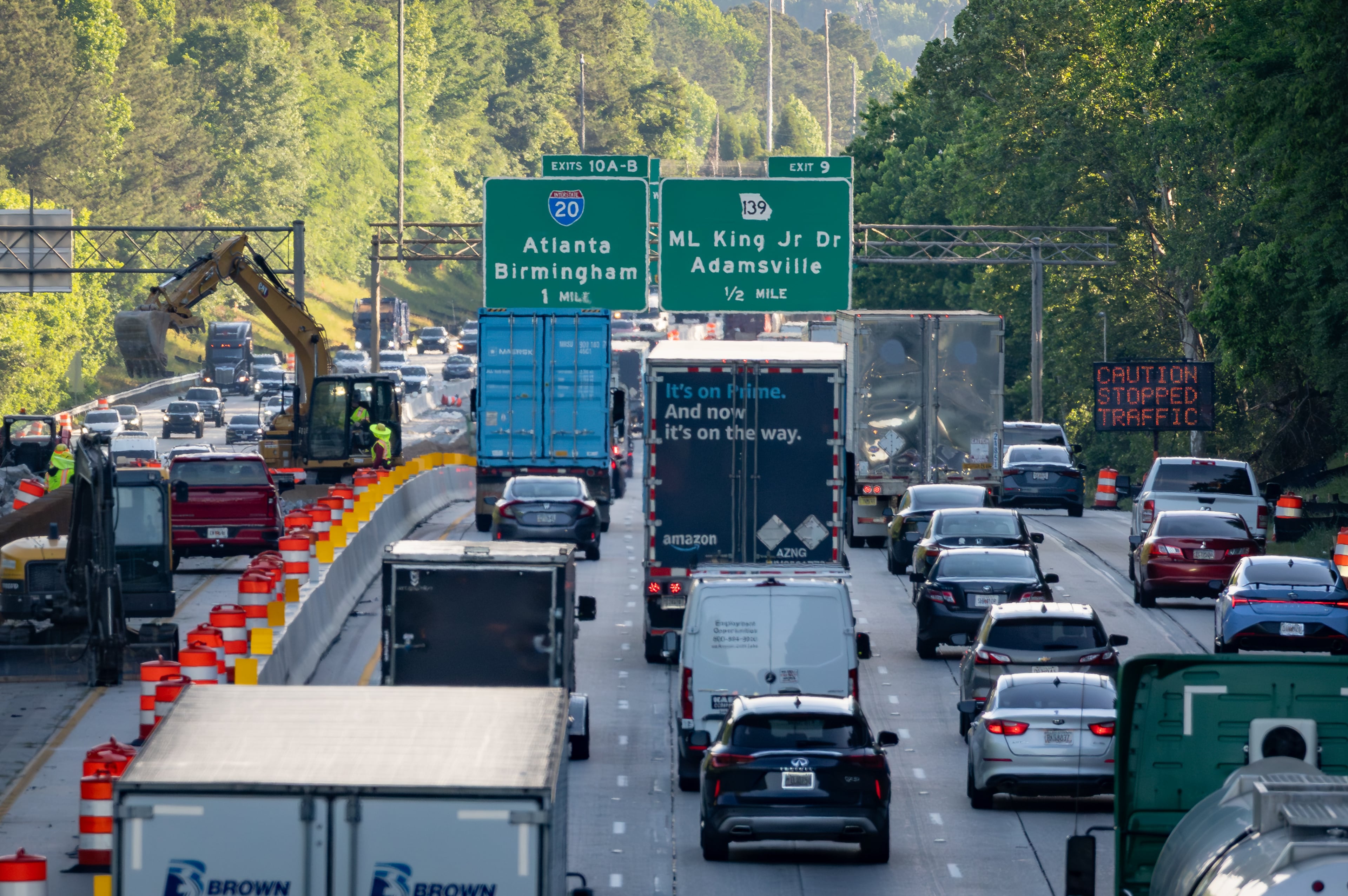
Hopefully your car has air conditioning, because traffic has already begun to build across most of metro Atlanta's major interstates, according to the WSB 24-hour Traffic Center.
In DeKalb County, a wreck on I-285 North at Lavista Road is blocking one lane, causing heavy delays, the Traffic Center reported.
Construction at the Cobb Cloverleaf and a blocked I-285 South lane near Cobb Parkway are both causing delays, according to the Traffic Center.
Construction: I-285/sb (outer loop) at Cobb Pkwy; in the right lane; delays; https://t.co/RuPa64SzPC; #ATLtraffic pic.twitter.com/CTqUdgbvN0
— Triple Team Traffic (@WSBTraffic) September 7, 2018
A slim chance of isolated afternoon showers has been in the forecast the entire week for metro Atlanta, and Friday will see more of the same. Sticky, hot conditions may persist by the time high school football teams hit fields across North Georgia.
RELATED: Top 10 games of Week 4
“Like the last couple of days, an isolated downpour cannot be ruled out,” Channel 2 meteorologist Katie Walls said. “I do have those rain chances running at just 20 percent, and by the time we hit that 8 p.m. hour, those showers (are) winding down. They'll lose their energy with that daytime heating fading away.”
That streak is thanks to a ridge of high pressure holding back moisture, she said, even as the Mississippi River valley and the Midwest are soaked by what’s left of Tropical Depression Gordon.
Our protective ridge will break down this weekend. That means increasing rain chances as we head into Sunday. @BradNitzWSB is breaking down that potential ahead on Ch. 2 Action News at Noon. pic.twitter.com/UD6rguauaz
— Katie Walls (@KatieWallsWSB) September 7, 2018
“The remnants of Gordon (are) combining with a stationary front, producing torrential amounts of rainfall across the Midwest,” Walls said. “Flood watches, flood warnings already in effect for our friends in that part of the country. For us, this ridge of high pressure is keeping us mainly dry today into (Saturday).”
Rain chances are expected to rise as the ridge of pressure breaks down. Channel 2 is also tracking the progress of Florence in the Atlantic Ocean, which has now been downgraded from a hurricane to a tropical storm. The storm is expected to restrengthen early next week, but Walls said it’s too soon to tell if it will make landfall in the U.S.
Get ready for even HOTTER temperatures this afternoon. Rain chances remain low this afternoon at 20%. Any showers we do have develop will wind down after sunset, a great evening to be outdoors and enjoy HS Football! #gawx pic.twitter.com/fzDypOZTuh
— Katie Walls (@KatieWallsWSB) September 7, 2018
Starting Friday night, drivers will have to contend with an increase in construction efforts, according to the Georgia Department of Transportation.
In Gwinnett County, one northbound lane of I-85 from Lawrenceville-Suwanee Road to I-985 will be closed for roadwork from 9 p.m. Friday until 5 p.m. Sunday, GDOT said.
One lane of I-985 from I-85 to Woodward Mill Road will also be closed from 9 p.m. Friday to 5 p.m. Sunday, GDOT said.
Heads up! SR 14 Conn/South Fulton Parkway Lane Closures and Detours Nightly: Includes I-85 and I-285 Ramps. Details here https://t.co/lBdm4GA26t @GADeptofTrans pic.twitter.com/bQi01zXKHy
— Georgia DOT ATL (@GDOTATL) September 6, 2018
By Sunday, there’s a 40 percent chance of rain, which will jump to 60 percent Monday and Tuesday.

» For updated traffic information, listen to News 95.5 and AM 750 WSB and follow @ajcwsbtraffic on Twitter.
» Download The Atlanta Journal-Constitution app for weather alerts on-the-go.
About the Authors

Zachary Hansen, a Georgia native, covers economic development and commercial real estate for the AJC. He's been with the newspaper since 2018 and enjoys diving into complex stories that affect people's lives.