Gwinnett’s $1B trails plan just one (big) key to connecting the region
From Buford in the north to Snellville in the south, about 120 miles of trails and greenways for walking, hiking and biking grace Gwinnett’s extensive parks system.
County officials are quick to point out — and rightfully so — that the area has had a lot of trails for a long time.
Their brand new trails master plan, then, does not represent as much a departure in thinking as it does a dramatic expansion.
VIDEO: Previous coverage of this issue
Adopted by the Board of Commissioners last month, the plan is a sort of pie-in-the-sky document proposing a billion dollars worth of projects and a new vision for where walking and biking routes should be located.
The plan lays out a network that exists not only within parks but along roadways and major people-moving corridors. The trails tie together not just greenspaces but employment centers and retail districts. They're still about recreation and healthy living and much-needed slices of nature in a rapidly urbanizing county, sure. Trails, though, can serve a connectivity purpose, too, officials said.
“I wouldn’t call it a shift in the paradigm,” Mark Patterson, deputy director of Gwinnett’s community services department, said. “It’s more of a broadening.”
That “broadening” also happens to fit into larger national trends — and the big picture plan for metro Atlanta.
‘Strong local visions’
Gwinnett’s trails master plan calls for 320 miles of trails, greenways and bikeways that could be built over the next two-plus decades. Nine “signature trails” are among them. The latter were designated as such “because they make such large connections” between existing cities, neighborhoods, job centers and other key areas, said Marcie Moore, a greenway planner in Gwinnett’s parks and recreation division.
The Western Gwinnett Bikeway, for example, would run 18 miles along Peachtree Industrial Boulevard from Sugar Hill to Peachtree Corners and on to the DeKalb County line. The proposed Loop Trail would connect the Gwinnett Place and McDaniel Farm Park areas to the Infinite Energy Center and to the city of Suwanee’s trail system.
Another proposal would create a trail to run east-to-west across the entire county, from Dacula to Norcross.

Such connections are key, both within Gwinnett and across the region.
Groups like the Atlanta Regional Commission are working to connect those local systems to each other.
The ARC’s regional trail report, for instance, envisions closing significant gaps in existing trails like Cobb’s Silver Comet Trail, the Big Creek Greenway in north Fulton and Forsyth counties, and the Western Gwinnett Bikeway in order to connect them and others to Atlanta’s Beltline — and create a truly regional system.
“For years, with a lot of trails here and probably other places, you just had small segments,” said Eric Meyer, the planning division manager for Cobb County’s Department of Transportation.
Cobb has a plan in the works that could add 220 miles of trails.
“We’re just really excited to see these strong local visions emerging,” said Byron Rushing, the ARC’s bicycle and pedestrian program manager. “Because the regional vision is advanced through strong local action.”
‘Practical applications’
Gwinnett officials readily admit that funding the entire trails plan likely will be a challenge.
About $16 million from the county’s 2017 special-purpose local option sales tax already has been allocated, and officials estimate about $100 million more could be raised by additional SPLOSTs (if they’re approved) through 2040. The rest will likely have to come from a range of sources, including city contributions, community improvement districts, state and federal funds and private developers.
Patterson, the deputy director of community services, said he expects the plan to take off.
“Trails are a growing aspect to connectivity, to transportation, to alternative transportation,” he said. “You see it used where other cities across the nation have done this. … Greenways, multi-use paths that transcend just staying within a park or a river corridor. What Gwinnett county is doing is creating that same type of transportation mode that does exist elsewhere, has been supported elsewhere, and has proven to be a successful model for usability.”
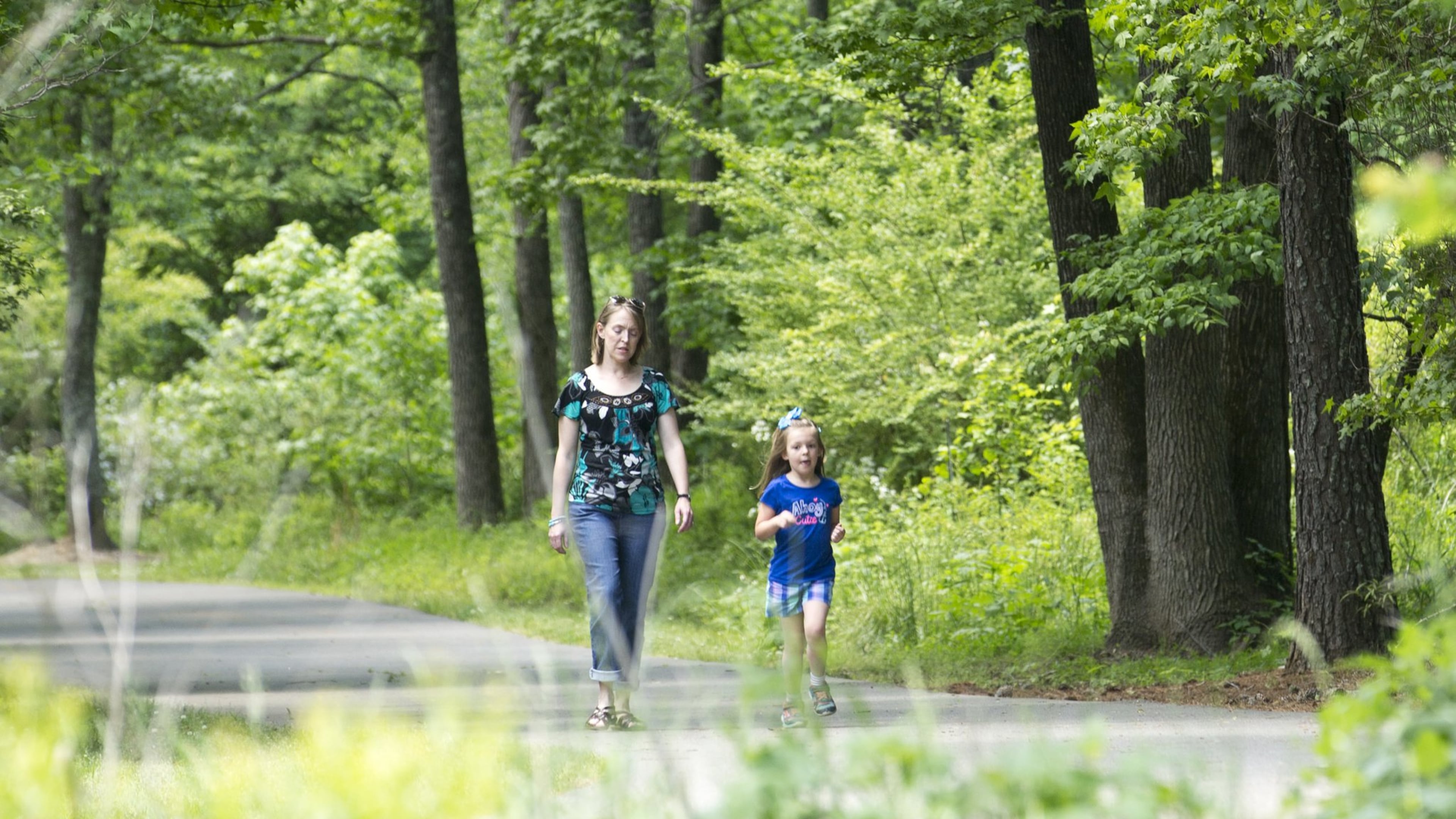
If a small sampling of the folks spending time on the trails at Duluth’s McDaniel Farm Park on a recent sunny lunch hour is any indication, the public support will be there too.
“I think that’s one of the best investments you can make,” Margaret Robling, who walks at the park with a friend about twice a week.
Angela Stima, who was enjoying the greenery with her kids, said they’re frequent guests of Gwinnett County parks and trails, and that they’re one of the reasons why the family is so glad to be back after living in Chicago for a few years.
Still, she said, it couldn’t hurt to make the trails more useful for pedestrians and bikers trying to get from one point to another.
“It’d be nice if they had practical applications too,” Stima said.
‘SIGNATURE TRAILS’ PROPOSED IN GWINNETT’S TRAILS MASTER PLAN
- The Western Gwinnett Bikeway, which would stretch 18 miles along or near Peachtree Industrial Boulevard, from Sugar Hill to Peachtree Corners and on to the DeKalb County line.
- The Harbins Greenway, which would run more than 17 miles and connect parks near Grayson and Loganville (Harbins, Bay Creek and Tribble Mill).
- The Ivy Creek Greenway, which would expand near Buford and the Mall of Georgia.
- The Ivy Creek to Snellville Trail.
- The Loop Trail, which would connect the Gwinnett Place and McDaniel Farm Park areas to the Infinite Energy Center and to Suwanee's trail system.
- The Norcross to Lilburn Trail.
- The Piedmont Pathway, which would stretch across the width of the county, from Dacula to Norcross.
- The Sugar Hill Greenway.
- The Suwanee Creek Greenway.
THE ARC’S REGIONAL TRAIL VISION
The Atlanta Regional Commission envisions filling gaps and building new connections between the following completed or proposed trails in order to create one connected, regional system:
- the Silver Comet Trail in Cobb County
- the Northwest Corridor Trail in Cobb County
- the Big Creek Greenway in north Fulton and Forsyth counties
- Path 400 in north Fulton County
- the Western Gwinnett Bikeway in Gwinnett County
- the Stone Mountain Trail in DeKalb County
- the Arabia Mountain Trail in DeKalb and Rockdale counties
- the Rockdale River Trail in Rockdale County
- the Atlanta Beltline
About the Author

Tyler Estep hosts the AJC Win Column, Atlanta's new weekly destination for all things sports. He also shepherds the Sports Daily and Braves Report newsletters to your inbox.
More Stories
The Latest