SUNDAY’S WEATHER-TRAFFIC: Rain due to move out after wet Mother’s Day
Mother’s Day was a “washout,” as moderate rain arrived in the metro Atlanta Sunday.
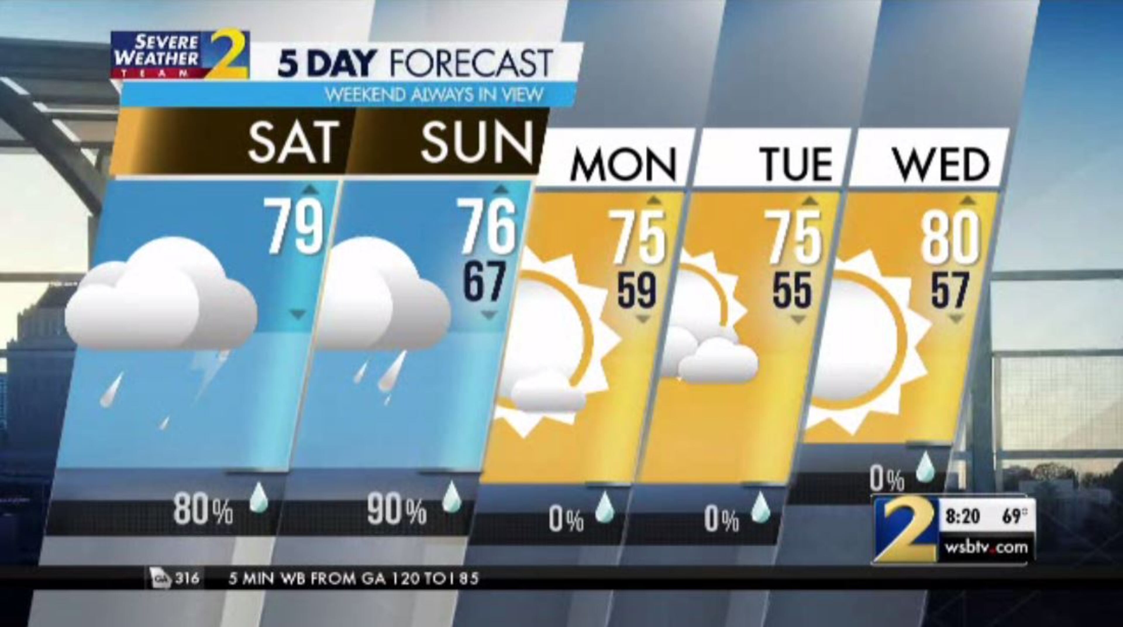
But the worst is over, according to Channel 2 Action News meteorologist Katie Walls. She said the showers and storms will be scattered going into the evening ahead of an approaching cold front.
Showers and storms will stay scattered throughout the day into the evening ahead of an approaching cold front. While the main threat for severe weather stays to our south, a few strong storms are still possible in the Metro with gusty wind and small hail our primary concerns. pic.twitter.com/6LulBOC4Ls
— Katie Walls (@KatieWallsWSB) May 12, 2019
A few strong storms are possible for the metro area, Walls said, but the main threat for severe weather is further south. Gusty winds and small hail are the primary concern in Atlanta.
With showers more scattered in nature this afternoon & evening, additional rainfall will be minimal, generally a half inch or less. Once the storms clear tonight, we head into a DRY stretch! I'm timing how long it lasts ahead at 6 pic.twitter.com/0AFBsLIqP1
— Katie Walls (@KatieWallsWSB) May 12, 2019
By the end of the weekend, some parts of North Georgia could receive 4 inches of rain or more.
However, additional rainfall will be minimal Sunday night as the wet weather begins to clear out.
The storms should move south by Sunday night and clear out completely by the start of the work week, Channel 2 meteorologist Eboni Deon said. Sunny skies are expected to return Monday as temperatures reach the mid-70s, setting the tone for the next several days.
» For a detailed forecast, visit The Atlanta Journal-Constitution weather page.
» For updated traffic information, listen to News 95.5 and AM 750 WSB and follow @ajcwsbtraffic on Twitter.
» Download The Atlanta Journal-Constitution app for weather alerts on-the-go.