Severe storms impacting Georgia after thunderstorm watch in metro Atlanta

A cluster of severe storms is moving across Georgia on Sunday and is expected to produce heavy winds and possibly hail, officials said.
The thunderstorm watch was issued Sunday morning in metro Atlanta amid a marginal risk (level 1 of 5) for the storms after a system moved in from Alabama, according to the National Weather Service.
The system tracked east-southeast into Georgia, where it impacted the south side of Atlanta and moved through the central portion of the state, the NWS said. Thunderstorm warnings were issued for areas that included Peachtree City, Newnan, Griffin, Macon and Warner Robins.
“Thunderstorms may develop on Sunday,” the NWS said. “Some may be severe with damaging winds and large hail as primary threats.”
Wind gusts were projected 70 mph in some areas, and officials warned that the large hail could grow to the size of golf balls.
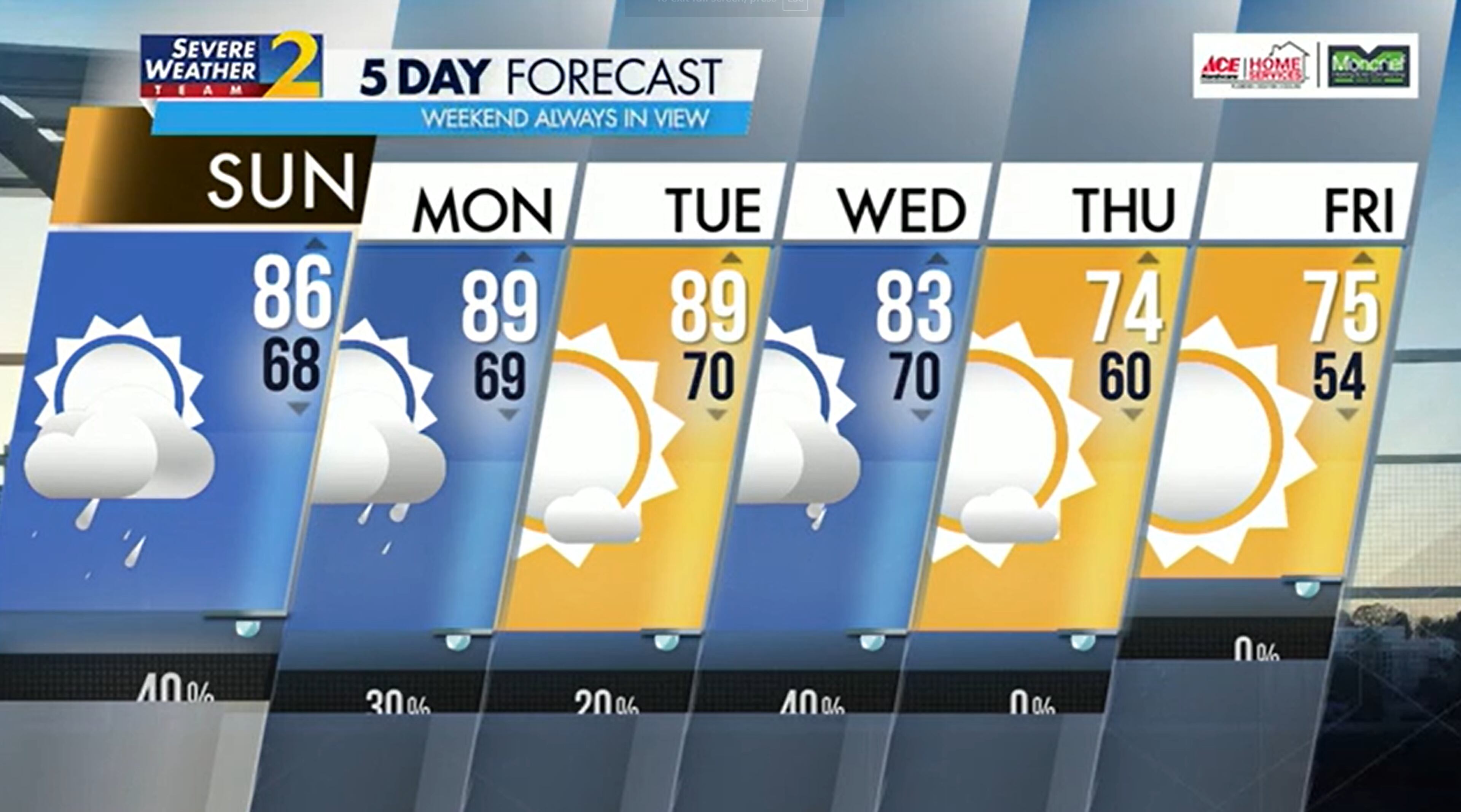
By Sunday afternoon, things should dry out in metro Atlanta where temperatures are expected to reach the mid-80s, according to Channel 2 Action News meteorologist Ashley Kramlich. Temperatures will continue to heat up on Monday.
The start to the week is projected to be hot and steamy with highs in the upper 80s through Tuesday. After that, things will be slighter cooler. Friday will see lows in the mid 50s.
» For a detailed forecast, visit www.ajc.com/weather.
» For updated traffic information, listen to News 95.5 and AM 750 WSB and follow @WSBTraffic on X.
» Download The Atlanta Journal-Constitution app for weather alerts on-the-go.