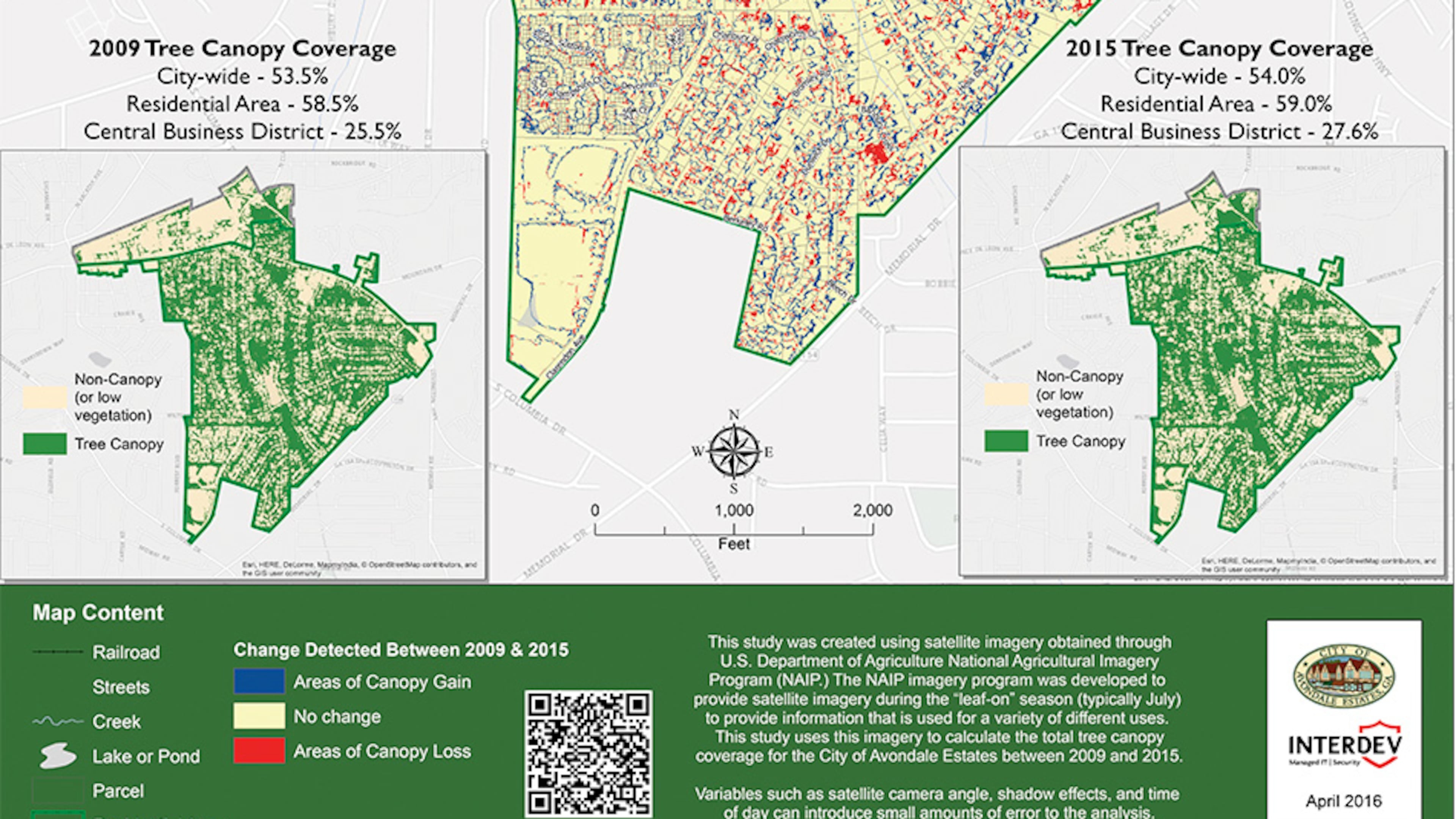
Mapping the forest in Avondale Estates

When Avondale Estates wanted to know how many trees had disappeared in its urban forest, the city turned to a metro Atlanta firm that works with digital mapping systems to track changes.
The resulting map, which combines U.S. Department of Agriculture aerial photos from 2009 and 2015, shows frequent red patches where parts of the tree canopy have disappeared from the DeKalb County community.
Less obvious were the many smaller blue patches where Avondale Estates gained new trees. The conclusion of the study: the city, which has been looking at adding tougher restrictions against residential tree removal to its tree protection ordinance, has slightly increased its overall tree canopy in recent years, from 53.5 percent in 2009 to 54 percent in 2015.
The map won industry recognition last month for InterDev, the company that produced the map, at an industry conference in San Diego.
The company said the map and study, “Tree Canopy Coverage and Change Detection for the City of Avondale Estates,” will allow the city to track its tree coverage over time, assisting residents and officials in making planning and development decisions.
Such geographic information systems (GIS mapping) “is becoming a vital element of operations and constituent services for governmental entities,” said InterDev CEO Gary Nichols. He said the company is working with more than a dozen cities and towns on such GIS mapping projects.
MYAJC.COM: REAL JOURNALISM. REAL LOCAL IMPACT.
AJC Business reporter Russell Grantham keeps you updated on the latest news about major companies, CEOs and public utilities in metro Atlanta and beyond. You'll find more on myAJC.com, including these stories:
- Study: Atlanta and Georgia pensions get mixed grades
- Georgians' auto premiums are through the roof, consumer researchers say
- How many lifetimes would you have to work to earn top Georgia CEOs' pay?
Never miss a minute of what's happening in local business news. Subscribe to myAJC.com.
In other news:


