Northside to get its version of the BeltLine trail
A bridge collapsing, a highway buckling: Atlanta has long had a reputation for lousy traffic, but the almost apocalyptic incidents on our critical Interstates have a small but apparently growing number seeking other options for getting around.
There aren't many. MARTA's been packed, of course. And those lucky enough to live near Atlanta's BeltLine and their job can hop on a bike or stroll to work.
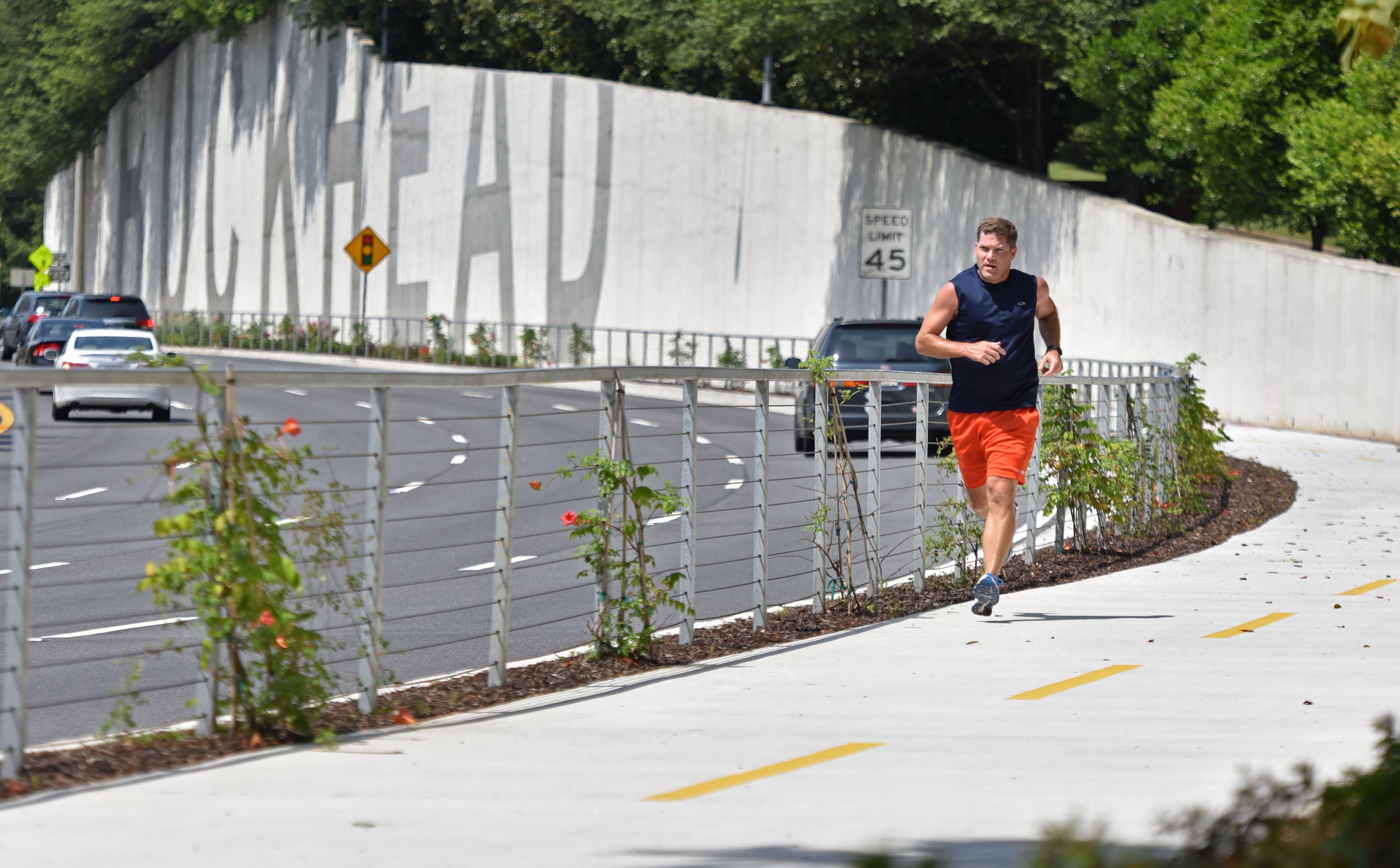
But a similar multipurpose path that will link Buckhead to the Perimeter area is already under construction along Ga. 400. When complete, the PATH400 Greenway Trail will bisect one of metro Atlanta's busiest job corridors, slicing through or flying above the gridlock. A final link, perhaps a decade out, will tie this new trail to the BeltLine near the I-85 bridge disaster.
With President Donald Trump's budget threatening to deprive metro Atlanta of $3 billion in future funding for transit, trails like this one could become even more important.
Anyone who's visited the BeltLine near Piedmont Park can see how popular that route has become since it opened five years ago, both benefiting from -- and likely contributing to -- a building boom. Like the roads, it's often clogged, but instead of bumpers there are baby carriages, dogs on leashes, joggers, skateboarders and strollers in yoga pants.

Weaving through the crowds are cyclists, some recreating but others bearing bags and backpacks, riding to or from work, school or the grocery store.
It’s a car-free, direct and safe route to Piedmont Park from Inman Park, a distance that previously seemed treacherous on foot or by bike.
Soon, northsiders will have a similar opportunity.
360 PHOTO: A view through the woods along Ga. 400 north of Miami Circle, where the PATH400 will be extended by 2018. “You can’t wrap your head around where it is,” Denise Starling, executive director of the Livable Buckhead organization, said of the route on a sliver of MARTA land along Ga. 400. “Most people can’t fathom it.” (Spin the photo with your cursor or simply move your phone.) That’s the highway beyond the chainlink fence.
The next segments of the PATH400 will cut through scrub woods along the verge of Ga. 400 and MARTA’s north-south line. About half of the Buckhead portion of the 5.2 mile trail is paved. Future sections will carry it through Sandy Springs to Dunwoody, adding a couple more miles.
INTERACTIVE MAP: The PATH400 Greenway Trail will eventually connect to the BeltLine (the purple loop). Here are the segments and their construction status.
The newest section, near Miami Circle, began drawing visitors as soon as it opened in December, even though it doesn’t go anywhere yet.
“They come through with their dogs running -- walkers, talkers, joggers,” said Phillip Carter Hines, who lives nearby and watched as builders tamed the rough, pothole-filled trail that was there before.
360 PHOTO: The north end of the section of PATH400 Trail that opened near Miami Circle in December. The next segment, to be completed next spring, will pick up here and go north to the Peachtree Park neighborhood next to the Buckhead business district. (Spin the photo with your cursor or simply move your phone.)
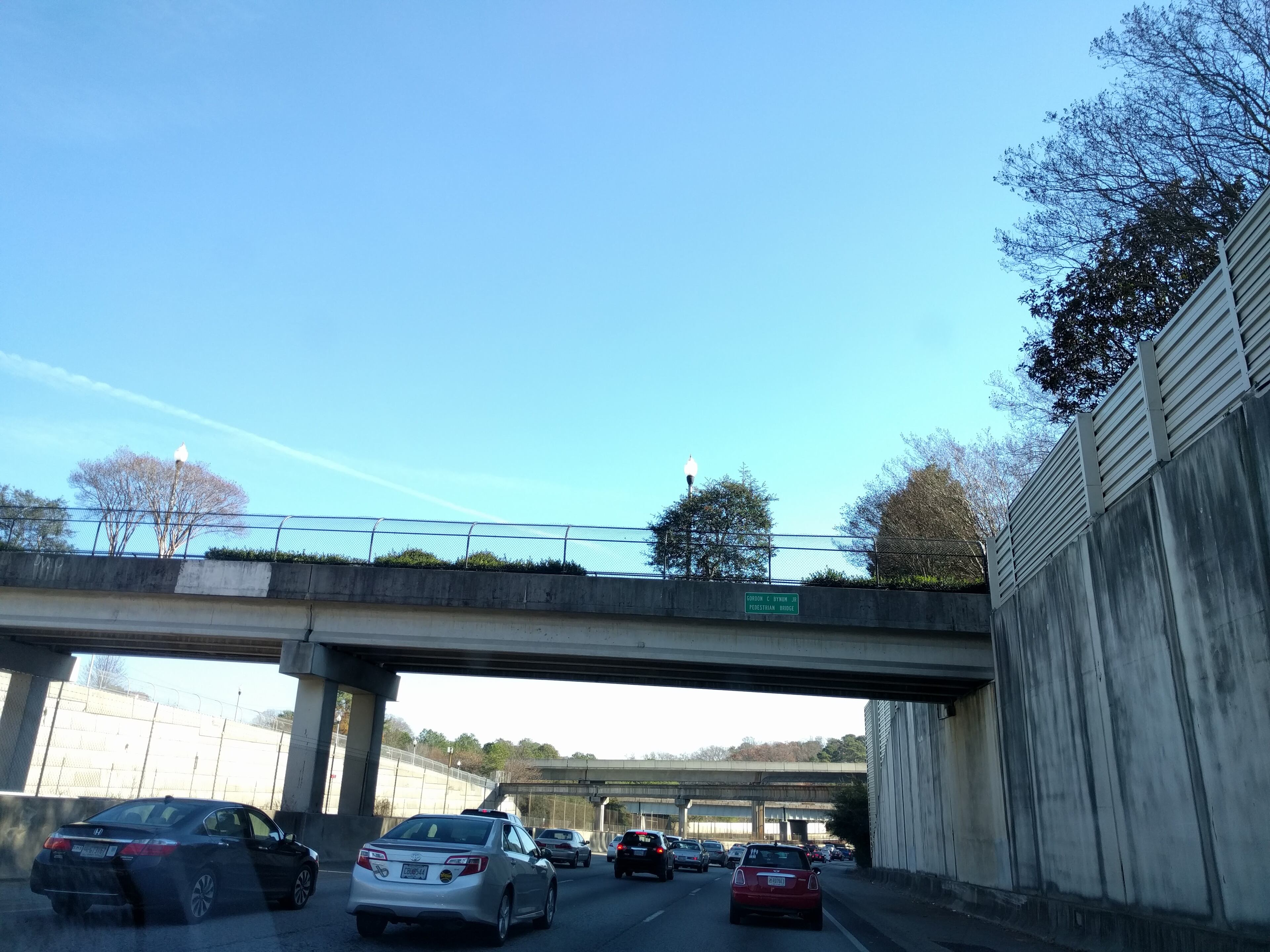
That stretch ends at the top of Miami Circle, but the construction continues, with an extension through the forest hugging Georgia 400 under the Red MARTA line. It will punch through a sound wall at the old Peachtree Park neighborhood across the highway from Lenox Square (connected by a pedestrian bridge over the highway), then follow surface streets through the heart of the Buckhead business district to link with the original sections of the PATH400, which start at Lenox Road and push about a mile north.
360 PHOTO: This is the northern end of the section of the PATH400 that will be completed next spring. It goes from Miami Circle to the Peachtree Park neighborhood next to the Buckhead business district. It’s a tight squeeze between Ga. 400 and the soundwall that protects homes from the highway noise. (Spin the photo with your cursor or simply move your phone.)
Ed McBrayer, executive director of the PATH Foundation, said construction of the section from Miami Circle to the Buckhead business district will take perhaps a year, with completion targeted for next spring. Then, comes an extension of the northernmost section from its current terminus at Wieuca Road, near a campus of Sarah Smith Elementary School. It'll hike by Ga. 400 over another mile north to the Atlanta city line -- past Loridans Drive and somewhere near where the tollbooths used to stand on the highway. The timeline for that one is not concrete yet.

From there, the city of Sandy Springs picks it up. This month, Fulton County started collecting a transportation sales tax approved by voters last year, and that city will put about $5.5 million toward driving the PATH400 north from the Atlanta line to the Glendridge Connector, on Dunwoody's doorstep. The Georgia Department of Transportation is planning to fold bike connections from there into Dunwoody as part of its expansion of the Ga. 400 intersection with I-285.
Sharon Kraun, spokeswoman for Sandy Springs, didn’t have a timeline for her city’s segment, but said the planning has begun now that the transportation sales tax money is coming in. A designer will soon be hired.
“It is going to happen,” she said of the nearly 2-mile stretch of path through Sandy Springs.
360 PHOTO: This section of the PATH400 opened last year. It’s the current northern terminus, at Wieuca Road. A future extension will carry it north past Loridans Drive, to the Atlanta city line. There, the city of Sandy Springs will carry it north to Ga DOT, which will take it into Dunwoody. (Spin the photo with your cursor or simply move your phone.)
When all the links are forged, Atlanta will have a 7-mile, mostly car-free path from the neighborhoods around the Lindbergh MARTA station to Dunwoody, through a major job and commuting corridor.
Then, perhaps a decade from now, the last break in the BeltLine will be connected by a tunnel under I-85, tying that 22-mile loop around the inside of the city with this straight shot to the top of the Perimeter. It will be possible to travel without a car, or the fear of being hit by one, from near Atlanta’s old Turner Field to Dunwoody.

Lee Harrop, program director for the BeltLine, said that connection between the BeltLine and the PATH400 Trail will be the most challenging to build. Environmental and archaeological surveys must be done, and threading over, under and around the Interstate, the roads, the train tracks and the creeks there will take time, which is why he doesn’t expect completion until around 2026.
“It is certainly going to be one of the most challenging from an engineering standpoint,” he said.
That connection will push under I-85 near where the bridge collapsed and caused havoc for commuters across the metro area because it’s such a key highway nexus.
The area will also be a crossroads for pedaling commuters, with other trails from the southern terminus of the PATH400 extending along Peachtree Creek and a tributary, to Chamblee and other points.
360 PHOTO: Denise Starling, executive director of the Livable Buckhead organization, shows how the PATH400 Greenway Trail weaves through woods and around a major highway and train tracks, passing graffiti covered concrete overpasses and woods with ferns and swamps. “We actually call it the infrastructure segment,” she said of this stretch north of Miami Circle, to be completed next year. (Spin the photo with your cursor or simply move your phone.)
Denise Starling, executive director of the Livable Buckhead organization, which spearheaded the PATH400 effort, calls the future connection to the BeltLine “the Spaghetti Junction of trails,” riffing off the nickname for the bumper-to-bumper flyways connecting I-285 to I-85.
Starling said the vision is for a seamless, safe and smooth network of multiuse paths linking the outer neighborhoods to the business center.

It all has to be insulated from roads, she said. Although people using PATH400 can see the cars zipping by on Ga. 400, they’re at a safe remove, looking down on the fast-moving -- or often log-jammed -- cars through a canopy of trees.

“Ninety nine percent of people are not going to ride their bikes on the streets,” Starling said.
360 PHOTO: The view from the Gordon C. Bynum Jr. pedestrian bridge. The next segment of the PATH400 Trial will punch through the soundwall south of the bridge to arrive in the Peachtree Park neighborhood. (Spin the photo with your cursor or simply move your phone.)


