News
Photos: A 3D view of 1930 Atlanta
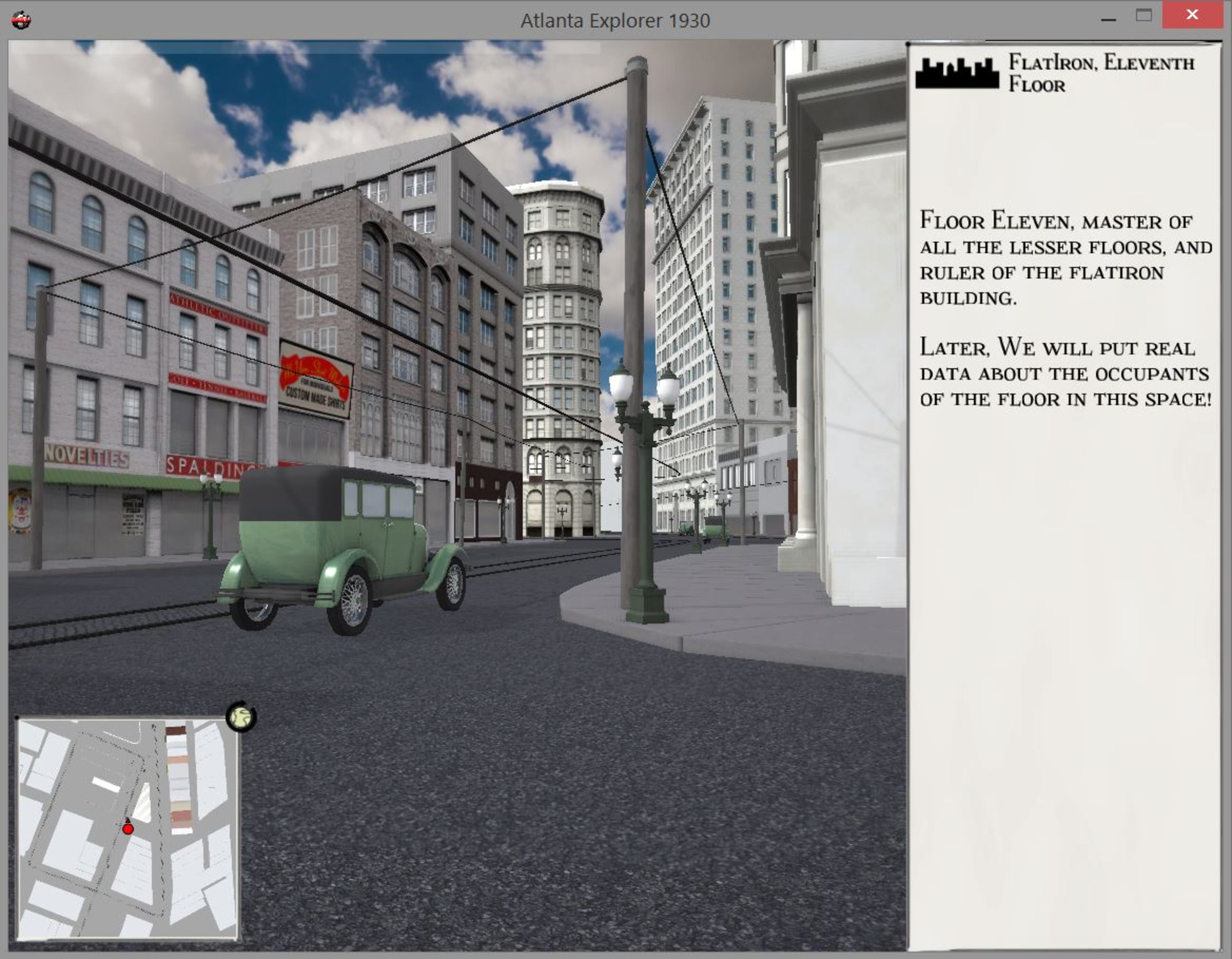
Atlanta Explorer is a 3D recreation of what downtown Atlanta looked like in 1930. It's part of a larger interactive map created by Emory's Center for Digital Scholarship, with assists from the university archives of Emory and GSU. The 3D part of the map, built in partnership with the architecture firm nVIS360, includes renderings of the buildings and streets surrounding the Flatiron Building. The team behind it hopes to add more blocks to the 3D rendering in future versions. (The Emory Center for Digital Scholarship)


1/8
Atlanta Explorer is a 3D recreation of what downtown Atlanta looked like in 1930. It's part of a larger interactive map created by Emory's Center for Digital Scholarship, with assists from the university archives of Emory and GSU. (The Emory Center for Digital Scholarship)
Today's Gallery Headlines