Pacific hurricane region sets record for big, long-lasting storms thanks to El Niño
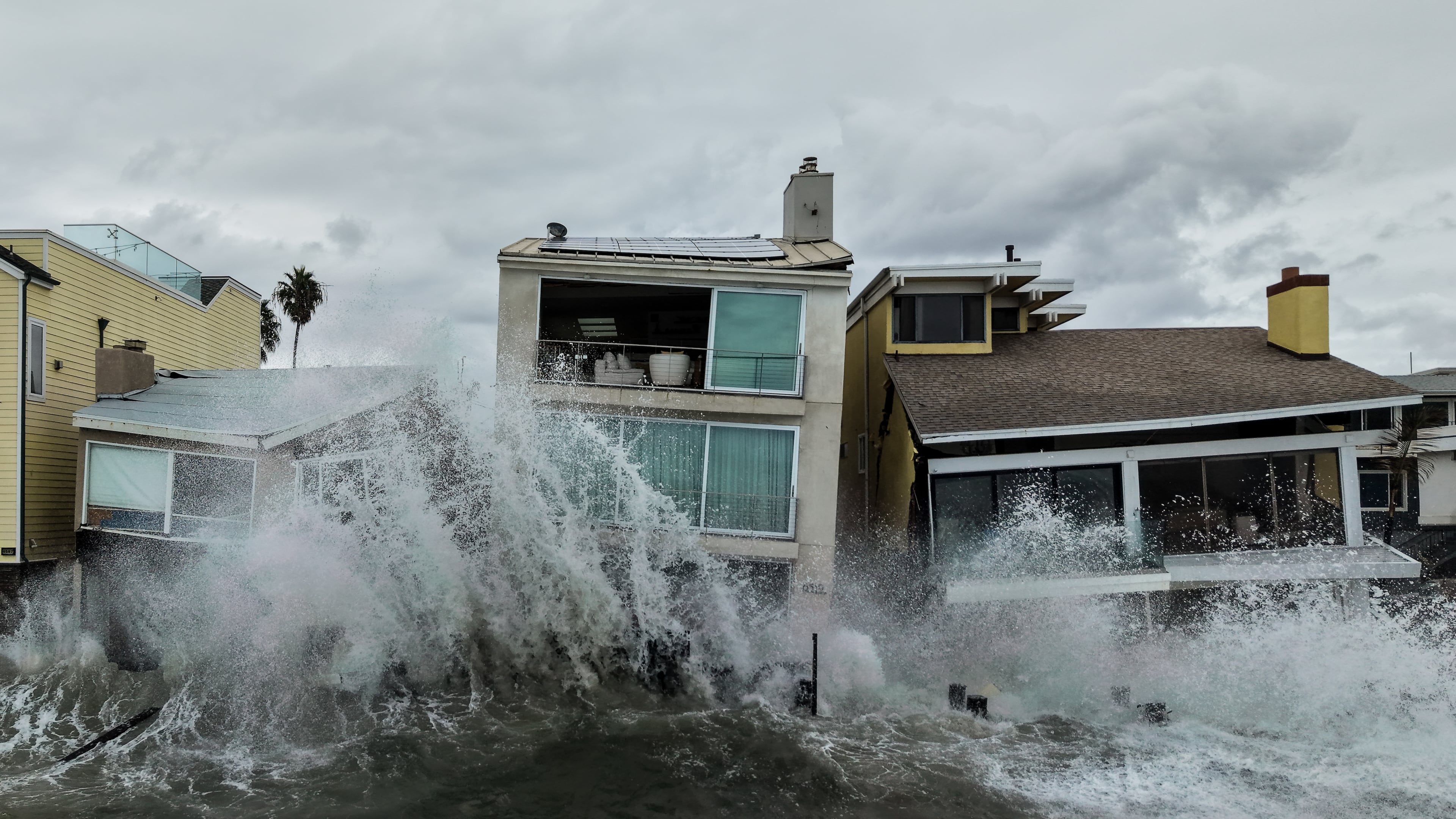
The drumbeat of monster hurricanes in the Pacific has broken a record for nasty long-lasting storms east of the international date line, turbocharged by nature’s supersized El Niño, scientists said.
“Since September 20th, when Odalys formed, it’s been berserk,” said Colorado State University researcher Phil Klotzbach, who forecasts and studies storm activity. “This year just everything that forms is just lasting a long time and getting really powerful.”
One of the key measurements meteorologists use to judge hurricane seasons is called accumulated cyclone energy, or ACE, which includes a storm’s wind speed and longevity. On Sunday, a section of the Pacific east of the date line, which brews storms headed for Hawaii, Mexico and the U.S. West Coast, passed the old mark set in 2018. The area is still going strong with Hurricane Simon and appears on the verge of spawning another one that will really ramp up in strength, Klotzbach said.
On Tuesday, the Pacific will tie a record for most days with a hurricane spinning and is likely to break it soon after that, Klotzbach said.
“It feels like almost everything that can spin up does spin up,” said University of Arizona atmospheric scientist Kim Wood.
El Niño and warm water are boosting Pacific hurricanes
Several meteorological factors have come together to supercharge the Pacific, chief among them the El Niño, Klotzbach and other hurricane researchers said. An El Niño weakens and shifts the high altitude vertical winds that otherwise can dampen or even decapitate storms. In the Pacific, that wind shear runs east to west, generally with the direction storms travel, so it's like riding a bicycle with a tail wind, Klotzbach said.
Meanwhile, the weather pattern has dampened hurricanes in the Atlantic, where the ACE is less than 18% of what's normal for this time of year. El Niño makes the wind shear in the Atlantic like riding into a headwind, he said.
Another factor is warm water, which serves as hurricane fuel. By definition El Niño is a warming of the equatorial Pacific that changes weather worldwide. In the Pacific storm basin, it's several degrees Fahrenheit warmer than normal, said Kristen Corbosiero, a professor of storm atmospheric sciences at the University at Albany in New York.
Usually in the Pacific, the extra warm storm-friendly water doesn't run as deep as it does in the Atlantic. So when one storm goes over a patch of water, it brings up cold water and makes it hard for a subsequent storm in the same area to stay alive, Wood said. But not this year.
Hurricane Rachel, whose remnants swamped Las Vegas over the weekend, didn't suffer as it went over, churned up by Category 5 Hurricane Polo, Wood said. She said the waters are warm from both El Niño and climate change from the burning of coal, oil and gas.
Another factor in recent storms was a counterclockwise atmosphere spin over Central America — called a gyre — that spits out seeds of stormy weather that can form into hurricanes. It spit out both the Atlantic's Isaias and the Pacific's Simon at about the same time, Corbosiero and Klotzbach said.
Five major hurricanes in a row
The last five Pacific hurricanes — long-lasting Nolo, Odalys, Polo, Rachel and Simon — have all reached major status with winds of at least 111 mph (178.6 kph). Nolo, Odalys and Simon hit Category 4, while Polo set the record for time spent at Category 5 at two-and-a-half days.
When Klotzbach made those calculations on the record-breaking activity of the eastern and central Pacific, he looked at all storms east of the date line.
That's a slightly different approach from the National Oceanic and Atmospheric Administration, which breaks that broad area into two regions. Neither NOAA-defined region is quite at record levels for ACE yet; put together they are.
Part of that is because often when one of those subregions is more active, the other isn't quite as crazy, but in 2026 they both are hyperactive, Wood said.
“This is the first year that both sides have been this active together,” Wood said. “Usually it’s kind of focused more on one or the other, so that speaks to just the wide extent across this region of where there’s been that lower shear, those warmer waters, and that higher moisture.”
Off the Mexican coast is a disturbance that the National Hurricane Center gives a 90% chance of becoming Tropical Storm Trudy, which then could power up to something big, Klotzbach and Corbosiero said.
“It seems like that area is just one after another. So I would not be surprised to have another storm,” Corbosiero said. “This year, because of the El Niño, we do have very favorable conditions. So as long as there’s some sort of the seeds either from the gyre or from remnant ends of cold fronts, it seems like this is going to continue for a bit.”
___
The Associated Press’ climate and environmental coverage receives financial support from multiple private foundations. AP is solely responsible for all content. Find AP’s standards for working with philanthropies, a list of supporters and funded coverage areas at AP.org.