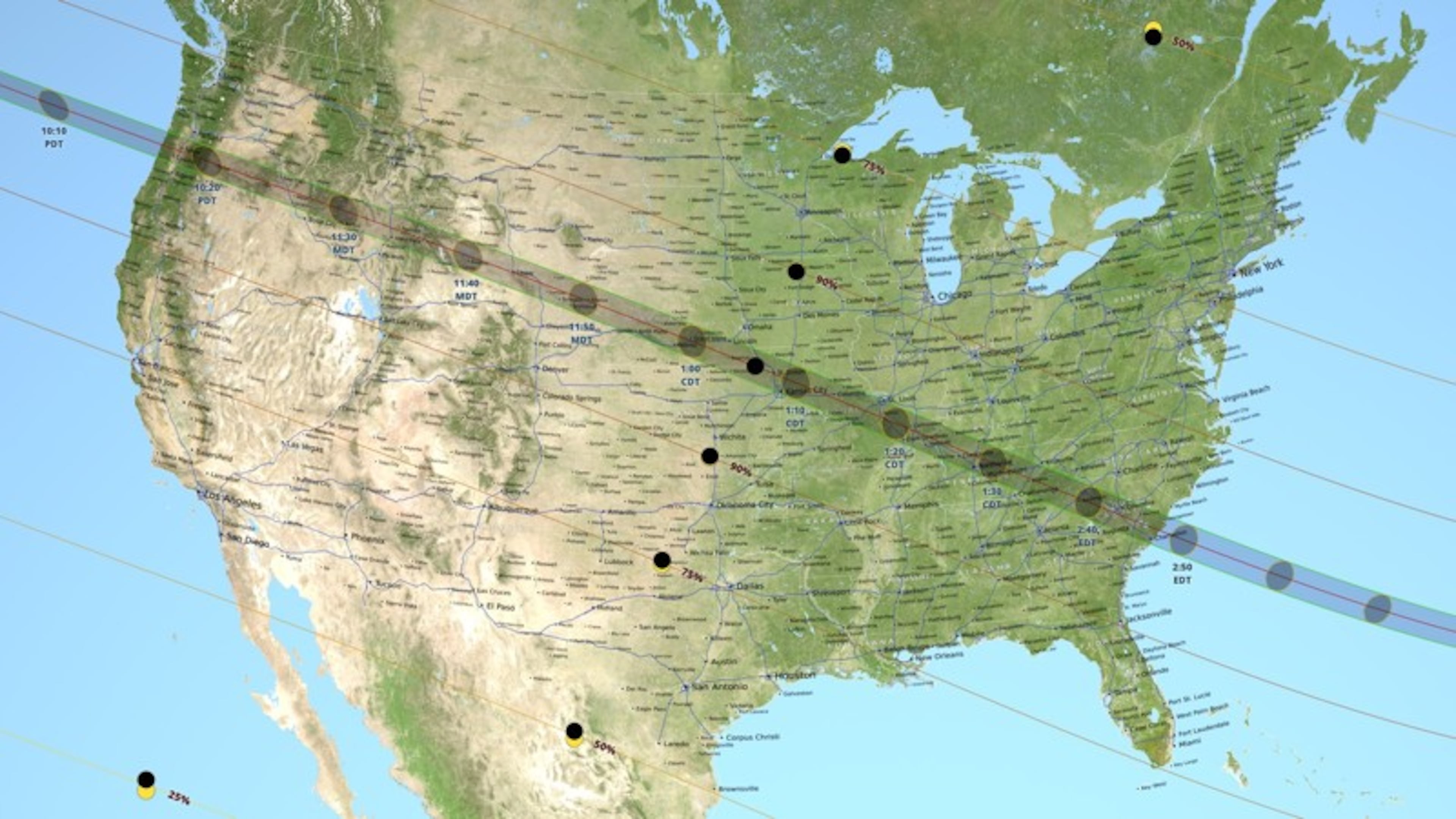
This is the most accurate map of the Great American Eclipse’s path of totality to date
It's the final countdown: We are officially one month away from the first total solar eclipse to cross the country coast to coast in nearly 100 years.
» RELATED: 7 things to know about the rare total solar eclipse crossing the nation this August
NASA data visualizer Ernie Wright recently published the most accurate map to date of the eclipse's path of totality using data from NASA's Lunar Reconnaissance Orbiter, elevation data on Earth and information on the sun's angles.
Whether or not you’re inside the path of totality on Aug. 21 will determine what you see in the sky. If you’re outside the path, you’ll likely see a partial (not total) eclipse.
To determine the most accurate eclipse path, according to Wright, you have to figure out where the moon's shadow will fall on the Earth's surface, which requires taking into account the elevation differences on both the moon and Earth's surfaces, he told Space.com.
Using elevation data from NASA’s Shuttle Radar Topography Mission, the locations of the Earth, moon and sun at each line of latitude or longitude and how long it takes sunlight to travel to the moon and down to Earth, Wright was able to compute where exactly the eclipse will cross and for how long.
More Great American Eclipse 2017 news:
- 7 things to know about the rare total solar eclipse crossing the nation this August
- What will the sky look like in your city during August's rare total solar eclipse?
- New color-changing #EclipseStamps honor 2017 total solar eclipse, magically transform into moon
- Eclipse will cross U.S. for first time since 1918