Isolated showers still possible in parts of metro Atlanta
ATLANTA FORECAST
Today: Mainly storms. High: 75
Tonight: Chance of storms. Low: 65
Tomorrow: Mostly dry. High: 72
» For a detailed forecast, visit The Atlanta Journal-Constitution weather page.
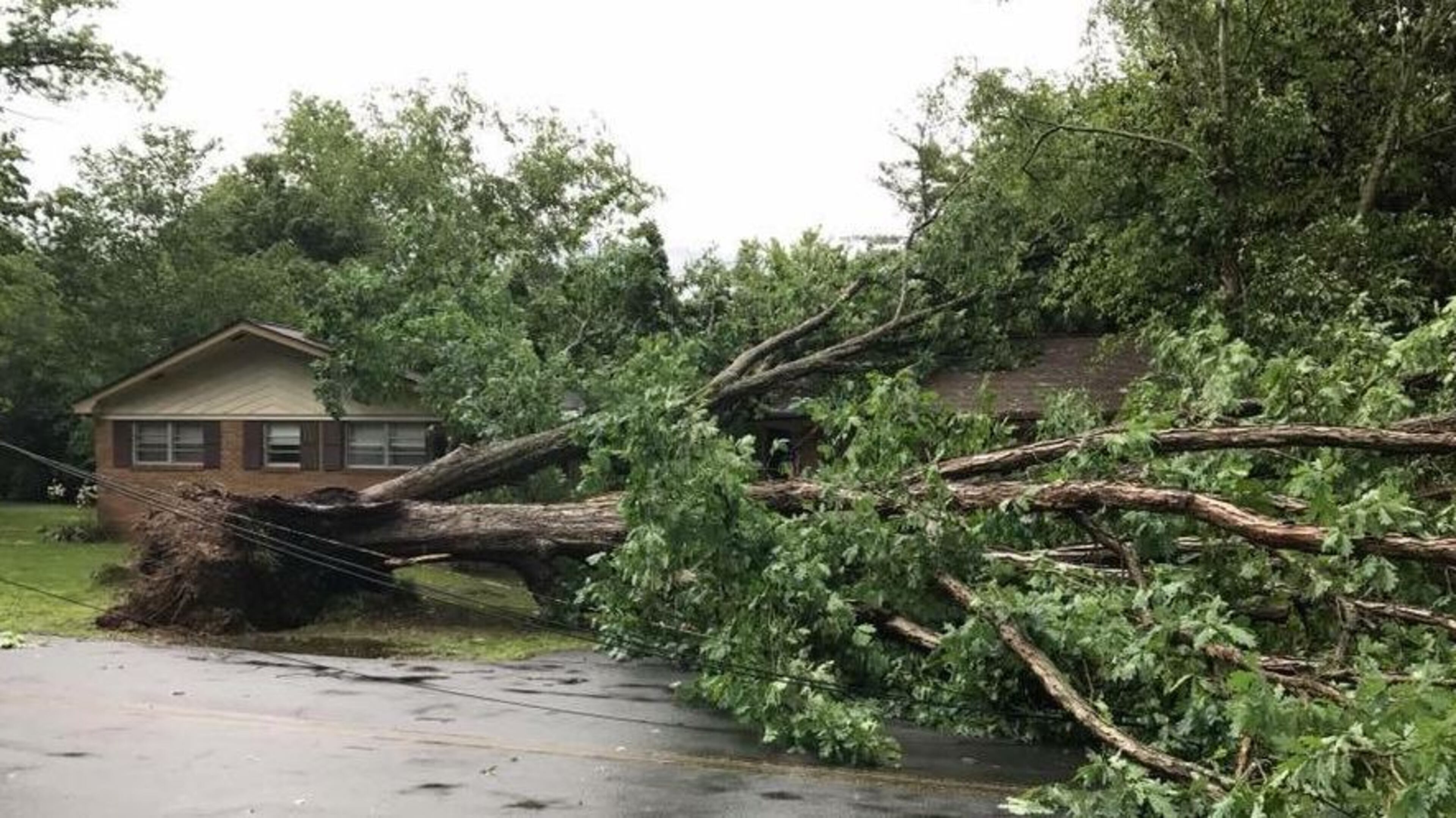
A storm system uprooted trees, knocked down power lines and led to tornado alerts throughout North Georgia on Wednesday.
That system headed east and moved toward Athens before moving south.
Georgia Power reported 45 outages throughout the state, affecting 1,725 customers about 9:45 p.m. Most of those customers are in North Georgia.
RELATED: Outage map
Channel 2 Action News reported a possible tornado touchdown off Pleasant Hill Drive in Dalton.
A tree also knocked down power lines and blocked a part of Green Street in Gainesville, Georgia Department of Transportation officials said. That street has since reopened.
And an emergency manager reported several trees down on Dale Court in Gilmer County from a possible tornado touchdown, Channel 2 meteorologist Brad Nitz said.
Heavy rain and severe weather that blanketed northeast Florida and southeast Georgia did provide some breathing room for fire crews battling the enormous West Mims Fire, officials said. That blaze, which is 60 percent contained, has burned more than 152,000 acres.
But metro Atlanta hardly felt the impact of the storm system, with only spotty showers and a brief heavy downpour Wednesday afternoon, according to Channel 2.
Severe weather and hail is still possible, with wind gusts that could reach 60 mph, Channel 2 reported.
“More showers and storms will develop in the hours ahead,” Nitz said.
Currently, the temperature is 67 degrees in Atlanta.

